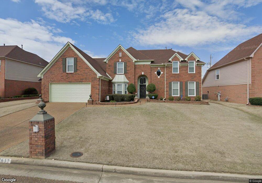
7612 Sandy Brook Cove Memphis, TN 38125
Southern Shelby County NeighborhoodEstimated Value: $275,410 - $340,000
4
Beds
3
Baths
2,978
Sq Ft
$102/Sq Ft
Est. Value
About This Home
This home is located at 7612 Sandy Brook Cove, Memphis, TN 38125 and is currently estimated at $304,103, approximately $102 per square foot. 7612 Sandy Brook Cove is a home located in Shelby County with nearby schools including Lowrance Elementary School, Southwind High School, and Power Center Academy - Southeast.
Ownership History
Date
Name
Owned For
Owner Type
Purchase Details
Closed on
Jun 28, 2024
Sold by
Murphy Donald L
Bought by
Murphy Donald L and Hale Daphanie
Current Estimated Value
Purchase Details
Closed on
Mar 22, 2006
Sold by
Murphy Patricia A
Bought by
Murphy Donald L
Home Financials for this Owner
Home Financials are based on the most recent Mortgage that was taken out on this home.
Original Mortgage
$174,250
Interest Rate
6.19%
Mortgage Type
Fannie Mae Freddie Mac
Purchase Details
Closed on
Apr 26, 1996
Sold by
Faxongillis Homes Inc
Bought by
Murphy Donald L and Webb Murphy Patricia A
Home Financials for this Owner
Home Financials are based on the most recent Mortgage that was taken out on this home.
Original Mortgage
$190,051
Interest Rate
8%
Mortgage Type
VA
Create a Home Valuation Report for This Property
The Home Valuation Report is an in-depth analysis detailing your home's value as well as a comparison with similar homes in the area
Home Values in the Area
Average Home Value in this Area
Purchase History
| Date | Buyer | Sale Price | Title Company |
|---|---|---|---|
| Murphy Donald L | -- | None Listed On Document | |
| Murphy Donald L | -- | None Available | |
| Murphy Donald L | $186,325 | -- |
Source: Public Records
Mortgage History
| Date | Status | Borrower | Loan Amount |
|---|---|---|---|
| Previous Owner | Murphy Donald L | $174,250 | |
| Previous Owner | Murphy Donald L | $190,051 |
Source: Public Records
Tax History Compared to Growth
Tax History
| Year | Tax Paid | Tax Assessment Tax Assessment Total Assessment is a certain percentage of the fair market value that is determined by local assessors to be the total taxable value of land and additions on the property. | Land | Improvement |
|---|---|---|---|---|
| 2025 | $925 | $73,500 | $10,425 | $63,075 |
| 2024 | $1,925 | $56,775 | $10,425 | $46,350 |
| 2023 | $1,925 | $56,775 | $10,425 | $46,350 |
| 2022 | $1,925 | $56,775 | $10,425 | $46,350 |
| 2021 | $1,959 | $56,775 | $10,425 | $46,350 |
| 2020 | $1,821 | $44,975 | $10,425 | $34,550 |
| 2019 | $1,821 | $44,975 | $10,425 | $34,550 |
| 2018 | $1,821 | $44,975 | $10,425 | $34,550 |
| 2017 | $1,848 | $44,975 | $10,425 | $34,550 |
| 2016 | $1,794 | $41,050 | $0 | $0 |
| 2014 | $1,794 | $41,050 | $0 | $0 |
Source: Public Records
Map
Nearby Homes
- 7555 Windsong Dr
- 4471 Hughes Meadow Dr
- 7421 Richmond Rd
- 4646 Sweet Whisper Ln
- 4294 Thunderstone Cir W
- 7527 Wilsford Cove
- 7395 Old Dominion Ct
- 4419 Berkley Woods Dr
- 7321 Stonington Dr
- 4333 Rainey Woods Cove
- 4764 Buttermilk Dr
- 7286 New Britain Dr
- 4310 Coral Creek Ln
- 7561 Shelby Cross Cir
- 4735 Harvest Knoll Cove N
- 4826 Callaway Hills Dr
- 4316 Barry Meadows Cove
- 4569 Cardiff Cove
- 4512 S Germantown Rd
- 4820 Harvest Knoll Ln
- 7622 Sandy Brook Cove
- 7602 Sandy Brook Cove
- 7623 Sand Crossing Cove
- 7619 Sandy Brook Cove
- 7613 Sand Crossing Cove
- 7632 Sandy Brook Cove
- 7592 Sandy Brook Cove
- 7609 Sandy Brook Cove
- 7633 Sand Crossing Cove
- 7629 Sandy Brook Cove
- 7599 Sandy Brook Cove
- 7643 Sand Crossing Cove
- 7639 Sandy Brook Cove
- 7642 Sandy Brook Cove
- 7610 Sand Crossing Cove
- 7582 Sandy Brook Cove
- 7579 Sandy Brook Cove
- 7626 Sand Crossing Cove
- 7616 Sand Crossing Cove
- 4495 Juniper Ridge Cove