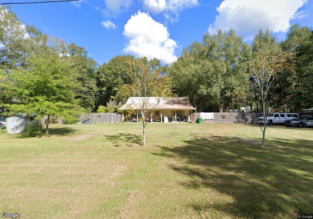
7617 Carter Rd Moss Point, MS 39562
Estimated Value: $114,000 - $242,000
Studio
2
Baths
1,520
Sq Ft
$120/Sq Ft
Est. Value
About This Home
This home is located at 7617 Carter Rd, Moss Point, MS 39562 and is currently estimated at $181,930, approximately $119 per square foot. 7617 Carter Rd is a home located in Jackson County with nearby schools including East Central Lower Elementary School, East Central Upper Elementary School, and East Central Middle School.
Ownership History
Date
Name
Owned For
Owner Type
Purchase Details
Closed on
Jun 11, 2020
Sold by
Lee Twila R
Bought by
Sellars Dean T and Sellars Judie A
Current Estimated Value
Home Financials for this Owner
Home Financials are based on the most recent Mortgage that was taken out on this home.
Original Mortgage
$59,850
Outstanding Balance
$52,581
Interest Rate
3.2%
Mortgage Type
New Conventional
Estimated Equity
$129,349
Purchase Details
Closed on
Apr 28, 2014
Sold by
Gary D Gary D and Lee Twila R
Bought by
Lee Twila R
Create a Home Valuation Report for This Property
The Home Valuation Report is an in-depth analysis detailing your home's value as well as a comparison with similar homes in the area
Purchase History
| Date | Buyer | Sale Price | Title Company |
|---|---|---|---|
| Sellars Dean T | -- | None Available | |
| Lee Twila R | -- | -- |
Source: Public Records
Mortgage History
| Date | Status | Borrower | Loan Amount |
|---|---|---|---|
| Open | Sellars Dean T | $59,850 |
Source: Public Records
Tax History
| Year | Tax Paid | Tax Assessment Tax Assessment Total Assessment is a certain percentage of the fair market value that is determined by local assessors to be the total taxable value of land and additions on the property. | Land | Improvement |
|---|---|---|---|---|
| 2025 | $110 | $9,860 | $1,035 | $8,825 |
| 2024 | $110 | $8,427 | $1,007 | $7,420 |
| 2023 | $111 | $8,427 | $1,007 | $7,420 |
| 2022 | $108 | $8,427 | $1,007 | $7,420 |
| 2021 | $116 | $8,491 | $1,007 | $7,484 |
| 2020 | $1,397 | $11,564 | $1,398 | $10,166 |
| 2019 | $1,382 | $11,564 | $1,398 | $10,166 |
| 2018 | $1,409 | $11,564 | $1,398 | $10,166 |
| 2017 | $1,438 | $11,606 | $1,398 | $10,208 |
| 2016 | $1,381 | $11,606 | $1,398 | $10,208 |
| 2015 | $1,279 | $71,270 | $9,320 | $61,950 |
| 2014 | $1,271 | $10,815 | $1,398 | $9,417 |
| 2013 | $1,234 | $10,869 | $1,506 | $9,363 |
Source: Public Records
Map
Nearby Homes
- 0 Ms-613 Hwy Unit 4116583
- 0 Ms-613 Hwy Unit 4107607
- 0 Ms-613 Hwy Unit 4107612
- 0 Ms-613 Hwy Unit 4116582
- 14004 Ann Rd
- 14015 Lily Orchard Rd
- 13111 Maida Hurd Rd
- 0 Perry St
- 14208 Lily Orchard Rd
- 9517 Dunn Rd
- 0 R B Dickerson Rd
- 0 Grafe Homestead Rd Unit 4137349
- 17500 Goff Farm Rd
- 26.1 Acres Brinkman Rd E
- -0- Rayford Shumock Rd
- 0 Rayford Shumock Rd Unit 24406728
- 0 Rayford Shumock Rd Unit 4121875
- 17920 Rayford Shumock Rd
- 14004 Timber Ridge Dr
- 7201 Bentwood Dr
- 7521 Carter Rd
- 7517 Carter's Rd
- 7517 Carter Rd
- 15013 Curtis Smith Rd
- 15112 Ike Brownlow Rd
- 7700 Carter Rd
- 15109 Ike Brownlow Rd
- 15109 Curtis Smith Rd
- 7729 Carter Rd
- 0 Carters Rd Unit 3257564
- 15111 Curtis Smith Rd
- 7733 Carter Rd
- 15107 Charles Williams Rd
- 15100 Charles Williams Rd
- 15109 Charles Williams Rd
- 7408 Carter Rd
- 15117 Curtis Smith Rd
- 7480 Carlos Keyes Rd
- 15135 Curtis Smith Rd
- 15132 Curtis Smith Rd
Your Personal Tour Guide
Ask me questions while you tour the home.