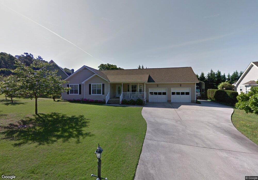
7617 Hunter Rd Hixson, TN 37343
Estimated Value: $353,648 - $531,000
3
Beds
2
Baths
1,700
Sq Ft
$243/Sq Ft
Est. Value
About This Home
This home is located at 7617 Hunter Rd, Hixson, TN 37343 and is currently estimated at $413,412, approximately $243 per square foot. 7617 Hunter Rd is a home located in Hamilton County with nearby schools including McConnell Elementary School, Loftis Middle School, and Hixson High School.
Ownership History
Date
Name
Owned For
Owner Type
Purchase Details
Closed on
Sep 5, 2024
Sold by
Sims Glen A and Sims Josephine L
Bought by
Glen A Sims Jr And Josephine L Sims Revocable and Sims
Current Estimated Value
Purchase Details
Closed on
Apr 24, 1997
Sold by
Black Neal J and Black Lana F
Bought by
Sims Glen A and Sims Josephine L
Home Financials for this Owner
Home Financials are based on the most recent Mortgage that was taken out on this home.
Original Mortgage
$65,000
Interest Rate
7.85%
Create a Home Valuation Report for This Property
The Home Valuation Report is an in-depth analysis detailing your home's value as well as a comparison with similar homes in the area
Home Values in the Area
Average Home Value in this Area
Purchase History
| Date | Buyer | Sale Price | Title Company |
|---|---|---|---|
| Glen A Sims Jr And Josephine L Sims Revocable | -- | None Listed On Document | |
| Sims Glen A | $123,500 | -- |
Source: Public Records
Mortgage History
| Date | Status | Borrower | Loan Amount |
|---|---|---|---|
| Previous Owner | Sims Glen A | $65,000 |
Source: Public Records
Tax History
| Year | Tax Paid | Tax Assessment Tax Assessment Total Assessment is a certain percentage of the fair market value that is determined by local assessors to be the total taxable value of land and additions on the property. | Land | Improvement |
|---|---|---|---|---|
| 2025 | $1,318 | $86,950 | $0 | $0 |
| 2024 | $1,278 | $57,125 | $0 | $0 |
| 2023 | $1,287 | $57,125 | $0 | $0 |
| 2022 | $1,287 | $57,125 | $0 | $0 |
| 2021 | $1,287 | $57,125 | $0 | $0 |
| 2020 | $1,181 | $42,400 | $0 | $0 |
| 2019 | $1,181 | $42,400 | $0 | $0 |
| 2018 | $1,181 | $42,400 | $0 | $0 |
| 2017 | $1,181 | $42,400 | $0 | $0 |
| 2016 | $1,020 | $0 | $0 | $0 |
| 2015 | $1,020 | $36,575 | $0 | $0 |
| 2014 | $1,020 | $0 | $0 | $0 |
Source: Public Records
Map
Nearby Homes
- 2801 Chapel Bend Dr
- 7619 Cove Ridge Dr
- 7622 Cove Ridge Dr
- 7825 Cove Ridge Dr
- 6619 Schooner Bay Ln
- 5818 Players Ct Unit 4
- 7559 Bendire Loop
- 7378 Bendire Loop
- 7553 Bendire Loop
- 7558 Bendire Loop
- 7402 Bendire Loop
- 7547 Bendire Loop
- 7366 Bendire Loop
- 7552 Bendire Loop
- 7541 Bendire Loop
- 7535 Bendire Loop
- 7369 Bendire Loop
- 7540 Bendire Loop
- 1716 Mountain Bay Dr
- 7534 Bendire Loop
- 7623 Hunter Rd
- 7613 Hunter Rd
- 7618 Hunter Rd
- 7614 Hunter Rd
- 7622 Hunter Rd
- 7629 Hunter Rd
- 2844 Chapel Bend Dr
- 7609 Hunter Rd
- 7610 Hunter Rd
- 2854 Chapel Bend Dr
- 3018 Tandy Ln
- 3003 Tandy Ln
- 2836 Chapel Bend Dr
- 7631 Hunter Rd
- 0 Hunter Rd
- 3019 Tandy Ln
- 7604 Hunter Rd
- 7604 Hunter Rd
- 2866 Chapel Bend Dr
- 7605 Hunter Rd
Your Personal Tour Guide
Ask me questions while you tour the home.