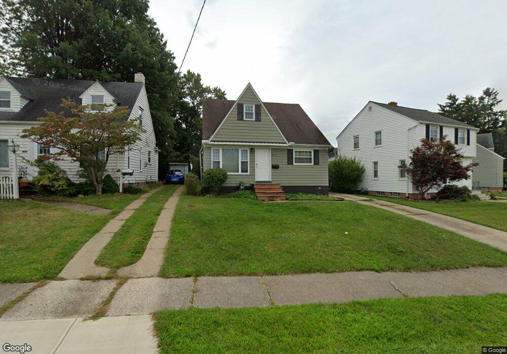
7619 Pelham Dr Cleveland, OH 44129
Estimated Value: $213,000 - $225,000
4
Beds
2
Baths
1,326
Sq Ft
$165/Sq Ft
Est. Value
About This Home
This home is located at 7619 Pelham Dr, Cleveland, OH 44129 and is currently estimated at $218,844, approximately $165 per square foot. 7619 Pelham Dr is a home located in Cuyahoga County with nearby schools including Renwood Elementary School, Thoreau Park Elementary School, and Greenbriar Middle School.
Ownership History
Date
Name
Owned For
Owner Type
Purchase Details
Closed on
Oct 2, 2019
Sold by
Orsino Mary L and Zambo Mary L
Bought by
Orsino Mary L and The Mary Louise Orsino Trust
Current Estimated Value
Purchase Details
Closed on
Jul 13, 1992
Sold by
Smerick Michael
Bought by
Zambo Mary L
Purchase Details
Closed on
Apr 19, 1984
Sold by
Cardwell Dale E
Bought by
Smerick Michael
Purchase Details
Closed on
Dec 20, 1983
Sold by
Dale E Cardwell
Bought by
Cardwell Dale E
Purchase Details
Closed on
Jun 27, 1980
Sold by
Cardwell Dale E
Bought by
Dale E Cardwell
Purchase Details
Closed on
Jun 28, 1978
Sold by
Sebek Blanche E
Bought by
Cardwell Dale E
Purchase Details
Closed on
Aug 6, 1975
Sold by
Sebek Milo and Sebek Blanche E
Bought by
Sebek Blanche E
Purchase Details
Closed on
Jan 1, 1975
Bought by
Sebek Milo and Sebek Blanche E
Create a Home Valuation Report for This Property
The Home Valuation Report is an in-depth analysis detailing your home's value as well as a comparison with similar homes in the area
Home Values in the Area
Average Home Value in this Area
Purchase History
| Date | Buyer | Sale Price | Title Company |
|---|---|---|---|
| Orsino Mary L | -- | None Available | |
| Zambo Mary L | $87,000 | -- | |
| Smerick Michael | $51,500 | -- | |
| Cardwell Dale E | -- | -- | |
| Dale E Cardwell | -- | -- | |
| Cardwell Dale E | $40,000 | -- | |
| Sebek Blanche E | -- | -- | |
| Sebek Milo | -- | -- |
Source: Public Records
Tax History Compared to Growth
Tax History
| Year | Tax Paid | Tax Assessment Tax Assessment Total Assessment is a certain percentage of the fair market value that is determined by local assessors to be the total taxable value of land and additions on the property. | Land | Improvement |
|---|---|---|---|---|
| 2024 | $3,908 | $64,645 | $10,465 | $54,180 |
| 2023 | $3,366 | $47,640 | $9,240 | $38,400 |
| 2022 | $3,334 | $47,640 | $9,240 | $38,400 |
| 2021 | $3,430 | $47,640 | $9,240 | $38,400 |
| 2020 | $3,002 | $36,650 | $7,110 | $29,540 |
| 2019 | $2,878 | $104,700 | $20,300 | $84,400 |
| 2018 | $2,448 | $36,650 | $7,110 | $29,540 |
| 2017 | $2,741 | $32,310 | $6,130 | $26,180 |
| 2016 | $2,724 | $32,310 | $6,130 | $26,180 |
| 2015 | $2,618 | $32,310 | $6,130 | $26,180 |
| 2014 | $2,618 | $32,980 | $6,270 | $26,710 |
Source: Public Records
Map
Nearby Homes
- 6136 Ridge Rd
- 6227 Ridge Rd
- 6168 Manchester Rd
- 6234 N Canterbury Rd
- 8017 Wainstead Dr
- 7503 Whittington Dr
- 6111 Manchester Rd
- 8017 Ackley Rd
- 6298 Chestnut Hills Dr
- 6096 Wareham Dr
- 6701 Pelham Dr
- 8514 Deerfield Dr
- 7014 Thornton Dr
- 6610 Renwood Dr
- 7514 Spring Garden Rd
- 6510 Belmere Dr
- 6430 Monmouth Dr
- 6439 Keltonshire Rd
- 6708 Thornton Dr
- 7115 Hampstead Ave
- 7615 Pelham Dr
- 7703 Pelham Dr
- 7611 Pelham Dr
- 6185 Holburn Rd
- 7607 Pelham Dr
- 7616 Kenton Ave
- 7612 Kenton Ave
- 7700 Kenton Ave
- 6187 Holburn Rd
- 7606 Kenton Ave
- 7706 Kenton Ave
- 7603 Pelham Dr
- 7606 Pelham Dr
- 7710 Kenton Ave
- 7521 Pelham Dr
- 6170 Holburn Rd
- 7602 Kenton Ave
- 7602 Pelham Dr
- 7710 Pelham Dr
- 6164 Holburn Rd