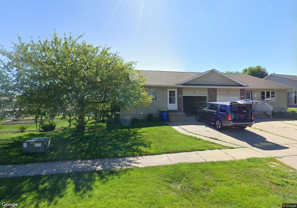
762 Molly Dr North Liberty, IA 52317
Estimated Value: $220,000 - $229,000
3
Beds
2
Baths
924
Sq Ft
$242/Sq Ft
Est. Value
About This Home
This home is located at 762 Molly Dr, North Liberty, IA 52317 and is currently estimated at $223,333, approximately $241 per square foot. 762 Molly Dr is a home located in Johnson County with nearby schools including Penn Elementary School, North Central Junior High School, and Liberty High School.
Create a Home Valuation Report for This Property
The Home Valuation Report is an in-depth analysis detailing your home's value as well as a comparison with similar homes in the area
Home Values in the Area
Average Home Value in this Area
Tax History Compared to Growth
Tax History
| Year | Tax Paid | Tax Assessment Tax Assessment Total Assessment is a certain percentage of the fair market value that is determined by local assessors to be the total taxable value of land and additions on the property. | Land | Improvement |
|---|---|---|---|---|
| 2025 | $3,768 | $233,800 | $38,900 | $194,900 |
| 2024 | $3,686 | $219,100 | $38,900 | $180,200 |
| 2023 | $3,598 | $219,100 | $38,900 | $180,200 |
| 2022 | $3,410 | $185,400 | $19,400 | $166,000 |
| 2021 | $3,286 | $185,400 | $19,400 | $166,000 |
| 2020 | $3,286 | $170,300 | $19,400 | $150,900 |
| 2019 | $3,284 | $170,300 | $19,400 | $150,900 |
| 2018 | $3,222 | $170,300 | $19,400 | $150,900 |
| 2017 | $3,222 | $170,300 | $19,400 | $150,900 |
| 2016 | $2,716 | $146,900 | $19,400 | $127,500 |
| 2015 | $2,716 | $146,900 | $19,400 | $127,500 |
| 2014 | $2,606 | $140,400 | $16,600 | $123,800 |
Source: Public Records
Map
Nearby Homes
- 740 Molly Dr
- 662 Molly Dr
- 667 Andy Ct
- 435 E Jefferson St
- 320 E Jefferson St
- 622 Emily St
- 70 Jefferson Ln Unit 70
- Mehaffey Mehaffey Bridge Rd NE Unit Mehaffey Bridge Road
- 2550 N Liberty Rd NE
- 110 Whitman Ave
- 25 Ash Ct
- 280 N Juniper St
- 155 N Front St
- 425 Stewart St
- 2343 Lake Ridge Place NE
- 1105 Millie Ln
- 1103 Millie Ln
- 1101 Millie Ln
- 270 & 280 Chestnut St
- 1165 Edward Dr