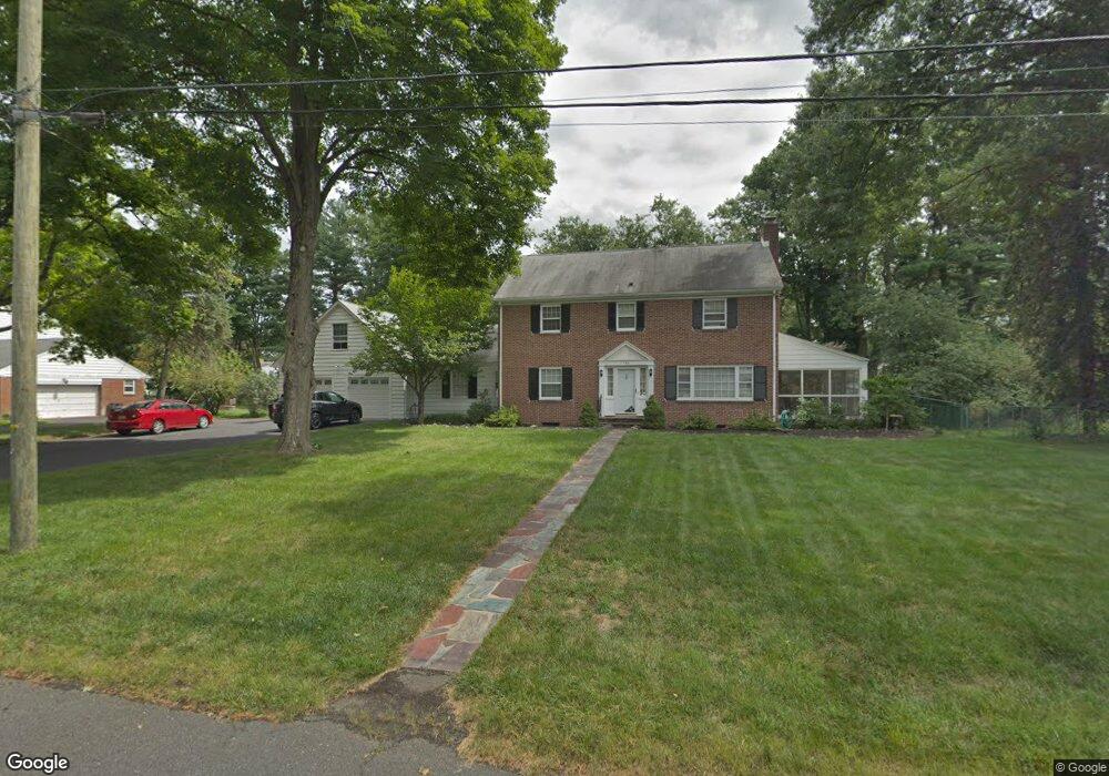
762 Ross Ln Bound Brook, NJ 08805
Estimated Value: $632,000 - $685,000
--
Bed
--
Bath
2,578
Sq Ft
$255/Sq Ft
Est. Value
About This Home
This home is located at 762 Ross Ln, Bound Brook, NJ 08805 and is currently estimated at $656,287, approximately $254 per square foot. 762 Ross Ln is a home located in Somerset County with nearby schools including LaMonte Annex Elementary School, Lafayette Elementary School, and Bound Brook High School.
Ownership History
Date
Name
Owned For
Owner Type
Purchase Details
Closed on
Jul 19, 2001
Sold by
Job Robert
Bought by
Bullard Thomas and Bullard Jareb
Current Estimated Value
Home Financials for this Owner
Home Financials are based on the most recent Mortgage that was taken out on this home.
Original Mortgage
$371,000
Interest Rate
6.99%
Purchase Details
Closed on
Aug 1, 1996
Sold by
Tolombo Mary
Bought by
Job Robert and Louis Job
Home Financials for this Owner
Home Financials are based on the most recent Mortgage that was taken out on this home.
Original Mortgage
$188,000
Interest Rate
8.08%
Create a Home Valuation Report for This Property
The Home Valuation Report is an in-depth analysis detailing your home's value as well as a comparison with similar homes in the area
Home Values in the Area
Average Home Value in this Area
Purchase History
| Date | Buyer | Sale Price | Title Company |
|---|---|---|---|
| Bullard Thomas | $371,000 | -- | |
| Job Robert | $235,450 | -- |
Source: Public Records
Mortgage History
| Date | Status | Borrower | Loan Amount |
|---|---|---|---|
| Previous Owner | Bullard Thomas | $371,000 | |
| Previous Owner | Job Robert | $188,000 |
Source: Public Records
Tax History Compared to Growth
Tax History
| Year | Tax Paid | Tax Assessment Tax Assessment Total Assessment is a certain percentage of the fair market value that is determined by local assessors to be the total taxable value of land and additions on the property. | Land | Improvement |
|---|---|---|---|---|
| 2025 | $12,974 | $601,200 | $261,200 | $340,000 |
| 2024 | $12,974 | $571,800 | $241,200 | $330,600 |
| 2023 | $12,592 | $534,000 | $211,200 | $322,800 |
| 2022 | $12,276 | $493,400 | $186,200 | $307,200 |
| 2021 | $12,754 | $445,900 | $161,200 | $284,700 |
| 2020 | $12,471 | $404,000 | $146,200 | $257,800 |
| 2019 | $12,754 | $394,000 | $136,200 | $257,800 |
| 2018 | $12,803 | $384,000 | $126,200 | $257,800 |
| 2017 | $12,829 | $376,100 | $126,200 | $249,900 |
| 2016 | $12,677 | $374,400 | $116,200 | $258,200 |
| 2015 | $13,029 | $393,500 | $126,200 | $267,300 |
| 2014 | $12,831 | $374,300 | $107,000 | $267,300 |
Source: Public Records
Map
Nearby Homes
- 807 Watchung Rd
- 811 Mountain Ave
- 180 Farm Ln
- 745 Schoolhouse Ln
- 650 Central Ave
- 1820 Woodland Terrace
- 1891 Middlebrook Rd
- 563 Winsor St
- 1740 Middlebrook Rd
- 520 Winsor St
- 14 E Maple Ave
- 112 E Union Ave
- 112-114 E Union Ave
- 320 Church St
- 143 Vosseller Ave
- 552 Stangle Rd
- 102 W Franklin St
- 205 Ashland Rd
- 363 Grant Ave
- 606 Vosseller Ave