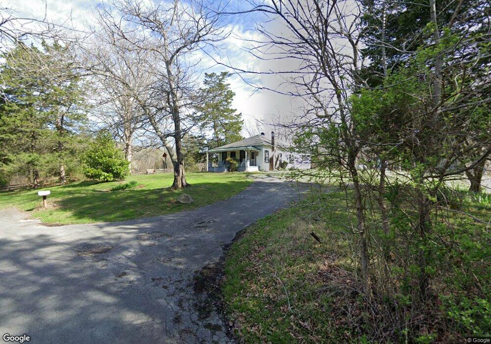
762 Shields Rd Rock Spring, GA 30739
Rock Spring NeighborhoodEstimated Value: $166,024 - $243,000
--
Bed
1
Bath
1,092
Sq Ft
$187/Sq Ft
Est. Value
About This Home
This home is located at 762 Shields Rd, Rock Spring, GA 30739 and is currently estimated at $204,341, approximately $187 per square foot. 762 Shields Rd is a home located in Walker County with nearby schools including Rock Spring Elementary School and Lafayette High School.
Ownership History
Date
Name
Owned For
Owner Type
Purchase Details
Closed on
Jan 30, 2012
Sold by
Shields Don
Bought by
Gaston John
Current Estimated Value
Purchase Details
Closed on
Jan 19, 1984
Sold by
Shields John W
Bought by
Shields Obera S and Shields
Purchase Details
Closed on
Jan 1, 1972
Bought by
Shields John W
Create a Home Valuation Report for This Property
The Home Valuation Report is an in-depth analysis detailing your home's value as well as a comparison with similar homes in the area
Home Values in the Area
Average Home Value in this Area
Purchase History
| Date | Buyer | Sale Price | Title Company |
|---|---|---|---|
| Gaston John | -- | -- | |
| Shields Obera S | -- | -- | |
| Shields John W | -- | -- |
Source: Public Records
Tax History Compared to Growth
Tax History
| Year | Tax Paid | Tax Assessment Tax Assessment Total Assessment is a certain percentage of the fair market value that is determined by local assessors to be the total taxable value of land and additions on the property. | Land | Improvement |
|---|---|---|---|---|
| 2024 | $1,431 | $56,751 | $40,320 | $16,431 |
| 2023 | $1,351 | $51,798 | $36,000 | $15,798 |
| 2022 | $1,106 | $42,902 | $9,278 | $33,624 |
| 2021 | $925 | $31,739 | $9,278 | $22,461 |
| 2020 | $887 | $29,141 | $9,278 | $19,863 |
| 2019 | $691 | $21,386 | $9,278 | $12,108 |
| 2018 | $566 | $21,386 | $9,278 | $12,108 |
| 2017 | $750 | $21,386 | $9,278 | $12,108 |
| 2016 | $838 | $34,052 | $19,342 | $14,710 |
| 2015 | $601 | $18,066 | $12,101 | $5,965 |
| 2014 | $521 | $18,066 | $12,101 | $5,965 |
| 2013 | -- | $18,065 | $12,100 | $5,964 |
Source: Public Records
Map
Nearby Homes
- 136 Ginger Lake Dr
- 514 Ginger Lake Dr
- 701 Bicentennial Trail
- 234 Dad Taylor Dr
- 1476 Arnold Rd
- 1370 Old Highway 27
- 1902 Long Hollow Rd
- 1003 Highway N Old 27
- The Pearson Plan at Laurel Ridge
- The Benson II Plan at Laurel Ridge
- The Langford Plan at Laurel Ridge
- The Lawson Plan at Laurel Ridge
- The Coleman Plan at Laurel Ridge
- The McGinnis Plan at Laurel Ridge
- The Caldwell Plan at Laurel Ridge
- 11 Willow Cir
- 16 Willow Cir
- 23 Willow Cir
- 10180 Us Highway 27
- 1121 Arnold Rd
- 232 Shields Rd
- 107 Blue Herron Dr
- 175 Shields Rd
- 161 Shields Rd
- 283 Ginger Lake Dr
- 101 Shields Rd
- 83 Blue Herron Dr
- 0 Shields Rd
- 61 Blue Herron Dr Unit 45
- 253 Ginger Lake Dr
- 253 Ginger Lake Dr Unit 38
- 235 Ginger Lake Dr
- 235 Ginger Lake Dr Unit 37
- 90 Blue Herron Dr
- 90 Blue Herron Cir
- 41 Blue Herron Dr
- 41 Blue Herron Dr Unit 44
- 303 Ginger Lake Dr Unit 42
- 303 Ginger Lake Dr
- 209 Ginger Lake Dr