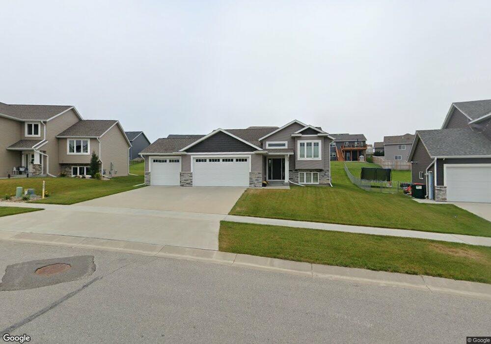
Estimated Value: $418,904 - $509,000
3
Beds
2
Baths
1,384
Sq Ft
$348/Sq Ft
Est. Value
About This Home
This home is located at 762 Towne Dr NE, Byron, MN 55920 and is currently estimated at $480,976, approximately $347 per square foot. 762 Towne Dr NE is a home located in Olmsted County with nearby schools including Byron Intermediate School, Byron Middle School, and Byron Senior High School.
Ownership History
Date
Name
Owned For
Owner Type
Purchase Details
Closed on
Sep 13, 2019
Sold by
Anderson Builders Llc
Bought by
Yennie Mitchell Dean and Yennie Michelle T
Current Estimated Value
Home Financials for this Owner
Home Financials are based on the most recent Mortgage that was taken out on this home.
Original Mortgage
$189,000
Outstanding Balance
$165,208
Interest Rate
3.5%
Mortgage Type
New Conventional
Estimated Equity
$315,768
Purchase Details
Closed on
Sep 18, 2018
Sold by
Decook Bryce D and Decook Brenda J
Bought by
Anderson Builders A Minnesota Limited Li
Create a Home Valuation Report for This Property
The Home Valuation Report is an in-depth analysis detailing your home's value as well as a comparison with similar homes in the area
Home Values in the Area
Average Home Value in this Area
Purchase History
| Date | Buyer | Sale Price | Title Company |
|---|---|---|---|
| Yennie Mitchell Dean | $339,000 | Hansen Ttl & Legal Svcs Llc | |
| Anderson Builders A Minnesota Limited Li | $60,000 | None Available |
Source: Public Records
Mortgage History
| Date | Status | Borrower | Loan Amount |
|---|---|---|---|
| Open | Yennie Mitchell Dean | $189,000 |
Source: Public Records
Tax History
| Year | Tax Paid | Tax Assessment Tax Assessment Total Assessment is a certain percentage of the fair market value that is determined by local assessors to be the total taxable value of land and additions on the property. | Land | Improvement |
|---|---|---|---|---|
| 2024 | $5,510 | $354,100 | $70,000 | $284,100 |
| 2023 | $5,570 | $357,100 | $70,000 | $287,100 |
| 2022 | $5,620 | $359,700 | $70,000 | $289,700 |
| 2021 | $5,146 | $314,400 | $65,000 | $249,400 |
| 2020 | $620 | $307,400 | $65,000 | $242,400 |
| 2019 | $252 | $55,000 | $55,000 | $0 |
| 2018 | $144 | $55,000 | $55,000 | $0 |
| 2017 | $73 | $4,400 | $4,400 | $0 |
Source: Public Records
Map
Nearby Homes
- 830 Towne Dr NE
- 1582 Brandt Dr NE
- 1792 (L3,B1) Brandt Dr NE
- 1644 Brandt Dr NE
- 1470 4th St NE
- 408 Verwood Ln NE
- 1812 Brandt Dr NE
- 1806 Brandt Dr NE
- 1667 Brandt Dr NE
- 1775 4th St NE
- 1847 4th St NE
- 1799 4th St NE
- 1863 (L13,B2) Robinson Ln NE
- 1886 (L11,B2) Robinson Ln NE
- 1844 (L8,B2) Robinson Ln NE
- 1830 (L7,B2) Robinson Ln NE
- 1860 (L9,B2) Robinson Ln NE
- 1872 (L10,B2) Robinson Ln NE
- 1807 (L14,B2) Robinson Ln NE
- 1705 Brandt Dr NE
- 750 Towne Dr NE
- 776 Towne Dr NE
- 468 15th Ave NE
- 456 15th Ave NE
- 488 15th Ave NE
- 744 Towne Dr NE
- 476 15th Ave NE
- 800 Towne Dr NE
- 496 15th Ave NE
- 747 Towne Dr NE
- 801 Towne Dr NE
- 739 Towne Dr NE
- 738 Towne Dr NE
- 805 Towne Dr NE
- 808 Towne Dr NE
- 518 15th Ave NE
- 1531 Wickford Place NE
- 438 15th Ave NE
- 475 15th Ave NE
- 530 15th Ave NE
