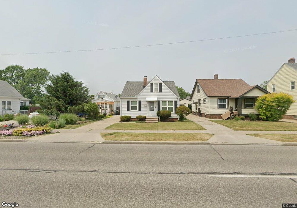
7620 Snow Rd Cleveland, OH 44129
Estimated Value: $151,000 - $188,000
3
Beds
2
Baths
1,105
Sq Ft
$159/Sq Ft
Est. Value
About This Home
This home is located at 7620 Snow Rd, Cleveland, OH 44129 and is currently estimated at $175,445, approximately $158 per square foot. 7620 Snow Rd is a home located in Cuyahoga County with nearby schools including Ridge-Brook Elementary School, Thoreau Park Elementary School, and Shiloh Middle School.
Ownership History
Date
Name
Owned For
Owner Type
Purchase Details
Closed on
Jul 30, 2009
Sold by
Cronlotac E Frank and Cronlotac Patricia
Bought by
7620 Snow Road Management Llc
Current Estimated Value
Purchase Details
Closed on
May 11, 1994
Bought by
Cronlotac E Frank
Purchase Details
Closed on
Nov 24, 1993
Sold by
Sperling Gary L
Bought by
Sec Of H U D
Purchase Details
Closed on
Aug 7, 1989
Sold by
Steponick John A and Steponick Kathleen
Bought by
Sperling Gary L
Purchase Details
Closed on
May 11, 1987
Sold by
Steponick Ann
Bought by
Steponick John A and Steponick Kathleen
Purchase Details
Closed on
Apr 16, 1987
Sold by
Steponick John A
Bought by
Steponick Ann
Purchase Details
Closed on
Aug 19, 1983
Sold by
Steponick John A and Steponick Ann
Bought by
Steponick John A
Purchase Details
Closed on
Jan 1, 1975
Bought by
Steponick John A and Steponick Ann
Create a Home Valuation Report for This Property
The Home Valuation Report is an in-depth analysis detailing your home's value as well as a comparison with similar homes in the area
Home Values in the Area
Average Home Value in this Area
Purchase History
| Date | Buyer | Sale Price | Title Company |
|---|---|---|---|
| 7620 Snow Road Management Llc | -- | Attorney | |
| Cronlotac E Frank | -- | -- | |
| Sec Of H U D | -- | -- | |
| Sperling Gary L | $67,000 | -- | |
| Steponick John A | -- | -- | |
| Steponick Ann | -- | -- | |
| Steponick John A | -- | -- | |
| Steponick John A | -- | -- |
Source: Public Records
Tax History Compared to Growth
Tax History
| Year | Tax Paid | Tax Assessment Tax Assessment Total Assessment is a certain percentage of the fair market value that is determined by local assessors to be the total taxable value of land and additions on the property. | Land | Improvement |
|---|---|---|---|---|
| 2024 | $3,235 | $51,485 | $7,700 | $43,785 |
| 2023 | $2,705 | $36,690 | $7,530 | $29,160 |
| 2022 | $2,680 | $36,680 | $7,530 | $29,160 |
| 2021 | $2,757 | $36,680 | $7,530 | $29,160 |
| 2020 | $2,417 | $28,210 | $5,780 | $22,440 |
| 2019 | $2,312 | $80,600 | $16,500 | $64,100 |
| 2018 | $2,120 | $28,210 | $5,780 | $22,440 |
| 2017 | $2,075 | $23,250 | $4,100 | $19,150 |
| 2016 | $2,063 | $23,250 | $4,100 | $19,150 |
| 2015 | $2,023 | $23,250 | $4,100 | $19,150 |
| 2014 | $2,023 | $24,710 | $4,340 | $20,370 |
Source: Public Records
Map
Nearby Homes
- 7910 Dresden Ave
- 7615 Bertha Ave
- 7906 Bertha Ave
- 7609 Wooster Pkwy
- 7514 Spring Garden Rd
- 6903 Alber Ave
- 6903 Forest Ave
- 6706 Alber Ave
- 7115 Hampstead Ave
- 6711 Forest Ave
- 6818 Hampstead Ave
- 5717 Chestnut Dr
- 6704 Charles Ave
- 6506 Snow Rd
- 7014 Thornton Dr
- 6403 Kenneth Ave
- 7915 Fernhill Ave
- 6306 Gilbert Ave
- 5906 Twin Lakes Dr
- 7706 Renwood Dr