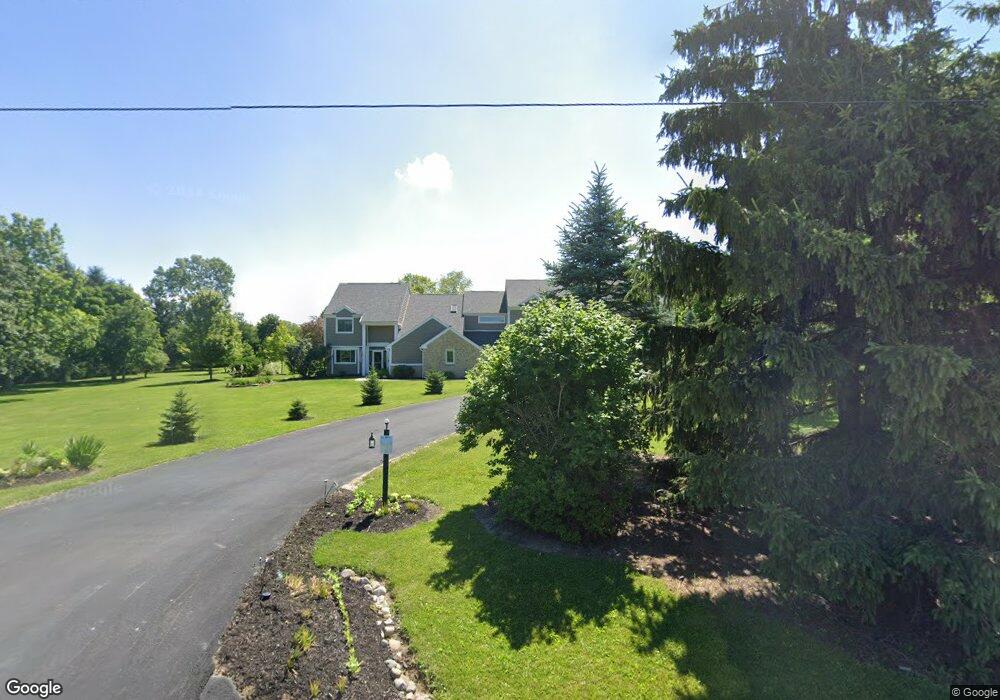
7625 Martindale Rd Tipp City, OH 45371
Estimated Value: $650,000 - $1,040,164
6
Beds
7
Baths
4,563
Sq Ft
$181/Sq Ft
Est. Value
About This Home
This home is located at 7625 Martindale Rd, Tipp City, OH 45371 and is currently estimated at $828,055, approximately $181 per square foot. 7625 Martindale Rd is a home located in Miami County with nearby schools including Broadway Elementary School, Nevin Coppock Elementary School, and L. T. Ball Intermediate School.
Ownership History
Date
Name
Owned For
Owner Type
Purchase Details
Closed on
Dec 5, 2018
Sold by
Mcmurry Glen R and Mcmurry Angela F
Bought by
Mcmurry Glen R and Mcmurry Angela F
Current Estimated Value
Purchase Details
Closed on
Dec 3, 2018
Sold by
Goodson Morris L and Goodson Kristine A
Bought by
Mcmurray Glen R and Mcmurray Angela F
Purchase Details
Closed on
Jun 1, 1984
Bought by
Goodson Morris L
Create a Home Valuation Report for This Property
The Home Valuation Report is an in-depth analysis detailing your home's value as well as a comparison with similar homes in the area
Home Values in the Area
Average Home Value in this Area
Purchase History
| Date | Buyer | Sale Price | Title Company |
|---|---|---|---|
| Mcmurry Glen R | -- | None Available | |
| Mcmurray Glen R | -- | None Available | |
| Goodson Morris L | $22,900 | -- |
Source: Public Records
Tax History Compared to Growth
Tax History
| Year | Tax Paid | Tax Assessment Tax Assessment Total Assessment is a certain percentage of the fair market value that is determined by local assessors to be the total taxable value of land and additions on the property. | Land | Improvement |
|---|---|---|---|---|
| 2024 | $15,033 | $284,420 | $55,760 | $228,660 |
| 2023 | $15,033 | $284,420 | $55,760 | $228,660 |
| 2022 | $6,893 | $284,420 | $55,760 | $228,660 |
| 2021 | $10,908 | $201,430 | $41,300 | $160,130 |
| 2020 | $10,547 | $201,430 | $41,300 | $160,130 |
| 2019 | $5,152 | $97,200 | $41,300 | $55,900 |
| 2018 | $3,995 | $79,140 | $23,070 | $56,070 |
| 2017 | $4,010 | $79,140 | $23,070 | $56,070 |
| 2016 | $3,847 | $79,140 | $23,070 | $56,070 |
| 2015 | $3,205 | $70,630 | $20,580 | $50,050 |
| 2014 | $3,205 | $70,630 | $20,580 | $50,050 |
| 2013 | $3,221 | $70,630 | $20,580 | $50,050 |
Source: Public Records
Map
Nearby Homes
- 8202 Cherry Birch Dr
- 7585 Peters Rd
- 1237 Old Springfield Rd
- 1111 Lightner Rd
- 925 Old Springfield Rd
- 212 Triple Crown Dr
- 182 Preakness Ct
- 5580 Peters Rd
- 2464 W State Route 571
- 6060 Detrick Rd
- 6980 S Karns Rd
- 5345 Kessler-Frederick Rd
- 0 Old Springfield Rd
- 5265 W Frederick Garland Rd
- 1675 W State Route 571
- 260 Kent Rd
- 1675 Ohio 571
- 6940 Bejay Dr
- 4150 W State Route 571
- The Prescott Plan at Fieldstone Place
- 7655 Martindale Rd
- 7535 Martindale Rd
- 7495 Martindale Rd
- 7715 Martindale Rd
- 7530 Martindale Rd
- 7455 Martindale Rd
- 7725 Martindale Rd
- 2625 Ginghamsburg Frederick Rd
- 2615 Ginghamsburg Frederick Rd
- 2645 W Gingham Fred Rd
- 2705 Ginghamsburg-Frederick Rd
- 2825 Ginghamsburg Frederick Rd
- 2645 Ginghamsburg-Frederick Rd
- 7230 Martindale Rd
- 2565 Ginghamsburg Frederick Rd
- 2605 Ginghamsburg Frederick Rd
- 2910 Ginghamsburg Frederick Rd
- 7180 Martindale Rd
- 2505 Ginghamsburg Frederick Rd
- 2612 Ginghamsburg Frederick Rd