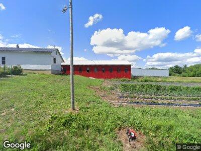
7625 W West Salem Rd West Salem, OH 44287
Estimated Value: $239,000 - $359,000
3
Beds
2
Baths
3,360
Sq Ft
$84/Sq Ft
Est. Value
About This Home
This home is located at 7625 W West Salem Rd, West Salem, OH 44287 and is currently estimated at $282,144, approximately $83 per square foot. 7625 W West Salem Rd is a home located in Wayne County with nearby schools including Northwestern Elementary School, Northwestern Middle School, and Northwestern High School.
Ownership History
Date
Name
Owned For
Owner Type
Purchase Details
Closed on
Mar 11, 2021
Sold by
Lehman Menno M
Bought by
Weaver Andy J and Weaver Lizzie J
Current Estimated Value
Home Financials for this Owner
Home Financials are based on the most recent Mortgage that was taken out on this home.
Original Mortgage
$150,000
Outstanding Balance
$135,983
Interest Rate
2.7%
Mortgage Type
Purchase Money Mortgage
Estimated Equity
$159,334
Create a Home Valuation Report for This Property
The Home Valuation Report is an in-depth analysis detailing your home's value as well as a comparison with similar homes in the area
Home Values in the Area
Average Home Value in this Area
Purchase History
| Date | Buyer | Sale Price | Title Company |
|---|---|---|---|
| Weaver Andy J | $180,000 | None Available | |
| Lehman Menno M | -- | None Available |
Source: Public Records
Mortgage History
| Date | Status | Borrower | Loan Amount |
|---|---|---|---|
| Open | Weaver Andy J | $150,000 | |
| Previous Owner | Lehman Menno M | $37,902 | |
| Previous Owner | Lehman Menno M | $42,715 | |
| Previous Owner | Lehman Menno M | $30,400 | |
| Previous Owner | Lehman Menno M | $95,123 | |
| Previous Owner | Lehman Menno M | $75,000 | |
| Previous Owner | Lehman Menno M | $25,500 |
Source: Public Records
Tax History Compared to Growth
Tax History
| Year | Tax Paid | Tax Assessment Tax Assessment Total Assessment is a certain percentage of the fair market value that is determined by local assessors to be the total taxable value of land and additions on the property. | Land | Improvement |
|---|---|---|---|---|
| 2024 | $3,376 | $104,270 | $39,640 | $64,630 |
| 2023 | $3,376 | $104,270 | $39,640 | $64,630 |
| 2022 | $3,533 | $104,270 | $39,640 | $64,630 |
| 2021 | $3,473 | $104,270 | $39,640 | $64,630 |
| 2020 | $2,357 | $85,260 | $39,640 | $45,620 |
| 2019 | $2,184 | $71,670 | $35,330 | $36,340 |
| 2018 | $2,147 | $71,670 | $35,330 | $36,340 |
| 2017 | $1,965 | $71,240 | $35,330 | $35,910 |
| 2016 | $1,904 | $56,650 | $28,020 | $28,630 |
| 2015 | $1,817 | $56,650 | $28,020 | $28,630 |
| 2014 | $3,116 | $72,280 | $32,510 | $39,770 |
| 2013 | $2,080 | $46,590 | $31,560 | $15,030 |
Source: Public Records
Map
Nearby Homes
- 15426 Fair Rd
- 5535 W Britton Rd
- 7104 Ruff Rd
- 141 Back St
- 12516 Congress Rd
- VL Franchester Rd
- 0 Ruff Rd Unit 9066272
- 0 Ruff Rd Unit 5105798
- 0 Ruff Rd Unit 229228
- 12255 Williams Rd
- 120 Sunset
- 120 Sunset Unit 28
- 105 W Oak St
- 125 Bank St
- 109 S Market St
- 215 High St
- 0 White Rd
- 432 Lisa Dr
- 214 County Road 620
- 9690 Firestone Rd
- 7625 W West Salem Rd
- 7568 W West Salem Rd
- 0 W Salem Rd Unit 216309
- 0 W Salem Rd Unit 216308
- 0 W Salem Rd Unit 4090195
- 0 W Salem Rd
- 7766 W West Salem Rd
- 7417 W Salem Rd
- 7417 W West Salem Rd
- 7807 W West Salem Rd
- 7379 W West Salem Rd
- 7844 W Salem Rd
- 7844 W West Salem Rd
- 7885 W West Salem Rd
- 7883 W West Salem Rd
- 7299 W Salem Rd
- 7917 W West Salem Rd
- 7948 W West Salem Rd
- 7951 W West Salem Rd
- 7951 W Salem Rd