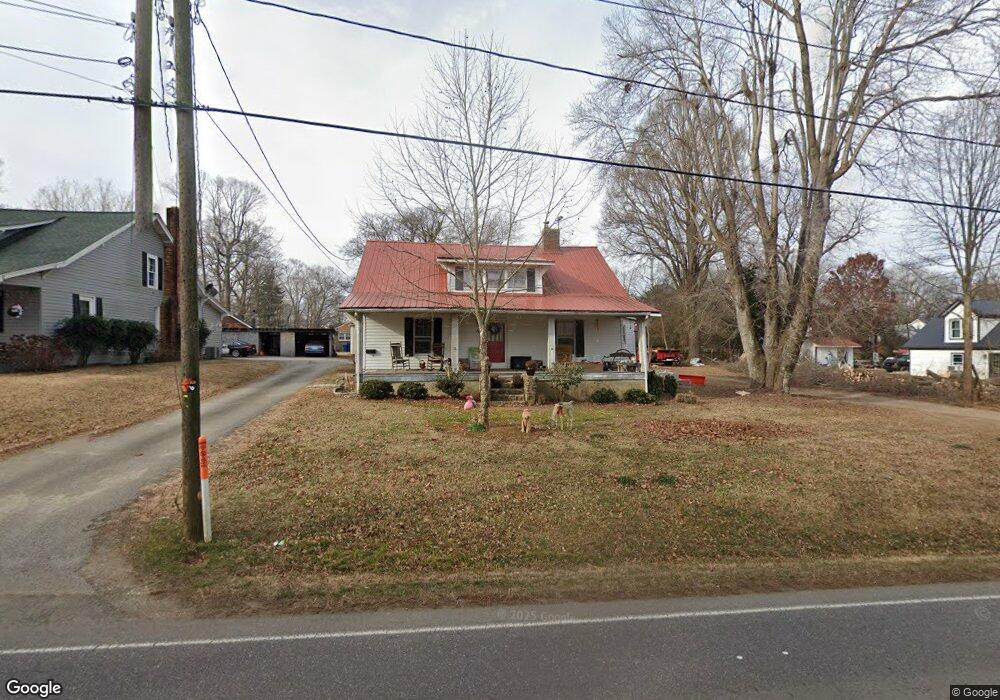
763 S Main St Mocksville, NC 27028
Estimated Value: $259,544 - $306,000
3
Beds
2
Baths
1,932
Sq Ft
$148/Sq Ft
Est. Value
About This Home
This home is located at 763 S Main St, Mocksville, NC 27028 and is currently estimated at $285,386, approximately $147 per square foot. 763 S Main St is a home located in Davie County with nearby schools including Mocksville Elementary School, South Davie Middle, and Davie County High School.
Ownership History
Date
Name
Owned For
Owner Type
Purchase Details
Closed on
Jul 3, 2023
Sold by
Porcari John Phillip
Bought by
Miller Rebecca Lynn and Reed Russell Robert
Current Estimated Value
Purchase Details
Closed on
Feb 1, 2001
Purchase Details
Closed on
Jul 1, 1997
Purchase Details
Closed on
Dec 1, 1990
Purchase Details
Closed on
Dec 1, 1987
Purchase Details
Closed on
Jul 1, 1986
Create a Home Valuation Report for This Property
The Home Valuation Report is an in-depth analysis detailing your home's value as well as a comparison with similar homes in the area
Home Values in the Area
Average Home Value in this Area
Purchase History
| Date | Buyer | Sale Price | Title Company |
|---|---|---|---|
| Miller Rebecca Lynn | $288,000 | None Listed On Document | |
| -- | $80,000 | -- | |
| -- | $60,000 | -- | |
| -- | -- | -- | |
| -- | $45,000 | -- | |
| -- | $45,000 | -- |
Source: Public Records
Tax History Compared to Growth
Tax History
| Year | Tax Paid | Tax Assessment Tax Assessment Total Assessment is a certain percentage of the fair market value that is determined by local assessors to be the total taxable value of land and additions on the property. | Land | Improvement |
|---|---|---|---|---|
| 2025 | $1,912 | $195,400 | $35,000 | $160,400 |
| 2024 | $1,225 | $115,250 | $40,000 | $75,250 |
| 2023 | $1,225 | $115,250 | $40,000 | $75,250 |
| 2022 | $1,225 | $115,250 | $40,000 | $75,250 |
| 2021 | $1,225 | $115,250 | $40,000 | $75,250 |
| 2020 | $1,265 | $118,440 | $40,000 | $78,440 |
| 2019 | $1,265 | $118,440 | $40,000 | $78,440 |
| 2018 | $1,265 | $118,440 | $40,000 | $78,440 |
| 2017 | $1,253 | $118,440 | $0 | $0 |
| 2016 | $1,314 | $124,210 | $0 | $0 |
| 2015 | $1,314 | $124,210 | $0 | $0 |
| 2014 | $1,180 | $124,210 | $0 | $0 |
| 2013 | -- | $124,210 | $0 | $0 |
Source: Public Records
Map
Nearby Homes
- 792 S Main St
- 142 Council St
- 135 Winding Creek Rd
- 181 New Hampshire Ct
- 147 Ariel Ct
- 210 Birchwood Ln
- 115 New Hampshire Ct Unit 35
- 115 New Hampshire Ct
- 151 Birchwood Ln
- LOT 66 N Carolina Cir
- LOT 13 N Carolina Cir
- LOT 62 N Carolina Cir
- 1 lot E Depot St
- 408 Pine St
- 351 Honeysuckle St
- 408 E Lake Dr
- 681 Sanford Ave
- 186 Crestview Dr
- 110 W Church St
- LOT 35 Rhode Island Ct
- 745 S Main St
- 775 S Main St
- 812 S Salisbury St
- 701 S Main St
- 810 S Salisbury St
- 820 S Salisbury St
- 753 S Main St
- 824 S Salisbury St
- 781 S Main St
- 800 S Salisbury St
- 776 S Main St
- 828 S Salisbury St
- 744 S Main St
- 793 S Main St
- 772 S Salisbury St
- 809 S Salisbury St
- 758 S Salisbury St
- 715 S Main St
- 801 S Salisbury St
- 799 S Main St