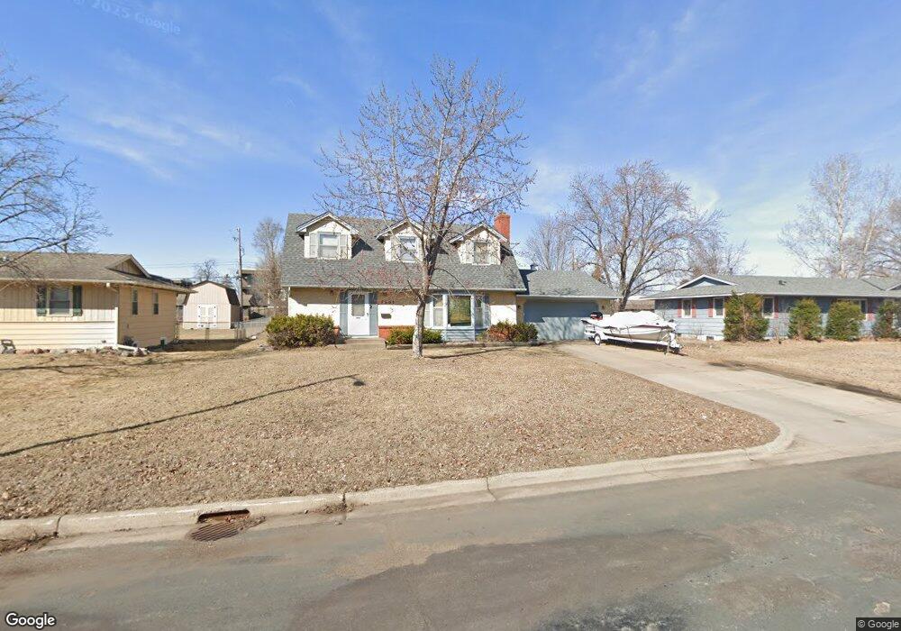
7633 Unity Ave N Brooklyn Park, MN 55443
Estimated Value: $322,446 - $356,000
3
Beds
3
Baths
1,887
Sq Ft
$181/Sq Ft
Est. Value
About This Home
This home is located at 7633 Unity Ave N, Brooklyn Park, MN 55443 and is currently estimated at $341,862, approximately $181 per square foot. 7633 Unity Ave N is a home located in Hennepin County with nearby schools including Zanewood Community School, North View Middle School, and Park Center Senior High.
Ownership History
Date
Name
Owned For
Owner Type
Purchase Details
Closed on
Feb 5, 2016
Sold by
Tvedt Wendi Lynn
Bought by
Munkhamxang Somboune
Current Estimated Value
Home Financials for this Owner
Home Financials are based on the most recent Mortgage that was taken out on this home.
Original Mortgage
$175,722
Outstanding Balance
$138,000
Interest Rate
3.5%
Mortgage Type
FHA
Estimated Equity
$203,862
Purchase Details
Closed on
Nov 26, 1999
Sold by
Bjorkedal Jon H and Bjorkedal Bonny Lou
Bought by
Tvedt Donald S and Tvedt Wendi L
Create a Home Valuation Report for This Property
The Home Valuation Report is an in-depth analysis detailing your home's value as well as a comparison with similar homes in the area
Home Values in the Area
Average Home Value in this Area
Purchase History
| Date | Buyer | Sale Price | Title Company |
|---|---|---|---|
| Munkhamxang Somboune | $179,000 | First American Title Ins Co | |
| Tvedt Donald S | $139,500 | -- |
Source: Public Records
Mortgage History
| Date | Status | Borrower | Loan Amount |
|---|---|---|---|
| Open | Munkhamxang Somboune | $175,722 |
Source: Public Records
Tax History Compared to Growth
Tax History
| Year | Tax Paid | Tax Assessment Tax Assessment Total Assessment is a certain percentage of the fair market value that is determined by local assessors to be the total taxable value of land and additions on the property. | Land | Improvement |
|---|---|---|---|---|
| 2024 | $3,757 | $273,600 | $120,000 | $153,600 |
| 2023 | $3,619 | $271,500 | $120,000 | $151,500 |
| 2022 | $3,226 | $287,100 | $120,000 | $167,100 |
| 2021 | $3,015 | $242,000 | $58,000 | $184,000 |
| 2020 | $2,931 | $228,200 | $58,000 | $170,200 |
| 2019 | $2,980 | $212,500 | $58,000 | $154,500 |
| 2018 | $2,785 | $205,500 | $50,500 | $155,000 |
| 2017 | $2,789 | $185,300 | $50,500 | $134,800 |
| 2016 | $2,857 | $167,100 | $50,500 | $116,600 |
| 2015 | $2,969 | $168,000 | $40,400 | $127,600 |
| 2014 | -- | $143,700 | $40,400 | $103,300 |
Source: Public Records
Map
Nearby Homes
- 5664 Brookdale Dr N
- 5648 Brookdale Dr N
- 7740 Arlington Ave N
- 5636 Brookdale Dr N
- 5624 Brookdale Dr N
- 7880 Yates Ave N
- 7936 Yates Ave N
- 7509 Xenia Ln N
- 5729 75th Ln N
- 5717 80th Ave N
- 5333 80th Ave N
- 7337 Unity Ln N
- 7308 Unity Ln N
- 8040 Xenia Ave N
- 8033 Quail Ave N
- 7700 Tessman Dr N
- 7441 Major Ave N
- 6034 72nd Ln N
- 7201 Perry Ct E
- 8230 Scott Ave N
- 7625 Unity Ave N
- 7641 Unity Ave N
- 7624 7624 Unity Ave N
- 7617 Unity Ave N
- 7649 Unity Ave N
- 7640 Unity Ave N
- 7624 Unity Ave N
- 7609 Unity Ave N
- 5324 76th Place N
- 7648 Unity Ave N
- 7657 Unity Ave N
- 5325 76th Place N
- 5325 77th Ave N
- 5521 Brookdale Dr N
- 7608 7608 N Unity-Avenue-n
- 7608 7608 Unity-Avenue-n
- 5316 76th Place N
- 7601 Unity Ave N
- 7608 Unity Ave N
- 7641 Scott Ave N