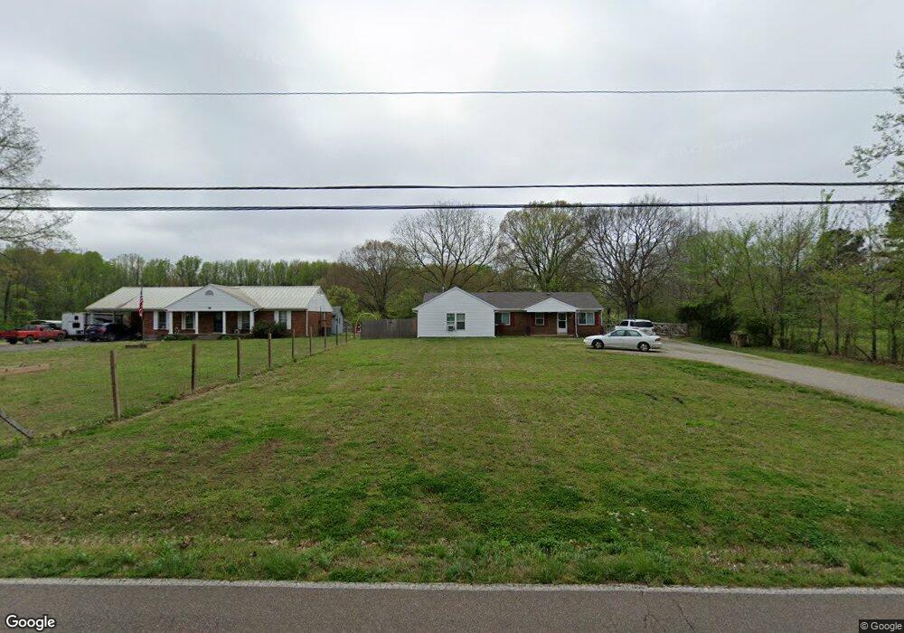
7637 Ward Rd Millington, TN 38053
Estimated Value: $243,000 - $287,000
4
Beds
2
Baths
2,294
Sq Ft
$115/Sq Ft
Est. Value
About This Home
This home is located at 7637 Ward Rd, Millington, TN 38053 and is currently estimated at $263,106, approximately $114 per square foot. 7637 Ward Rd is a home located in Shelby County with nearby schools including E.E. Jeter Elementary School and Trezevant High School.
Ownership History
Date
Name
Owned For
Owner Type
Purchase Details
Closed on
Mar 19, 2015
Sold by
Sloan Alice L
Bought by
Weaks Stephanie L
Current Estimated Value
Home Financials for this Owner
Home Financials are based on the most recent Mortgage that was taken out on this home.
Original Mortgage
$73,641
Outstanding Balance
$55,749
Interest Rate
3.37%
Mortgage Type
FHA
Estimated Equity
$207,357
Purchase Details
Closed on
Jan 6, 1999
Sold by
Sloan Leon P and Sloan Alice L
Bought by
Sloan Leon P and Sloan Alice L
Purchase Details
Closed on
Apr 19, 1996
Bought by
Lamont Ralph W and Lamont Athryn L
Create a Home Valuation Report for This Property
The Home Valuation Report is an in-depth analysis detailing your home's value as well as a comparison with similar homes in the area
Home Values in the Area
Average Home Value in this Area
Purchase History
| Date | Buyer | Sale Price | Title Company |
|---|---|---|---|
| Weaks Stephanie L | $75,000 | None Available | |
| Sloan Leon P | -- | Mid America Title Agency Inc | |
| Lamont Ralph W | $60,500 | -- |
Source: Public Records
Mortgage History
| Date | Status | Borrower | Loan Amount |
|---|---|---|---|
| Open | Weaks Stephanie L | $73,641 |
Source: Public Records
Tax History Compared to Growth
Tax History
| Year | Tax Paid | Tax Assessment Tax Assessment Total Assessment is a certain percentage of the fair market value that is determined by local assessors to be the total taxable value of land and additions on the property. | Land | Improvement |
|---|---|---|---|---|
| 2025 | $1,476 | $56,950 | $4,900 | $52,050 |
| 2024 | $1,476 | $43,525 | $4,300 | $39,225 |
| 2023 | $1,476 | $43,525 | $4,300 | $39,225 |
| 2022 | $1,476 | $43,525 | $4,300 | $39,225 |
| 2021 | $906 | $26,250 | $4,300 | $21,950 |
| 2020 | $764 | $18,875 | $3,900 | $14,975 |
| 2019 | $764 | $18,875 | $3,900 | $14,975 |
| 2018 | $764 | $18,875 | $3,900 | $14,975 |
| 2017 | $776 | $18,875 | $3,900 | $14,975 |
| 2016 | $612 | $14,000 | $0 | $0 |
| 2014 | $612 | $14,000 | $0 | $0 |
Source: Public Records
Map
Nearby Homes
- 7265 Ward Rd
- 7550 Woodstock Cuba Rd
- 2078 Russell Bond Rd
- 7790 Deer Lake Dr
- 8292 Rankin Branch Rd
- 1907 Campbell Rd
- 8205 Shakerag Rd
- 7441 Walsh Rd
- 3300 Cuba Millington Rd
- 6770 Camp John Rd
- 8159 Epperson Mill Rd
- 6639 Old Millington Rd
- 6746 Old Millington Rd
- TRACT 9 Powder Plant Dr
- 1 Walsh Rd
- 8925 Herring Hill Rd
- 1435 Walsh Cove
- 0 St Paul Rd Unit 10199051
- 6234 Woodstock Cuba Rd
- 1932 Saint Paul Rd
- 7625 Ward Rd
- 7663 Ward Rd
- 7685 Ward Rd
- 7583 Ward Rd
- 7705 Ward Rd
- 7716 Independence Rd
- 7580 Independence Rd
- 7559 Ward Rd
- 7660 Independence Rd
- 7726 Ward Rd
- 7545 Ward Rd
- 7736 Ward Rd
- 7584 Independence Rd
- 7531 Ward Rd
- 7519 Ward Rd
- 7711 Independence Rd
- 7574 Independence Rd
- 7756 Ward Rd
- 7512 Ward Rd
- 7491 Ward Rd