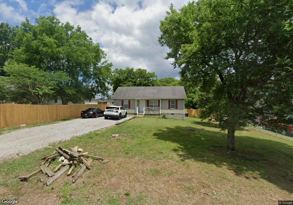
764 Cedar St Lewisburg, TN 37091
Estimated Value: $160,000 - $200,000
--
Bed
2
Baths
912
Sq Ft
$201/Sq Ft
Est. Value
About This Home
This home is located at 764 Cedar St, Lewisburg, TN 37091 and is currently estimated at $183,343, approximately $201 per square foot. 764 Cedar St is a home located in Marshall County with nearby schools including Marshall Elementary School, Oak Grove Elementary School, and Westhills Elementary School.
Ownership History
Date
Name
Owned For
Owner Type
Purchase Details
Closed on
Jun 15, 2007
Sold by
Homesales Inc
Bought by
Nancy Denison
Current Estimated Value
Home Financials for this Owner
Home Financials are based on the most recent Mortgage that was taken out on this home.
Original Mortgage
$54,900
Outstanding Balance
$33,538
Interest Rate
6.16%
Estimated Equity
$149,805
Purchase Details
Closed on
Feb 15, 2007
Sold by
Dawn Cozart Christie
Bought by
Homesales Inc
Purchase Details
Closed on
May 22, 2000
Bought by
Jent David
Create a Home Valuation Report for This Property
The Home Valuation Report is an in-depth analysis detailing your home's value as well as a comparison with similar homes in the area
Home Values in the Area
Average Home Value in this Area
Purchase History
| Date | Buyer | Sale Price | Title Company |
|---|---|---|---|
| Nancy Denison | $61,000 | -- | |
| Homesales Inc | -- | -- | |
| Homesales Inc | $64,132 | -- | |
| Jent David | $15,200 | -- |
Source: Public Records
Mortgage History
| Date | Status | Borrower | Loan Amount |
|---|---|---|---|
| Open | Jent David | $54,900 | |
| Closed | Jent David | $54,900 |
Source: Public Records
Tax History Compared to Growth
Tax History
| Year | Tax Paid | Tax Assessment Tax Assessment Total Assessment is a certain percentage of the fair market value that is determined by local assessors to be the total taxable value of land and additions on the property. | Land | Improvement |
|---|---|---|---|---|
| 2024 | -- | $30,475 | $5,000 | $25,475 |
| 2023 | $946 | $30,475 | $5,000 | $25,475 |
| 2022 | $784 | $30,475 | $5,000 | $25,475 |
| 2021 | $847 | $18,225 | $3,000 | $15,225 |
| 2020 | $847 | $18,225 | $3,000 | $15,225 |
| 2019 | $820 | $18,225 | $3,000 | $15,225 |
| 2018 | $811 | $18,225 | $3,000 | $15,225 |
| 2017 | $811 | $18,225 | $3,000 | $15,225 |
| 2016 | $765 | $14,925 | $2,625 | $12,300 |
| 2015 | $697 | $14,925 | $2,625 | $12,300 |
| 2014 | $697 | $14,925 | $2,625 | $12,300 |
Source: Public Records
Map
Nearby Homes
- 610 Forrest St
- 518 Maple St
- 525 Maple St
- 215 5th Ave N
- 726 Thomas Ave
- 0 New Lake Rd Unit RTC3030964
- 117 W End Ave N
- 1221 W Commerce St
- 251 Joyce Ave
- 108 W End Ave N
- 1111 W End Ave N
- 632 Colburn Dr
- 240 Joyce Ave
- 316 Haynes St
- 640 6th Ave S
- 347 Oakwood Dr
- 966 Berry St
- 1371 W Commerce St
- 0 Joyce Ave
- 630 6th Ave N
- 139 8th Ave S
- 756 Cedar St
- 121 8th Ave S
- 763 Cedar St
- 203 8th Ave S
- 778 Villa Green Dr
- 755 Cedar St
- 751 Villa Green Dr
- 780 Villa Green Dr
- 740 Cedar St
- 138 8th Ave S
- 753 Villa Green Dr
- 126 8th Ave S
- 761 Villa Green Dr
- 781 Villa Green Dr
- 111 8th Ave S
- 214 8th Ave S
- 783 Villa Green Dr
- 739 Cedar St
- 120 8th Ave S