C
Seller's Agent in 2025
Crystal Thomas
United Real Estate Indpls
2 in this area
8 Total Sales
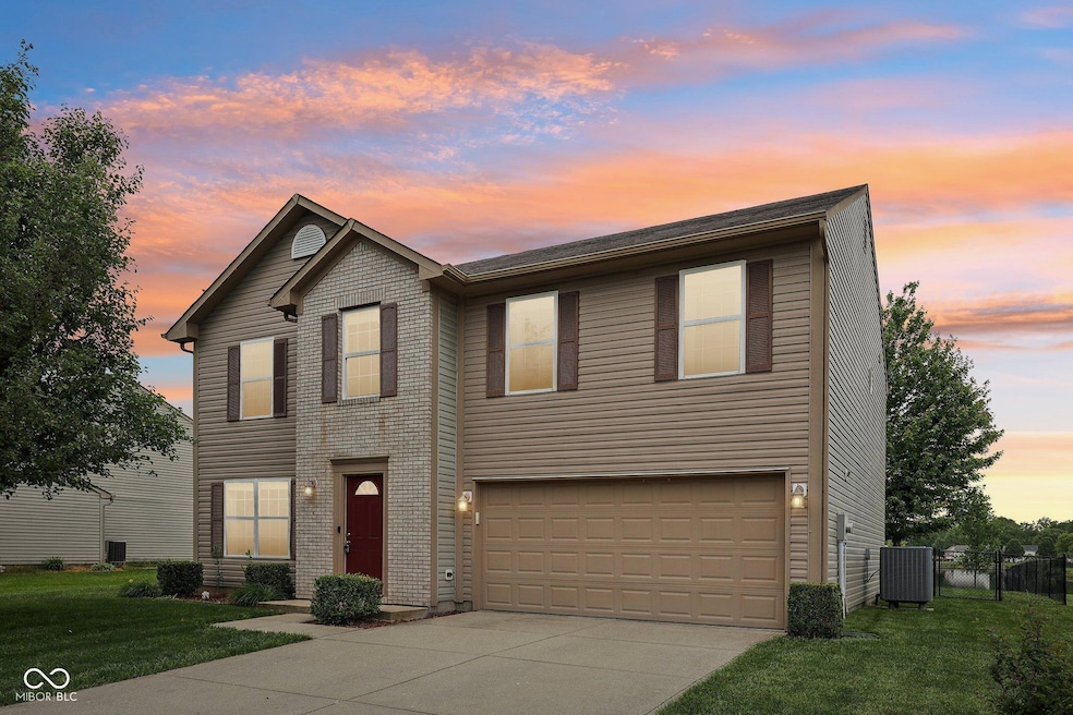
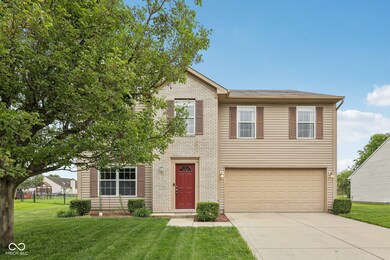

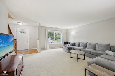
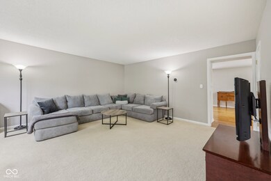
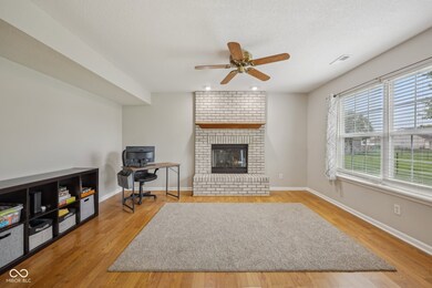
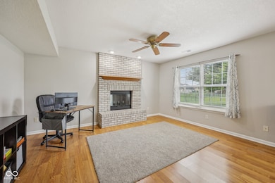
Lakeland Farms Community 4-bedroom, 2.5-bath home. Located within Avon Community School District, this home features an oversized primary suite complete with both a shower & garden tub and his-and-her closets. Laundry and 3 generously sized bedrooms, each with walk-in closets are located on the upper level. Downstairs, two separate living areas provide the perfect blend of comfort and versatility. Step just outside your brand new sliding glass door from dining room to enjoy summer evenings in a fully fenced backyard, where you can take in a beautiful view of the sunset over the community pond. Please reach out to schedule a private tour.
Last Buyer's Agent
Gigiola Gomez
Horizon Real Estate of Indiana
| Date | Type | Sale Price | Title Company |
|---|---|---|---|
| Warranty Deed | -- | None Listed On Document | |
| Interfamily Deed Transfer | -- | Fidelity National Title | |
| Warranty Deed | -- | None Available | |
| Special Warranty Deed | -- | -- | |
| Sheriffs Deed | $124,764 | -- |
| Date | Status | Loan Amount | Loan Type |
|---|---|---|---|
| Open | $341,440 | New Conventional | |
| Previous Owner | $141,137 | FHA |
| Date | Event | Price | List to Sale | Price per Sq Ft |
|---|---|---|---|---|
| 07/18/2025 07/18/25 | Sold | $352,000 | +0.6% | $141 / Sq Ft |
| 06/02/2025 06/02/25 | Pending | -- | -- | -- |
| 05/29/2025 05/29/25 | For Sale | $349,900 | -- | $141 / Sq Ft |
| Year | Tax Paid | Tax Assessment Tax Assessment Total Assessment is a certain percentage of the fair market value that is determined by local assessors to be the total taxable value of land and additions on the property. | Land | Improvement |
|---|---|---|---|---|
| 2024 | $2,929 | $261,400 | $37,300 | $224,100 |
| 2023 | $2,673 | $241,100 | $37,300 | $203,800 |
| 2022 | $2,532 | $225,700 | $37,300 | $188,400 |
| 2021 | $2,211 | $192,800 | $37,300 | $155,500 |
| 2020 | $2,086 | $184,900 | $37,300 | $147,600 |
| 2019 | $1,875 | $168,700 | $30,800 | $137,900 |
| 2018 | $1,927 | $166,700 | $30,800 | $135,900 |
| 2017 | $1,594 | $159,400 | $29,300 | $130,100 |
| 2016 | $1,553 | $155,300 | $29,300 | $126,000 |
| 2014 | $1,425 | $142,500 | $26,500 | $116,000 |
C
Seller's Agent in 2025
Crystal Thomas
United Real Estate Indpls
2 in this area
8 Total Sales

Seller Co-Listing Agent in 2025
Dody Mariscotti
United Real Estate Indpls
(317) 914-5557
33 in this area
145 Total Sales
G
Buyer's Agent in 2025
Gigiola Gomez
Horizon Real Estate of Indiana
Source: MIBOR Broker Listing Cooperative®
MLS Number: 22040593
APN: 32-10-01-231-006.000-022
Disclaimer: Certain information contained herein is derived from information provided by parties other than Homes.com. All information provided is deemed reliable, but is not guaranteed to be accurate and should be independently verified.
![]() Based on information submitted to the MLS GRID. All data is obtained from various sources and may not have been verified by broker or MLS GRID. Supplied Open House Information is subject to change without notice. All information should be independently reviewed and verified for accuracy. Properties may or may not be listed by the office/agent presenting the information. Some IDX listings have been excluded from this website.
Based on information submitted to the MLS GRID. All data is obtained from various sources and may not have been verified by broker or MLS GRID. Supplied Open House Information is subject to change without notice. All information should be independently reviewed and verified for accuracy. Properties may or may not be listed by the office/agent presenting the information. Some IDX listings have been excluded from this website.