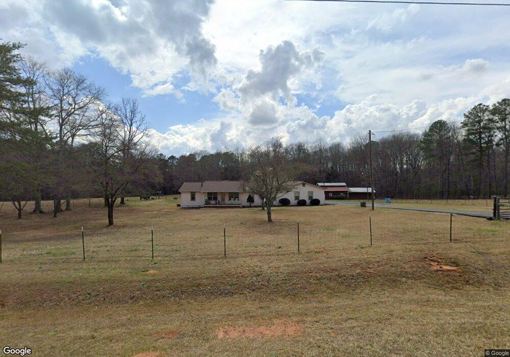
764 S Bethany Rd McDonough, GA 30252
Estimated Value: $319,547 - $474,000
3
Beds
2
Baths
1,800
Sq Ft
$212/Sq Ft
Est. Value
About This Home
This home is located at 764 S Bethany Rd, McDonough, GA 30252 and is currently estimated at $381,137, approximately $211 per square foot. 764 S Bethany Rd is a home located in Henry County with nearby schools including Tussahaw Elementary School, Locust Grove Middle School, and Locust Grove High School.
Ownership History
Date
Name
Owned For
Owner Type
Purchase Details
Closed on
Sep 23, 2025
Sold by
Wilson Joe T
Bought by
Wilson Joe T Jr Trust and Wilson Joe T
Current Estimated Value
Purchase Details
Closed on
Feb 23, 1998
Sold by
Felix Michael R and Felix Patricia C
Bought by
Wilson Joe Thomas
Home Financials for this Owner
Home Financials are based on the most recent Mortgage that was taken out on this home.
Original Mortgage
$108,000
Interest Rate
6.95%
Mortgage Type
New Conventional
Create a Home Valuation Report for This Property
The Home Valuation Report is an in-depth analysis detailing your home's value as well as a comparison with similar homes in the area
Home Values in the Area
Average Home Value in this Area
Purchase History
| Date | Buyer | Sale Price | Title Company |
|---|---|---|---|
| Wilson Joe T Jr Trust | -- | -- | |
| Wilson Joe Thomas | $135,000 | -- |
Source: Public Records
Mortgage History
| Date | Status | Borrower | Loan Amount |
|---|---|---|---|
| Previous Owner | Wilson Joe Thomas | $108,000 |
Source: Public Records
Tax History Compared to Growth
Tax History
| Year | Tax Paid | Tax Assessment Tax Assessment Total Assessment is a certain percentage of the fair market value that is determined by local assessors to be the total taxable value of land and additions on the property. | Land | Improvement |
|---|---|---|---|---|
| 2025 | $3,046 | $125,520 | $32,400 | $93,120 |
| 2024 | $3,046 | $120,600 | $29,160 | $91,440 |
| 2023 | $2,823 | $116,080 | $28,080 | $88,000 |
| 2022 | $2,790 | $93,480 | $25,920 | $67,560 |
| 2021 | $2,504 | $81,520 | $22,240 | $59,280 |
| 2020 | $2,308 | $73,280 | $20,960 | $52,320 |
| 2019 | $2,153 | $66,800 | $19,880 | $46,920 |
| 2018 | $2,023 | $61,320 | $18,360 | $42,960 |
| 2016 | $1,912 | $55,920 | $16,200 | $39,720 |
| 2015 | $1,822 | $52,360 | $15,560 | $36,800 |
| 2014 | $1,533 | $44,680 | $15,560 | $29,120 |
Source: Public Records
Map
Nearby Homes
- 705 S Bethany Rd
- 281 Laney Dr
- 121, 125, 129 Case Dr
- 767 Old Jackson Rd
- 995 Old Jackson Rd
- 1171 King Mill Rd
- 461 Old Jackson Rd
- 205 Calvery Way
- 315 S Bethany Rd
- 1126 Old Jackson Rd
- 143 Kimbell Farm Dr
- 275 S Bethany Rd
- 201 Nina Cir
- 100 Harbin Trail
- 242 Old Jackson Rd
- 215 Laney Rd
- 103 Royal Way
- 1000 Coan Dr
- 521 Deadwood Trail
- 151 River Park Cir
- 746 S Bethany Rd
- 776 S Bethany Rd
- 772 S Bethany Rd
- 0 Laney Dr Unit 8429622
- 0 Laney Dr Unit 3178042
- 0 Laney Dr Unit 7173176
- 0 Laney Dr Unit 209 7273477
- 778 S Bethany Rd
- 710 S Bethany Rd
- 800 S Bethany Rd Unit 3.69
- 800 S Bethany Rd
- 820 S Bethany Rd
- 647 S Bethany Rd
- 704 S Bethany Rd
- 25 Laney Dr
- 15 Laney Dr
- 890 S Bethany Rd
- S S Bethany Rd Unit 3.69
- S S Bethany Rd
- 944 Bethany Ln Unit 3