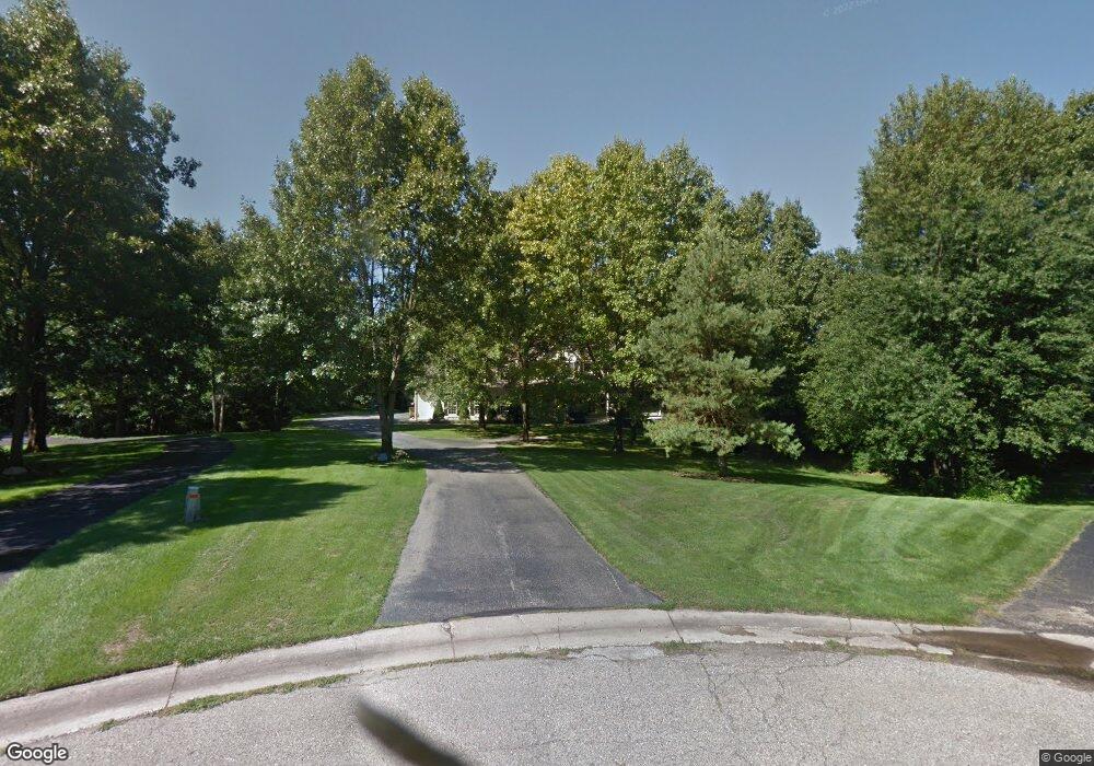
7643 Spring Point Ct NE Rockford, MI 49341
Estimated Value: $720,000 - $974,000
5
Beds
5
Baths
3,693
Sq Ft
$237/Sq Ft
Est. Value
About This Home
This home is located at 7643 Spring Point Ct NE, Rockford, MI 49341 and is currently estimated at $876,692, approximately $237 per square foot. 7643 Spring Point Ct NE is a home located in Kent County with nearby schools including Meadow Ridge Elementary School, East Rockford Middle School, and Rockford High School Freshman Center.
Ownership History
Date
Name
Owned For
Owner Type
Purchase Details
Closed on
Mar 24, 2023
Sold by
Wurn Mark R and Wurn Lori M
Bought by
Wurn Mark R and Wurn Mark R
Current Estimated Value
Purchase Details
Closed on
Jan 12, 2006
Sold by
Wurn Mark R and Farquhar Lori M
Bought by
Wurn Mark R and Wurn Lori M
Home Financials for this Owner
Home Financials are based on the most recent Mortgage that was taken out on this home.
Original Mortgage
$750,000
Interest Rate
6.2%
Mortgage Type
Credit Line Revolving
Create a Home Valuation Report for This Property
The Home Valuation Report is an in-depth analysis detailing your home's value as well as a comparison with similar homes in the area
Home Values in the Area
Average Home Value in this Area
Purchase History
| Date | Buyer | Sale Price | Title Company |
|---|---|---|---|
| Wurn Mark R | -- | None Listed On Document | |
| Wurn Mark R | -- | None Available |
Source: Public Records
Mortgage History
| Date | Status | Borrower | Loan Amount |
|---|---|---|---|
| Previous Owner | Wurn Mark R | $750,000 |
Source: Public Records
Tax History Compared to Growth
Tax History
| Year | Tax Paid | Tax Assessment Tax Assessment Total Assessment is a certain percentage of the fair market value that is determined by local assessors to be the total taxable value of land and additions on the property. | Land | Improvement |
|---|---|---|---|---|
| 2025 | $5,788 | $389,800 | $0 | $0 |
| 2024 | $5,788 | $375,400 | $0 | $0 |
| 2023 | $5,537 | $324,100 | $0 | $0 |
| 2022 | $7,775 | $307,400 | $0 | $0 |
| 2021 | $7,474 | $290,700 | $0 | $0 |
| 2020 | $5,125 | $283,600 | $0 | $0 |
| 2019 | $7,399 | $259,900 | $0 | $0 |
| 2018 | $7,399 | $248,500 | $51,100 | $197,400 |
| 2017 | $7,208 | $239,900 | $0 | $0 |
| 2016 | $6,901 | $217,400 | $0 | $0 |
| 2015 | -- | $217,400 | $0 | $0 |
| 2013 | -- | $216,300 | $0 | $0 |
Source: Public Records
Map
Nearby Homes
- 7650 Courtland Dr NE
- 4777 Windcliff Dr NE
- 4749 Windcliff Dr NE Unit 9
- 7878 Northland Dr NE
- 4985 Tiamo Ln NE
- 8241 Courtland Dr NE
- 6950 Barkley Creek Dr NE
- 5090 Natchez Ct NE
- 5700 Kies St NE
- 8365 Atlanta Dr NE
- 8343 Atlanta Dr NE
- 7994 Jericho Ave NE
- 4875 Belding Rd NE
- 4286 Millpond Dr NE
- 6640 Walnut Run Dr NE
- 8035 Jericho Ave NE
- 175 S Main St
- 131 S Monroe St NE
- 8311 Rum Creek Trail NE
- 126 S Main St
- 7655 Spring Point Ct NE
- 7642 Spring Point Ct NE
- 7667 Spring Point Ct NE
- 7658 Spring Point Ct NE
- 7699 Spring Point Ct NE
- 7700 Forest Ct NE
- 7710 Forest Ct NE
- 7722 Forest Ct NE
- 7680 Spring Point Ct NE
- 7725 Spring Point Ct NE
- 7453 Courtland Dr NE
- 7750 Forest Ct NE
- 7385 Courtland Dr NE
- 7753 Spring Point Ct NE
- 7728 Spring Point Ct NE
- 7757 Forest Ct NE
- 7775 Spring Point Ct NE
- 7764 Forest Ct NE
- 7754 Spring Point Ct NE
- 7505 Courtland Dr NE Unit 7453