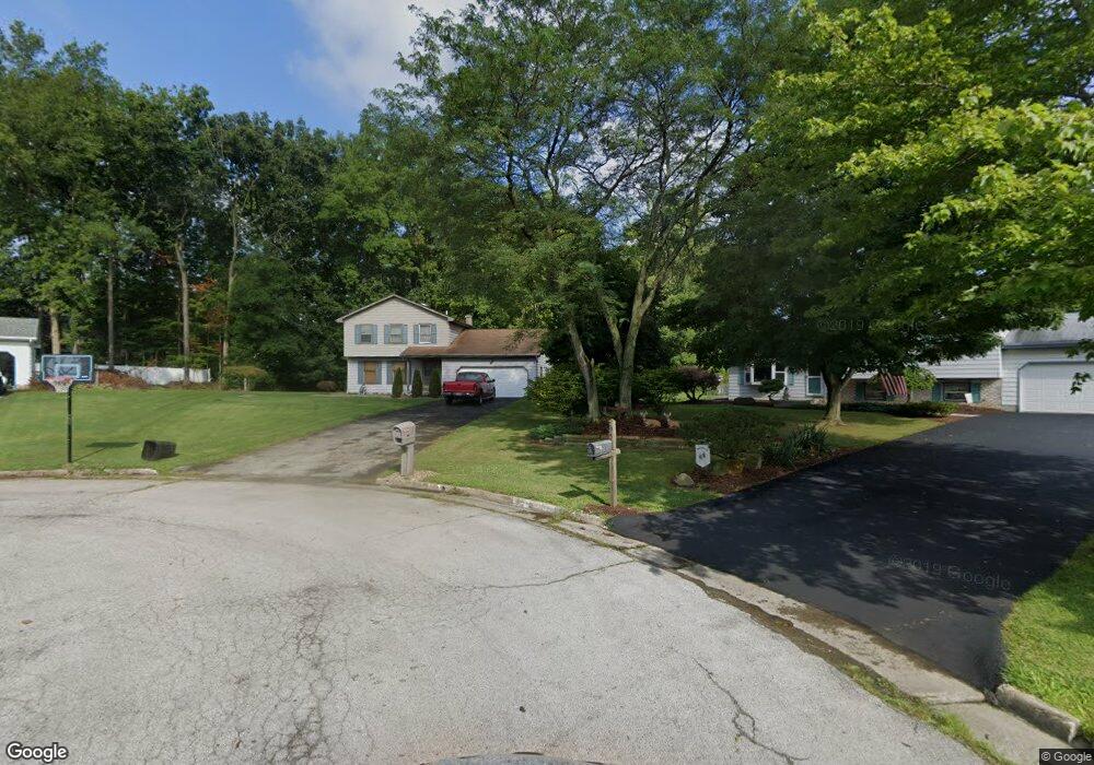
7644 Franco Ct Youngstown, OH 44512
Estimated Value: $234,000 - $263,000
3
Beds
2
Baths
1,542
Sq Ft
$162/Sq Ft
Est. Value
About This Home
This home is located at 7644 Franco Ct, Youngstown, OH 44512 and is currently estimated at $249,371, approximately $161 per square foot. 7644 Franco Ct is a home located in Mahoning County with nearby schools including Robinwood Lane Elementary School, Boardman Glenwood Junior High School, and Boardman High School.
Ownership History
Date
Name
Owned For
Owner Type
Purchase Details
Closed on
Oct 21, 2002
Sold by
Sloan Anne M
Bought by
Sirak Andrew M
Current Estimated Value
Home Financials for this Owner
Home Financials are based on the most recent Mortgage that was taken out on this home.
Original Mortgage
$96,800
Outstanding Balance
$40,968
Interest Rate
6.29%
Estimated Equity
$208,403
Purchase Details
Closed on
Mar 15, 2001
Sold by
Sloan Thomas J and Sloan Anne M
Bought by
Sloan Anne M
Home Financials for this Owner
Home Financials are based on the most recent Mortgage that was taken out on this home.
Original Mortgage
$70,500
Interest Rate
7.05%
Purchase Details
Closed on
May 10, 1989
Bought by
Sloan Thomas J and Sloan Anne M
Create a Home Valuation Report for This Property
The Home Valuation Report is an in-depth analysis detailing your home's value as well as a comparison with similar homes in the area
Home Values in the Area
Average Home Value in this Area
Purchase History
| Date | Buyer | Sale Price | Title Company |
|---|---|---|---|
| Sirak Andrew M | $121,000 | -- | |
| Sloan Anne M | -- | -- | |
| Sloan Thomas J | $91,000 | -- |
Source: Public Records
Mortgage History
| Date | Status | Borrower | Loan Amount |
|---|---|---|---|
| Open | Sirak Andrew M | $96,800 | |
| Previous Owner | Sloan Anne M | $70,500 |
Source: Public Records
Tax History Compared to Growth
Tax History
| Year | Tax Paid | Tax Assessment Tax Assessment Total Assessment is a certain percentage of the fair market value that is determined by local assessors to be the total taxable value of land and additions on the property. | Land | Improvement |
|---|---|---|---|---|
| 2024 | $3,094 | $69,930 | $15,800 | $54,130 |
| 2023 | $3,084 | $69,930 | $15,800 | $54,130 |
| 2022 | $2,731 | $49,770 | $12,170 | $37,600 |
| 2021 | $2,733 | $49,770 | $12,170 | $37,600 |
| 2020 | $2,746 | $49,770 | $12,170 | $37,600 |
| 2019 | $3,034 | $39,980 | $11,060 | $28,920 |
| 2018 | $2,631 | $39,980 | $11,060 | $28,920 |
| 2017 | $2,579 | $39,980 | $11,060 | $28,920 |
| 2016 | $2,570 | $39,450 | $12,250 | $27,200 |
| 2015 | $2,520 | $39,450 | $12,250 | $27,200 |
| 2014 | $2,527 | $39,450 | $12,250 | $27,200 |
| 2013 | $2,495 | $39,450 | $12,250 | $27,200 |
Source: Public Records
Map
Nearby Homes
- 7708 Buchanan Dr
- 912 Pearson Cir Unit 5
- 0 Saddlebrook Lot 123 Dr Unit 4442579
- 0 Saddlebrook Lot 153 Dr Unit 4442592
- 0 Saddlebrook Lot 156 Dr Unit 4442599
- 918 Pearson Cir Unit 4
- 829 Pearson Cir
- 942 Pearson Cir Unit 4
- 681 Saddlebrook Dr
- 816 Pearson Un#1
- 873 Auburn Hills Dr Unit 3
- 7368 Eisenhower Dr Unit 5
- 7680 Paulin Dr
- 7733 Crimson Trail Unit B
- 8360 South Ave
- 7900 Walnut St Unit 25
- 8010 Sigle Ln
- 785 Terraview Dr
- 8129 South Ave
- 110 Boardman Blvd
- 7640 Franco Ct
- 7648 Franco Ct
- 7636 Franco Ct
- 7661 Winterberry Dr
- 7669 Winterberry Dr
- 7652 Franco Ct
- 7653 Winterberry Dr
- 7632 Franco Ct
- 7656 Franco Ct
- 7677 Winterberry Dr
- 783 Presidential Dr
- 797 Presidential Dr
- 777 Presidential Dr
- 7660 Franco Ct
- 803 Presidential Dr
- 7645 Winterberry Dr
- 7685 Winterberry Dr
- 771 Presidential Dr
- 7668 Buchanan Dr
- 7654 Winterberry Dr