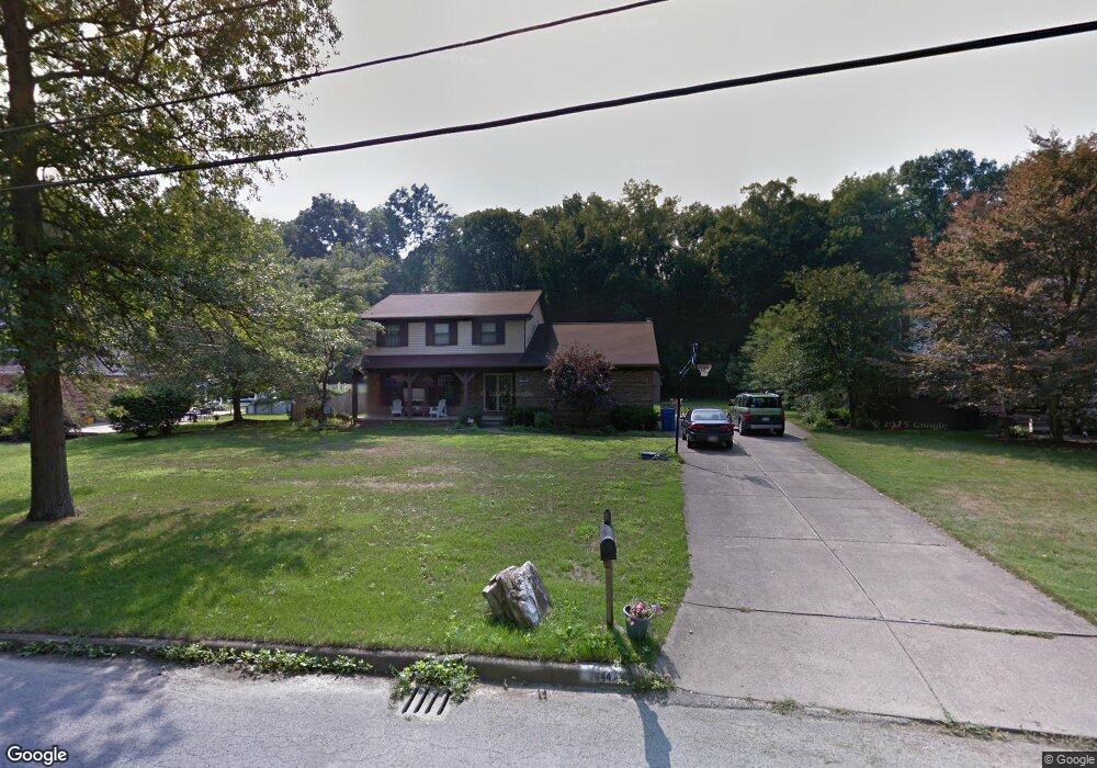
7644 Spring Park Dr Youngstown, OH 44512
Estimated Value: $311,000 - $339,000
3
Beds
3
Baths
2,256
Sq Ft
$144/Sq Ft
Est. Value
About This Home
This home is located at 7644 Spring Park Dr, Youngstown, OH 44512 and is currently estimated at $325,086, approximately $144 per square foot. 7644 Spring Park Dr is a home located in Mahoning County with nearby schools including Stadium Drive Elementary School, Boardman Center Middle School, and Boardman High School.
Ownership History
Date
Name
Owned For
Owner Type
Purchase Details
Closed on
Jul 6, 2005
Sold by
Barrett Guy C and Barrett Shannon L
Bought by
May Christopher J and May Laurie A
Current Estimated Value
Home Financials for this Owner
Home Financials are based on the most recent Mortgage that was taken out on this home.
Original Mortgage
$162,050
Outstanding Balance
$85,083
Interest Rate
5.75%
Mortgage Type
Fannie Mae Freddie Mac
Estimated Equity
$240,003
Purchase Details
Closed on
May 10, 2000
Sold by
Awad Mounir and Awad Linda
Bought by
Barrett Guy C and Barrett Shannon L
Home Financials for this Owner
Home Financials are based on the most recent Mortgage that was taken out on this home.
Original Mortgage
$125,800
Interest Rate
8.26%
Purchase Details
Closed on
Aug 31, 1981
Bought by
Awad Mounir and Awad Linda
Create a Home Valuation Report for This Property
The Home Valuation Report is an in-depth analysis detailing your home's value as well as a comparison with similar homes in the area
Home Values in the Area
Average Home Value in this Area
Purchase History
| Date | Buyer | Sale Price | Title Company |
|---|---|---|---|
| May Christopher J | $170,600 | -- | |
| Barrett Guy C | $148,000 | -- | |
| Awad Mounir | -- | -- |
Source: Public Records
Mortgage History
| Date | Status | Borrower | Loan Amount |
|---|---|---|---|
| Open | May Christopher J | $162,050 | |
| Closed | Barrett Guy C | $125,800 |
Source: Public Records
Tax History Compared to Growth
Tax History
| Year | Tax Paid | Tax Assessment Tax Assessment Total Assessment is a certain percentage of the fair market value that is determined by local assessors to be the total taxable value of land and additions on the property. | Land | Improvement |
|---|---|---|---|---|
| 2024 | $4,305 | $85,340 | $11,740 | $73,600 |
| 2023 | $4,247 | $85,340 | $11,740 | $73,600 |
| 2022 | $4,175 | $64,200 | $11,740 | $52,460 |
| 2021 | $4,178 | $64,200 | $11,740 | $52,460 |
| 2020 | $4,199 | $64,200 | $11,740 | $52,460 |
| 2019 | $4,265 | $58,580 | $11,740 | $46,840 |
| 2018 | $3,710 | $58,580 | $11,740 | $46,840 |
| 2017 | $3,707 | $58,580 | $11,740 | $46,840 |
| 2016 | $3,338 | $52,230 | $11,740 | $40,490 |
| 2015 | $3,271 | $52,230 | $11,740 | $40,490 |
| 2014 | $3,281 | $52,230 | $11,740 | $40,490 |
| 2013 | $3,239 | $52,230 | $11,740 | $40,490 |
Source: Public Records
Map
Nearby Homes
- 7511 E Parkside Dr
- 7716 Silver Fox Dr
- 7556 Jaguar Dr
- 7544 Jaguar Dr
- 2319 Hunters Ridge
- 7603 Red Fox Dr
- 1193 Red Tail Hawk Ct Unit 1
- 7784 Hitchcock Rd
- 7851 Huntington Cir
- 1133 Red Tail Hawk Ct Unit 6
- 0 Pinewood Dr Unit 5140025
- 6938 Ron Park Place
- 7553 Glenwood Ave
- 6957 Tippecanoe Rd
- 6911 Tippecanoe Rd
- 179 Southwoods Ave
- 6873 Tippecanoe Rd
- 6632 Harrington Ave
- 6729 Tippecanoe Rd Unit 6
- 7387 Oregon Trail
- 7650 Spring Park Dr
- 7638 Spring Park Dr
- 7632 Spring Park Dr
- 7621 Spring Park Dr
- 7656 Spring Park Dr
- 7649 Spring Park Dr
- 7662 Spring Park Dr
- 7655 Spring Park Dr
- 7590 W Parkside Dr
- 7612 W Parkside Dr
- 7632 W Parkside Dr
- 7663 Spring Park Dr
- 7570 W Parkside Dr
- 7666 Spring Park Dr
- 7646 W Parkside Dr
- 7654 W Parkside Dr
- 7558 W Parkside Dr
- 7669 Spring Park Dr
- 7611 W Parkside Dr
- 7660 W Parkside Dr