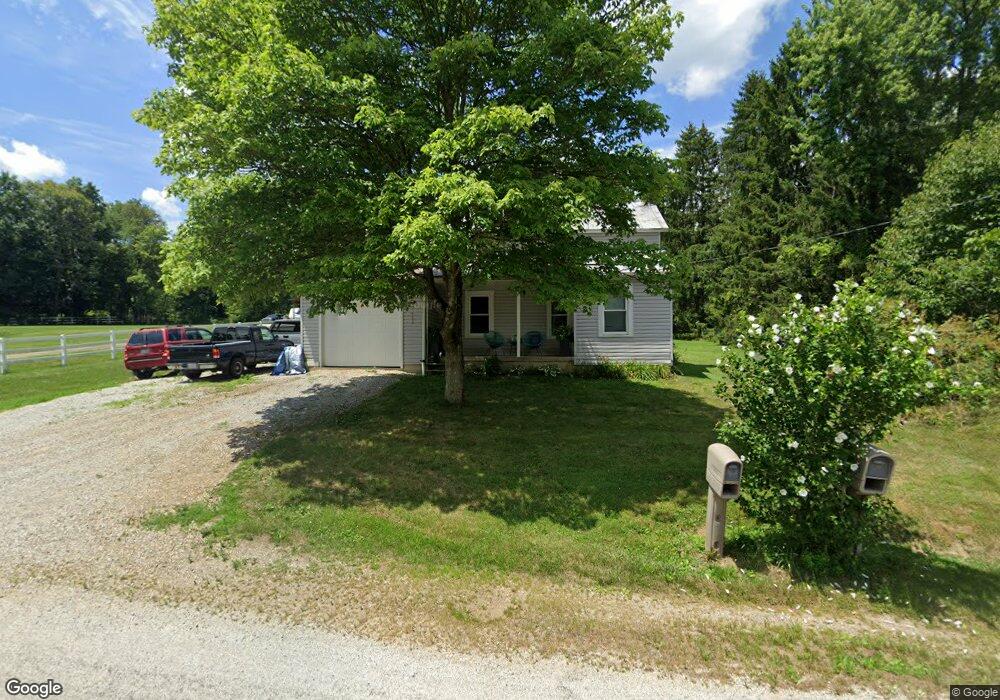
766 Pugh Rd Mansfield, OH 44903
Estimated Value: $104,000 - $204,000
3
Beds
1
Bath
1,272
Sq Ft
$120/Sq Ft
Est. Value
About This Home
This home is located at 766 Pugh Rd, Mansfield, OH 44903 and is currently estimated at $152,832, approximately $120 per square foot. 766 Pugh Rd is a home located in Richland County.
Ownership History
Date
Name
Owned For
Owner Type
Purchase Details
Closed on
Feb 22, 2008
Sold by
Keith Nancy L and Keith Nancy
Bought by
Cook Mark D and Cook Lynsey R
Current Estimated Value
Purchase Details
Closed on
Jan 8, 2008
Sold by
Estate Of Daniel L Keith
Bought by
Keith Nancy
Purchase Details
Closed on
Sep 5, 1997
Sold by
Keith Sherri L
Bought by
Keith Daniel L
Purchase Details
Closed on
Sep 1, 1986
Create a Home Valuation Report for This Property
The Home Valuation Report is an in-depth analysis detailing your home's value as well as a comparison with similar homes in the area
Home Values in the Area
Average Home Value in this Area
Purchase History
| Date | Buyer | Sale Price | Title Company |
|---|---|---|---|
| Cook Mark D | $12,000 | Chicago Title | |
| Keith Nancy | -- | None Available | |
| Keith Daniel L | -- | -- | |
| -- | $17,000 | -- |
Source: Public Records
Tax History Compared to Growth
Tax History
| Year | Tax Paid | Tax Assessment Tax Assessment Total Assessment is a certain percentage of the fair market value that is determined by local assessors to be the total taxable value of land and additions on the property. | Land | Improvement |
|---|---|---|---|---|
| 2024 | $1,502 | $29,120 | $4,950 | $24,170 |
| 2023 | $1,502 | $29,120 | $4,950 | $24,170 |
| 2022 | $1,352 | $24,060 | $3,940 | $20,120 |
| 2021 | $1,352 | $24,060 | $3,940 | $20,120 |
| 2020 | $1,362 | $24,060 | $3,940 | $20,120 |
| 2019 | $1,313 | $21,620 | $3,310 | $18,310 |
| 2018 | $1,302 | $21,620 | $3,310 | $18,310 |
| 2017 | $1,278 | $21,620 | $3,310 | $18,310 |
| 2016 | $809 | $13,370 | $3,150 | $10,220 |
| 2015 | $809 | $13,370 | $3,150 | $10,220 |
| 2014 | $793 | $13,370 | $3,150 | $10,220 |
| 2012 | $383 | $14,070 | $3,310 | $10,760 |
Source: Public Records
Map
Nearby Homes
- 0 Mount Zion Rd Unit 9069748
- 2750 Lutz Ave
- 0 Peterson Rd
- 775 Touby Ln
- 0 McBride Road Parcel # 1 Unit 9066028
- 598 Impala Dr
- 0 Satinwood Dr
- 2364 Satinwood Dr
- 27 E Main St
- 945 Pike Dr
- 174 W Main St
- 2495 Emma Ln
- 2172 Satinwood Dr
- 19 Maine St
- 0 Moffett Rd
- 0 Applegate Rd
- 640 Running Brook Way
- 0 State Route 39 & I-71 Northeast Quadrant
- 1183 County Road 30a
- 0 State Route 39 & I-71 Southeast Quadrant