Estimated Value: $318,000 - $492,000
3
Beds
3
Baths
1,956
Sq Ft
$219/Sq Ft
Est. Value
About This Home
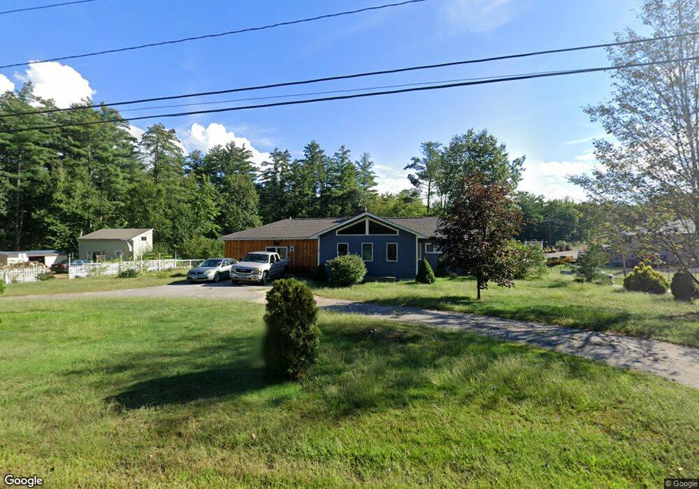
This home is located at 767 River Rd, Bow, NH 03304 and is currently estimated at $427,616, approximately $218 per square foot. 767 River Rd is a home with nearby schools including Bow Elementary School, Bow Memorial School, and Bow High School.
Ownership History
Date
Name
Owned For
Owner Type
Purchase Details
Closed on
Feb 17, 2011
Sold by
Leblanc Leslie P
Bought by
Beauchesne Daniel A and Leighton Patricia L
Current Estimated Value
Home Financials for this Owner
Home Financials are based on the most recent Mortgage that was taken out on this home.
Original Mortgage
$72,000
Outstanding Balance
$49,245
Interest Rate
4.77%
Mortgage Type
Purchase Money Mortgage
Estimated Equity
$378,371
Create a Home Valuation Report for This Property
The Home Valuation Report is an in-depth analysis detailing your home's value as well as a comparison with similar homes in the area
Home Values in the Area
Average Home Value in this Area
Purchase History
| Date | Buyer | Sale Price | Title Company |
|---|---|---|---|
| Beauchesne Daniel A | $90,000 | -- |
Source: Public Records
Mortgage History
| Date | Status | Borrower | Loan Amount |
|---|---|---|---|
| Open | Beauchesne Daniel A | $72,000 | |
| Closed | Beauchesne Daniel A | $83,000 |
Source: Public Records
Tax History
| Year | Tax Paid | Tax Assessment Tax Assessment Total Assessment is a certain percentage of the fair market value that is determined by local assessors to be the total taxable value of land and additions on the property. | Land | Improvement |
|---|---|---|---|---|
| 2024 | $6,935 | $350,600 | $134,700 | $215,900 |
| 2023 | $6,471 | $232,700 | $95,200 | $137,500 |
| 2022 | $6,171 | $232,700 | $95,200 | $137,500 |
| 2021 | $5,932 | $232,700 | $95,200 | $137,500 |
| 2020 | $5,855 | $228,900 | $95,200 | $133,700 |
| 2019 | $5,999 | $228,900 | $95,200 | $133,700 |
| 2018 | $5,375 | $193,500 | $86,900 | $106,600 |
| 2017 | $5,301 | $190,900 | $86,900 | $104,000 |
| 2016 | $5,019 | $190,900 | $86,900 | $104,000 |
| 2015 | $4,347 | $152,300 | $86,900 | $65,400 |
| 2014 | $4,494 | $152,300 | $86,900 | $65,400 |
| 2011 | -- | $137,000 | $82,600 | $54,400 |
Source: Public Records
Map
Nearby Homes
- 7 Morgan Dr
- 2 Brandywine Dr
- 7 Oak St
- 100 Main St Unit 108
- 42 Westover Ln
- 135 Main St
- 36 Westover Ln Unit k
- 117 Merrimack St
- 131 Merrimack St
- 430 Dawn Dr Unit 20
- 422 Dawn Dr Unit 23
- 427 Dawn Dr Unit 15
- 99 Bow Bog Rd
- 259 Pembroke St
- 13 Ferry Rd
- 0 Granite St Unit 48
- 1821 Hooksett Rd
- 357 Pembroke St
- 19 Sullivan Dr
- 27 River Rd
- 1459 New Hampshire 3a
- 714 Route 3a
- 758 River Rd
- 1494 New Hampshire 3a
- 1494 Route 3a
- 1494 Route 3-A
- 687 Route 3-A
- 1506 Route 3a
- 1421 New Hampshire 3a
- 1408 Route 3a
- 1407 New Hampshire 3a
- 1407 Route 3a
- 704 Route 3a
- 700 Route 3-A
- 1398 Route 3a
- 1390 Route 3a
- 671 Route 3a
- 1379 Route 3a
- 37 Johnson Rd
- 1371 New Hampshire 3a
Your Personal Tour Guide
Ask me questions while you tour the home.