Estimated Value: $128,000 - $162,000
3
Beds
1
Bath
1,060
Sq Ft
$137/Sq Ft
Est. Value
About This Home
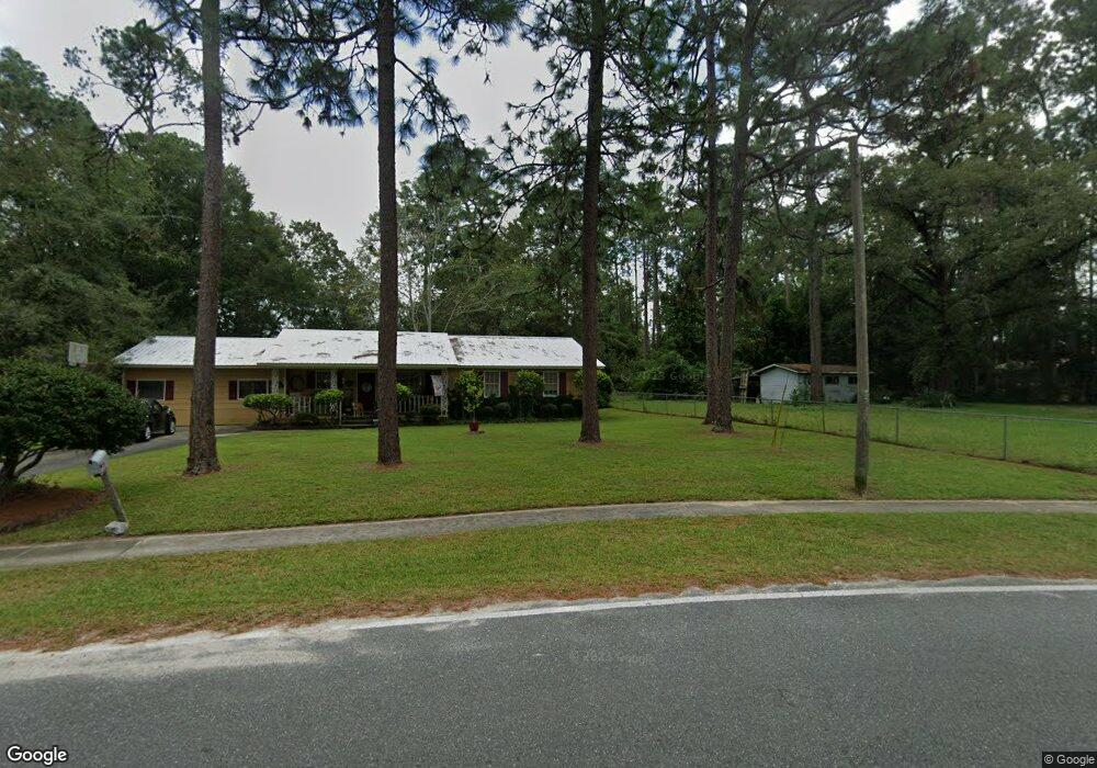
This home is located at 767 S 6th St, Jesup, GA 31545 and is currently estimated at $144,881, approximately $136 per square foot. 767 S 6th St is a home located in Wayne County with nearby schools including Martha Rawls Smith Elementary School, Arthur Williams Middle School, and Wayne County High School.
Ownership History
Date
Name
Owned For
Owner Type
Purchase Details
Closed on
Oct 3, 2018
Sold by
Godwin Elizabeth
Bought by
Blocker Gregory
Current Estimated Value
Purchase Details
Closed on
Dec 8, 2006
Sold by
Knight Donna Elizabeth Har
Bought by
Godwin Elizabeth
Home Financials for this Owner
Home Financials are based on the most recent Mortgage that was taken out on this home.
Original Mortgage
$65,000
Interest Rate
6.31%
Mortgage Type
New Conventional
Purchase Details
Closed on
Aug 1, 1995
Purchase Details
Closed on
Oct 1, 1990
Purchase Details
Closed on
Feb 1, 1975
Create a Home Valuation Report for This Property
The Home Valuation Report is an in-depth analysis detailing your home's value as well as a comparison with similar homes in the area
Purchase History
| Date | Buyer | Sale Price | Title Company |
|---|---|---|---|
| Blocker Gregory | $67,500 | -- | |
| Godwin Elizabeth | $65,000 | -- | |
| -- | -- | -- | |
| -- | $35,000 | -- | |
| -- | -- | -- |
Source: Public Records
Mortgage History
| Date | Status | Borrower | Loan Amount |
|---|---|---|---|
| Previous Owner | Godwin Elizabeth | $65,000 |
Source: Public Records
Tax History
| Year | Tax Paid | Tax Assessment Tax Assessment Total Assessment is a certain percentage of the fair market value that is determined by local assessors to be the total taxable value of land and additions on the property. | Land | Improvement |
|---|---|---|---|---|
| 2025 | $1,339 | $42,437 | $4,044 | $38,393 |
| 2024 | $1,259 | $41,161 | $4,044 | $37,117 |
| 2023 | $973 | $27,518 | $3,974 | $23,544 |
| 2022 | $866 | $27,518 | $3,974 | $23,544 |
| 2021 | $928 | $27,518 | $3,974 | $23,544 |
| 2020 | $960 | $27,518 | $3,974 | $23,544 |
| 2019 | $989 | $27,518 | $3,974 | $23,544 |
| 2018 | $809 | $27,518 | $3,974 | $23,544 |
| 2017 | $696 | $27,518 | $3,974 | $23,544 |
| 2016 | $674 | $27,519 | $3,974 | $23,544 |
| 2014 | $676 | $27,519 | $3,974 | $23,544 |
| 2013 | -- | $27,518 | $3,974 | $23,544 |
Source: Public Records
Map
Nearby Homes
Your Personal Tour Guide
Ask me questions while you tour the home.