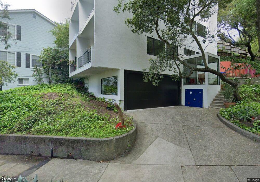
767 San Diego Rd Berkeley, CA 94707
Berkeley Hills NeighborhoodEstimated Value: $1,786,000 - $2,597,000
5
Beds
4
Baths
2,440
Sq Ft
$885/Sq Ft
Est. Value
About This Home
This home is located at 767 San Diego Rd, Berkeley, CA 94707 and is currently estimated at $2,158,847, approximately $884 per square foot. 767 San Diego Rd is a home located in Alameda County with nearby schools including Thousand Oaks Elementary School, Berkeley Arts Magnet at Whittier School, and Ruth Acty Elementary.
Ownership History
Date
Name
Owned For
Owner Type
Purchase Details
Closed on
Oct 9, 2024
Sold by
Wilson David A and Kruger Cecilia J
Bought by
Wilson And Kruger Trust and Wilson
Current Estimated Value
Purchase Details
Closed on
Nov 7, 1997
Sold by
Silverstein Eileen and Ritter Alan
Bought by
Wilson David A and Kruger Cecilia J
Home Financials for this Owner
Home Financials are based on the most recent Mortgage that was taken out on this home.
Original Mortgage
$296,000
Interest Rate
7.3%
Create a Home Valuation Report for This Property
The Home Valuation Report is an in-depth analysis detailing your home's value as well as a comparison with similar homes in the area
Home Values in the Area
Average Home Value in this Area
Purchase History
| Date | Buyer | Sale Price | Title Company |
|---|---|---|---|
| Wilson And Kruger Trust | -- | None Listed On Document | |
| Wilson David A | $370,000 | Nortwestern Title Company |
Source: Public Records
Mortgage History
| Date | Status | Borrower | Loan Amount |
|---|---|---|---|
| Previous Owner | Wilson David A | $296,000 |
Source: Public Records
Tax History
| Year | Tax Paid | Tax Assessment Tax Assessment Total Assessment is a certain percentage of the fair market value that is determined by local assessors to be the total taxable value of land and additions on the property. | Land | Improvement |
|---|---|---|---|---|
| 2025 | $12,481 | $646,567 | $177,230 | $476,337 |
| 2024 | $12,481 | $633,755 | $173,756 | $466,999 |
| 2023 | $12,005 | $628,192 | $170,349 | $457,843 |
| 2022 | $11,685 | $608,875 | $167,009 | $448,866 |
| 2021 | $11,683 | $596,800 | $163,734 | $440,066 |
| 2020 | $10,982 | $597,611 | $162,056 | $435,555 |
| 2019 | $10,459 | $585,896 | $158,879 | $427,017 |
| 2018 | $10,245 | $574,411 | $155,765 | $418,646 |
| 2017 | $9,872 | $563,150 | $152,711 | $410,439 |
| 2016 | $9,480 | $552,110 | $149,717 | $402,393 |
| 2015 | $9,334 | $543,818 | $147,469 | $396,349 |
| 2014 | $9,179 | $533,166 | $144,580 | $388,586 |
Source: Public Records
Map
Nearby Homes
- 765 San Diego Rd
- 1983 Yosemite Rd
- 813 San Diego Rd
- 758 Spruce St
- 589 San Luis Rd
- 777 Cragmont Ave
- 614 Cragmont Ave
- 483 Boynton Ave
- 1858 San Lorenzo Ave
- 450 Vermont Ave
- 938 San Benito Rd
- 470 Spruce St
- 606 Grizzly Peak Blvd
- 380 Vermont Ave
- 1004 Cragmont Ave
- 543 Grizzly Peak Blvd
- 491 Vincente Ave
- 410 Grizzly Peak Blvd
- 962 Regal Rd
- 1950 Hopkins St
- 771 San Diego Rd
- 168 Southampton Ave
- 763 San Diego Rd
- 775 San Diego Rd
- 160 Southampton Ave
- 170 Southampton Ave
- 761 San Diego Rd
- 175 Southampton Ave
- 768 San Luis Rd
- 150 Southampton Ave
- 740 San Luis Rd
- 180 Southampton Ave
- 774 San Luis Rd
- 757 San Diego Rd
- 159 Southampton Ave
- 793 San Diego Rd
- 140 Southampton Ave
- 780 San Luis Rd
- 151 Southampton Ave
- 751 San Diego Rd
Your Personal Tour Guide
Ask me questions while you tour the home.