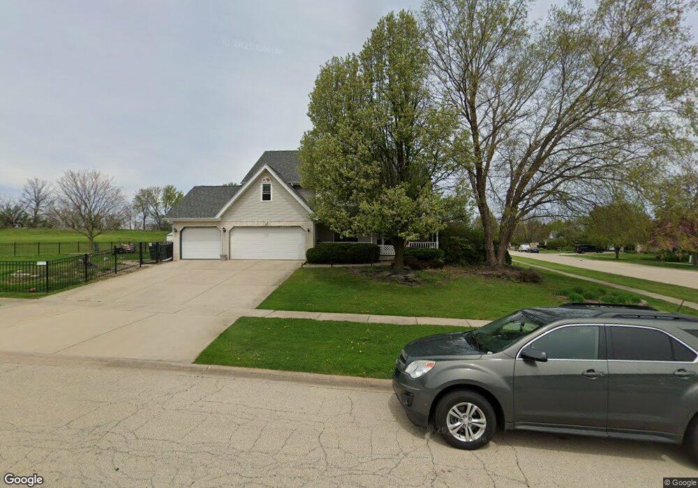
767 Sunburst Ct New Lenox, IL 60451
Estimated Value: $413,000 - $502,000
--
Bed
--
Bath
--
Sq Ft
1.01
Acres
About This Home
This home is located at 767 Sunburst Ct, New Lenox, IL 60451 and is currently estimated at $445,535. 767 Sunburst Ct is a home located in Will County with nearby schools including Oster-Oakview School, Haines Elementary School, and Lincoln Way West.
Ownership History
Date
Name
Owned For
Owner Type
Purchase Details
Closed on
Aug 28, 2003
Sold by
Sieger Robert A and Sieger Lisa M
Bought by
Vasil Albert
Current Estimated Value
Home Financials for this Owner
Home Financials are based on the most recent Mortgage that was taken out on this home.
Original Mortgage
$279,000
Outstanding Balance
$123,885
Interest Rate
5.62%
Mortgage Type
Purchase Money Mortgage
Estimated Equity
$321,650
Purchase Details
Closed on
Sep 28, 1998
Sold by
Nlsb
Bought by
Sieger Robert A and Sieger Lisa M
Home Financials for this Owner
Home Financials are based on the most recent Mortgage that was taken out on this home.
Original Mortgage
$207,000
Interest Rate
6.9%
Create a Home Valuation Report for This Property
The Home Valuation Report is an in-depth analysis detailing your home's value as well as a comparison with similar homes in the area
Home Values in the Area
Average Home Value in this Area
Purchase History
| Date | Buyer | Sale Price | Title Company |
|---|---|---|---|
| Vasil Albert | $310,000 | Lawyers Title Insurance Corp | |
| Sieger Robert A | $225,500 | -- |
Source: Public Records
Mortgage History
| Date | Status | Borrower | Loan Amount |
|---|---|---|---|
| Open | Vasil Albert | $279,000 | |
| Previous Owner | Sieger Robert A | $207,000 |
Source: Public Records
Tax History Compared to Growth
Tax History
| Year | Tax Paid | Tax Assessment Tax Assessment Total Assessment is a certain percentage of the fair market value that is determined by local assessors to be the total taxable value of land and additions on the property. | Land | Improvement |
|---|---|---|---|---|
| 2024 | $11,363 | $148,018 | $30,696 | $117,322 |
| 2023 | $11,363 | $134,930 | $27,982 | $106,948 |
| 2022 | $10,236 | $124,302 | $25,778 | $98,524 |
| 2021 | $9,720 | $116,902 | $24,243 | $92,659 |
| 2020 | $9,444 | $112,731 | $23,378 | $89,353 |
| 2019 | $9,040 | $109,235 | $22,653 | $86,582 |
| 2018 | $8,833 | $105,469 | $21,872 | $83,597 |
| 2017 | $8,394 | $102,437 | $21,243 | $81,194 |
| 2016 | $8,149 | $99,695 | $20,674 | $79,021 |
| 2015 | $7,851 | $96,557 | $20,023 | $76,534 |
| 2014 | $7,851 | $95,365 | $19,776 | $75,589 |
| 2013 | $7,851 | $96,651 | $20,043 | $76,608 |
Source: Public Records
Map
Nearby Homes
- 1301 Silver Cross Blvd
- 338 Willow St
- 0 Silver Cross Blvd
- 133 Barbara Ln
- 1999 Silver Cross Blvd
- 1344 N Cedar Rd
- 331 Old Hickory Rd
- Vacant W Maple St
- 1500 Ramp
- 217 Aspen Dr
- 125 Kimber Dr
- 200 Redwood Ave
- 208 Redwood Ave
- 218 Manor Dr Unit A
- 203 Fir St
- 224 Hauser Ct
- 3420 Avondale Ln
- 513 Pueblo Dr
- 416 Manor Ct Unit B
- 14119 W Maple Rd
- 797 Sunburst Ct
- 1410 Creekside Ct
- 1380 Creekside Ct
- 1440 Creekside Ct
- 1467 Creekside Ct
- 814 Sunburst Ct
- 1350 Creekside Ct
- 1464 Creekside Ct
- 353 W Francis Rd Unit 1
- 1484 Creekside Ct
- 402 W Francis Rd
- 428 W Francis Rd
- 349 W Francis Rd
- 430 W Francis Rd
- 1497 Creekside Ct
- 364 W Francis Rd
- 424 W Francis Rd
- 360 W Francis Rd
- 347 W Francis Rd Unit 1
- 1268 Gordon St