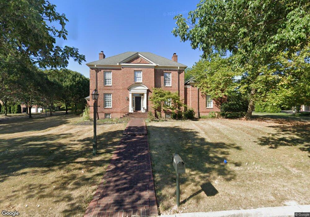
7674 Brandon Rd New Albany, OH 43054
Estimated Value: $1,602,000 - $1,878,000
5
Beds
7
Baths
6,500
Sq Ft
$259/Sq Ft
Est. Value
About This Home
This home is located at 7674 Brandon Rd, New Albany, OH 43054 and is currently estimated at $1,686,330, approximately $259 per square foot. 7674 Brandon Rd is a home located in Franklin County with nearby schools including New Albany Primary School, New Albany Intermediate School, and New Albany Middle School.
Ownership History
Date
Name
Owned For
Owner Type
Purchase Details
Closed on
Apr 13, 1999
Sold by
Tuckerman Development Company
Bought by
Gardner Kathryn G
Current Estimated Value
Home Financials for this Owner
Home Financials are based on the most recent Mortgage that was taken out on this home.
Original Mortgage
$525,000
Interest Rate
7.1%
Create a Home Valuation Report for This Property
The Home Valuation Report is an in-depth analysis detailing your home's value as well as a comparison with similar homes in the area
Home Values in the Area
Average Home Value in this Area
Purchase History
| Date | Buyer | Sale Price | Title Company |
|---|---|---|---|
| Gardner Kathryn G | $675,000 | Amerititle Agency Inc |
Source: Public Records
Mortgage History
| Date | Status | Borrower | Loan Amount |
|---|---|---|---|
| Closed | Gardner Kathryn G | $525,000 |
Source: Public Records
Tax History Compared to Growth
Tax History
| Year | Tax Paid | Tax Assessment Tax Assessment Total Assessment is a certain percentage of the fair market value that is determined by local assessors to be the total taxable value of land and additions on the property. | Land | Improvement |
|---|---|---|---|---|
| 2024 | $28,606 | $459,800 | $169,400 | $290,400 |
| 2023 | $26,901 | $459,795 | $169,400 | $290,395 |
| 2022 | $20,149 | $260,370 | $55,130 | $205,240 |
| 2021 | $19,392 | $260,370 | $55,130 | $205,240 |
| 2020 | $19,370 | $260,370 | $55,130 | $205,240 |
| 2019 | $20,156 | $247,770 | $52,500 | $195,270 |
| 2018 | $18,006 | $247,770 | $52,500 | $195,270 |
| 2017 | $20,006 | $247,770 | $52,500 | $195,270 |
| 2016 | $16,064 | $182,000 | $80,500 | $101,500 |
| 2015 | $16,095 | $182,000 | $80,500 | $101,500 |
| 2014 | $15,090 | $182,000 | $80,500 | $101,500 |
| 2013 | $8,154 | $182,000 | $80,500 | $101,500 |
Source: Public Records
Map
Nearby Homes
- 7747 Sutton Place
- 3637 Head of Pond Rd
- 6590 Wheatly Rd
- 6540 Wheatly Rd Unit LOT 701
- 3377 Abberley Dr Unit LOT 902
- 6544 Wheatly Rd Unit LOT 702
- 6526 Wheatly Rd Unit LOT 802
- 6531 Wheatly Rd Unit LOT 102
- 6522 Wheatly Rd Unit LOT 801
- 6532 Wheatly Rd Unit LOT 804
- 6528 Wheatly Rd Unit LOT 803
- 5945 Johnstown Rd
- 5950 Johnstown Rd
- 3292 Strickland Dr Unit 66
- 7030 Hanby's Loop
- 7 Richmond Square
- 4135 High Grove Crest
- 14 Richmond Square
- 6929 Clivdon Mews
- 1497 Harrison Pond Dr
- 7692 Brandon Rd
- 3946 Redford Ct
- 7640 Brandon Rd
- 3981 Farber Ct
- 3961 Redford Ct
- 7708 Brandon Rd
- 3968 Redford Ct
- 3961 Farber Ct
- 16 Redford Ct
- 3989 Farber Ct
- 7614 Brandon Rd
- 7726 Brandon Rd
- 4 Brandon Rd
- 3982 Redford Ct
- 3993 Redford Ct
- 3996 Redford Ct
- 3901 Farber Ct
- 3997 Farber Ct
- 3933 Farber Ct
- 4037 Redford Ct