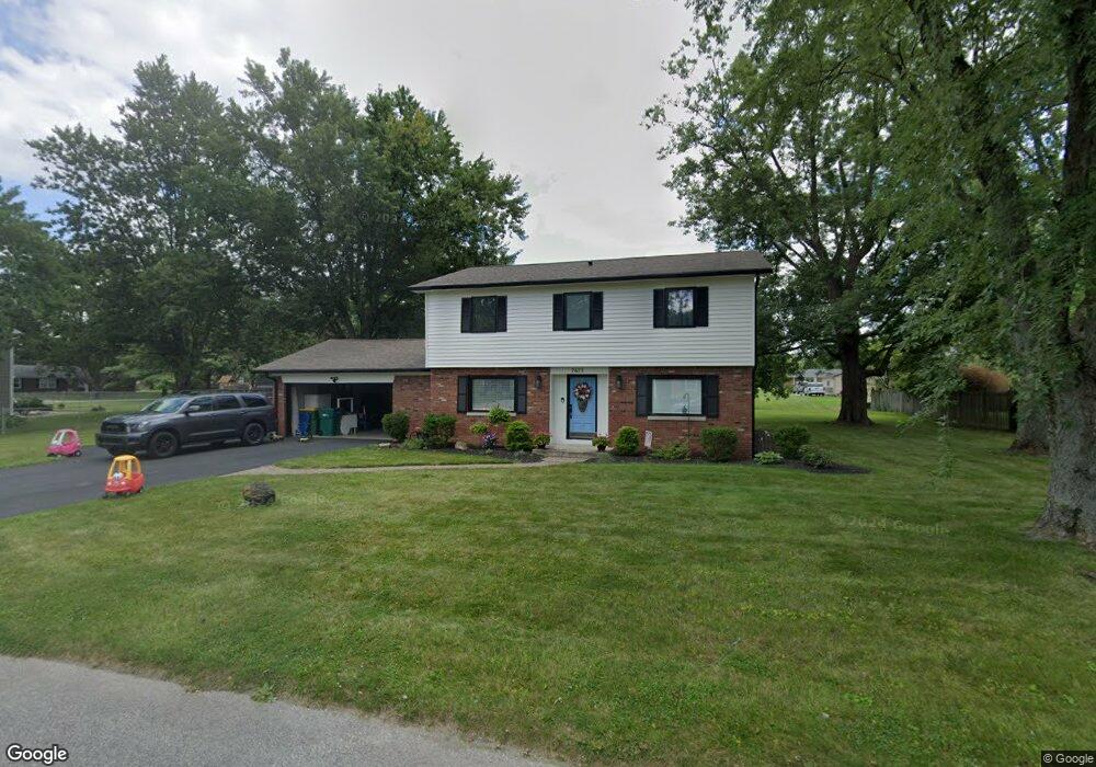
7675 Dianna Dr Brownsburg, IN 46112
Estimated Value: $355,000 - $376,000
5
Beds
3
Baths
2,372
Sq Ft
$153/Sq Ft
Est. Value
About This Home
This home is located at 7675 Dianna Dr, Brownsburg, IN 46112 and is currently estimated at $363,419, approximately $153 per square foot. 7675 Dianna Dr is a home located in Hendricks County with nearby schools including Eagle Elementary School, Brownsburg West Middle School, and Brownsburg High School.
Ownership History
Date
Name
Owned For
Owner Type
Purchase Details
Closed on
Jul 2, 2020
Sold by
Wysong Elizabeth M and Wysong Grant D
Bought by
Wysong Elizabeth M and Wysong Grant D
Current Estimated Value
Purchase Details
Closed on
Dec 21, 2018
Sold by
Leboehi Patrick D and Leboehi Vanessa S
Bought by
Fox Elizabeth M and Wysong Grant D
Home Financials for this Owner
Home Financials are based on the most recent Mortgage that was taken out on this home.
Original Mortgage
$186,000
Outstanding Balance
$164,197
Interest Rate
4.9%
Mortgage Type
New Conventional
Estimated Equity
$199,222
Purchase Details
Closed on
Jul 29, 2011
Sold by
Taylor Timothy W and Taylor Amy M
Bought by
Leboehi Patrick D and Leboehi Vanessa S Downs
Home Financials for this Owner
Home Financials are based on the most recent Mortgage that was taken out on this home.
Original Mortgage
$157,700
Interest Rate
4.54%
Mortgage Type
New Conventional
Create a Home Valuation Report for This Property
The Home Valuation Report is an in-depth analysis detailing your home's value as well as a comparison with similar homes in the area
Home Values in the Area
Average Home Value in this Area
Purchase History
| Date | Buyer | Sale Price | Title Company |
|---|---|---|---|
| Wysong Elizabeth M | -- | None Available | |
| Fox Elizabeth M | -- | None Available | |
| Leboehi Patrick D | -- | None Available |
Source: Public Records
Mortgage History
| Date | Status | Borrower | Loan Amount |
|---|---|---|---|
| Open | Fox Elizabeth M | $186,000 | |
| Previous Owner | Leboehi Patrick D | $157,700 |
Source: Public Records
Tax History Compared to Growth
Tax History
| Year | Tax Paid | Tax Assessment Tax Assessment Total Assessment is a certain percentage of the fair market value that is determined by local assessors to be the total taxable value of land and additions on the property. | Land | Improvement |
|---|---|---|---|---|
| 2024 | $3,089 | $303,900 | $53,400 | $250,500 |
| 2023 | $2,693 | $264,300 | $46,500 | $217,800 |
| 2022 | $2,507 | $246,800 | $44,300 | $202,500 |
| 2021 | $2,275 | $221,400 | $42,600 | $178,800 |
| 2020 | $2,192 | $212,900 | $42,600 | $170,300 |
| 2019 | $2,111 | $204,900 | $40,900 | $164,000 |
| 2018 | $1,533 | $162,900 | $40,900 | $122,000 |
| 2017 | $1,555 | $162,400 | $38,100 | $124,300 |
| 2016 | $1,508 | $156,900 | $38,100 | $118,800 |
| 2014 | $1,306 | $143,400 | $34,700 | $108,700 |
Source: Public Records
Map
Nearby Homes
- 7633 Janean Dr
- 7395 N State Road 267
- 7680 Sherry Ln
- 7706 Firethorn Ct
- 203 Woodside Ct
- 7252 Barrett Dr
- 7263 Barrett Dr
- 7242 Barrett Dr
- 8001 Parkview
- 7250 N State Road 267
- 256 Brooks Bend
- 6773 Highland Way
- 10848 Sablecliff Way
- 7101 Oak Trace Ln
- 6933 Sonora Blvd
- 10810 Arendale Dr
- 7820 Highland Park Dr
- 7215 Barrett Dr
- 1505 Arbor Springs Dr
- 6736 Sonora Blvd
