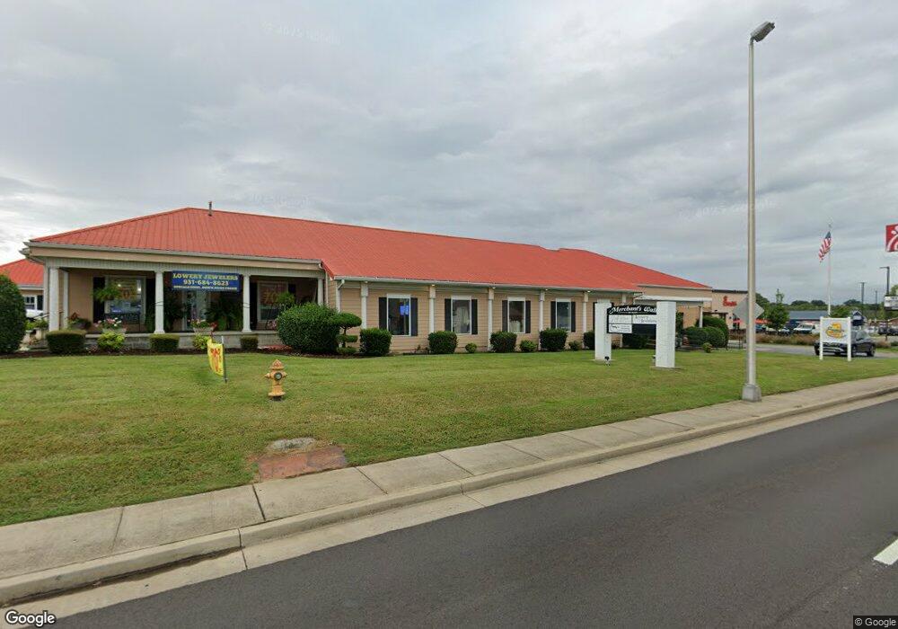
768 N Main St Shelbyville, TN 37160
Estimated Value: $541,000 - $1,193,000
--
Bed
4
Baths
6,512
Sq Ft
$137/Sq Ft
Est. Value
About This Home
This home is located at 768 N Main St, Shelbyville, TN 37160 and is currently estimated at $893,873, approximately $137 per square foot. 768 N Main St is a home located in Bedford County with nearby schools including Harris Middle School, Victory Baptist Academy, and Christian Chapel Academy.
Ownership History
Date
Name
Owned For
Owner Type
Purchase Details
Closed on
Mar 18, 2025
Sold by
Matusek Carolyn Simmons
Bought by
Matusek Anthony M
Current Estimated Value
Purchase Details
Closed on
Feb 10, 2025
Sold by
Matusek Michael Simmons and Matusek Anthony Christopher
Bought by
Matusek Anthony M
Purchase Details
Closed on
Mar 19, 1996
Sold by
Perry Hubert President
Bought by
Matusek Tony and Matusek Carolyn
Purchase Details
Closed on
May 31, 1938
Bought by
Simmons Simmons E and Simmons Paulean
Create a Home Valuation Report for This Property
The Home Valuation Report is an in-depth analysis detailing your home's value as well as a comparison with similar homes in the area
Home Values in the Area
Average Home Value in this Area
Purchase History
| Date | Buyer | Sale Price | Title Company |
|---|---|---|---|
| Matusek Anthony M | -- | None Listed On Document | |
| Matusek Anthony M | -- | None Listed On Document | |
| Matusek Anthony M | -- | None Listed On Document | |
| Matusek Tony | $62,500 | -- | |
| Simmons Simmons E | -- | -- |
Source: Public Records
Tax History Compared to Growth
Tax History
| Year | Tax Paid | Tax Assessment Tax Assessment Total Assessment is a certain percentage of the fair market value that is determined by local assessors to be the total taxable value of land and additions on the property. | Land | Improvement |
|---|---|---|---|---|
| 2025 | -- | $286,880 | $0 | $0 |
| 2024 | -- | $286,880 | $114,600 | $172,280 |
| 2023 | $4,193 | $286,880 | $114,600 | $172,280 |
| 2022 | $11,093 | $283,320 | $114,600 | $168,720 |
| 2021 | $10,073 | $283,320 | $114,600 | $168,720 |
| 2020 | $8,747 | $283,320 | $114,600 | $168,720 |
| 2019 | $8,747 | $197,440 | $162,520 | $34,920 |
| 2018 | $8,549 | $197,440 | $162,520 | $34,920 |
| 2017 | $8,293 | $191,520 | $162,520 | $29,000 |
| 2016 | $8,216 | $191,520 | $162,520 | $29,000 |
| 2015 | $8,216 | $191,520 | $162,520 | $29,000 |
| 2014 | $7,363 | $187,843 | $0 | $0 |
Source: Public Records
Map
Nearby Homes
- 112 E Cedar St
- 0 Hilltop Rd Unit RTC2897754
- 0 Hilltop Rd Unit RTC3001632
- 703 Deery St
- 636 Deery St
- 724 Alton Ave
- 1017 Fairfield Pike
- 713 King Ave
- 714 King Ave
- 527 Deery St
- 102 Saddlewood Dr
- 115 Scotland Heights
- 129 Annas Way
- 610 Sundance St
- 178 Lucas Rd
- 134 Butler St
- 216 Celebration St
- 312 Cottonwood Dr
- 114 Collier Ave
- 464 Whitthorne St
- 760 N Main St
- 112 E Highland Ave
- 107 E Highland Ave
- 756 N Main St
- 110 W Highland Ave
- 111 E Highland Ave
- 810 N Main St
- 752 N Main St
- 116 E Highland Ave
- 108 E Cedar St
- 117 E Highland Ave
- 110 E Cedar St
- 200 E Highland Ave
- 119 E Highland Ave
- 114 E Cedar St
- 109 Noblitt St
- 747 N Main St
- 121 E Highland Ave
- 120 E Cedar St
- 202 E Highland Ave
