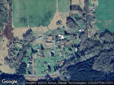
76864 Maple Ln Clatskanie, OR 97016
Estimated Value: $243,000 - $458,000
3
Beds
1
Bath
1,310
Sq Ft
$275/Sq Ft
Est. Value
About This Home
This home is located at 76864 Maple Ln, Clatskanie, OR 97016 and is currently estimated at $360,437, approximately $275 per square foot. 76864 Maple Ln is a home located in Columbia County with nearby schools including Clatskanie Elementary School and Clatskanie Middle/High School.
Ownership History
Date
Name
Owned For
Owner Type
Purchase Details
Closed on
Feb 22, 2021
Sold by
Krautscheid Jonathan and Krautscheid Emily
Bought by
Krautscheid Jonathan B
Current Estimated Value
Home Financials for this Owner
Home Financials are based on the most recent Mortgage that was taken out on this home.
Original Mortgage
$225,478
Outstanding Balance
$204,408
Interest Rate
2.7%
Mortgage Type
Fannie Mae Freddie Mac
Estimated Equity
$159,557
Purchase Details
Closed on
Jul 10, 2015
Sold by
Anicker Florence M
Bought by
Krautscheid Jonathan and Krautscheid Emily
Home Financials for this Owner
Home Financials are based on the most recent Mortgage that was taken out on this home.
Original Mortgage
$166,326
Interest Rate
3.83%
Mortgage Type
New Conventional
Create a Home Valuation Report for This Property
The Home Valuation Report is an in-depth analysis detailing your home's value as well as a comparison with similar homes in the area
Home Values in the Area
Average Home Value in this Area
Purchase History
| Date | Buyer | Sale Price | Title Company |
|---|---|---|---|
| Krautscheid Jonathan B | -- | Ticor Title | |
| Krautscheid Jonathan | $163,000 | None Available |
Source: Public Records
Mortgage History
| Date | Status | Borrower | Loan Amount |
|---|---|---|---|
| Open | Krautscheid Jonathan B | $50,000 | |
| Open | Krautscheid Jonathan B | $225,478 | |
| Closed | Krautscheid Jonathan | $40,000 | |
| Closed | Krautscheid Jonathan | $166,326 |
Source: Public Records
Tax History Compared to Growth
Tax History
| Year | Tax Paid | Tax Assessment Tax Assessment Total Assessment is a certain percentage of the fair market value that is determined by local assessors to be the total taxable value of land and additions on the property. | Land | Improvement |
|---|---|---|---|---|
| 2024 | $2,021 | $198,720 | $89,840 | $108,880 |
| 2023 | $2,012 | $192,940 | $94,250 | $98,690 |
| 2022 | $1,927 | $187,330 | $91,500 | $95,830 |
| 2021 | $1,875 | $181,880 | $70,110 | $111,770 |
| 2020 | $1,859 | $176,590 | $67,670 | $108,920 |
| 2019 | $1,816 | $171,450 | $65,080 | $106,370 |
| 2018 | $1,751 | $166,460 | $72,710 | $93,750 |
| 2017 | $1,752 | $161,620 | $70,590 | $91,030 |
| 2016 | $1,695 | $156,310 | $67,010 | $89,300 |
| 2015 | $1,707 | $156,920 | $67,600 | $89,320 |
| 2014 | $1,549 | $143,880 | $64,220 | $79,660 |
Source: Public Records
Map
Nearby Homes
- 0 Palm Hill Rd Unit 467442641
- 0 Palm Hill Rd Unit 22099075
- 78135 Point Adams Rd
- 78098 Erickson Dike Rd
- 1205 Oregon 47
- 11754 Colvin Rd
- 487 SW Juniper Ct
- 865 E Columbia River Hwy
- 0 Bel Air Dr
- 0 Conyers Creek Unit 208773965
- 420 Bryant St
- 970 SW Tichenor St
- 95 SW 7th St
- 636 S Nehalem St
- 1192 E State Route 4
- 29 S Nehalem St
- 365 Bellflower Rd
- 11097 Colvin Rd
- 0 Sr-4 Unit NWM2258480
- 950 Shasta Way
- 76864 Maple Ln
- 76888 Maple Ln
- 76794 Maple Ln
- 76885 Maple Ln
- 14457 Colvin Rd
- 14471 Colvin Rd
- 76823 Maple Ln
- 14353 Colvin Rd
- 76842 Ha Ha Ln
- 14099 Colvin Rd
- 14665 Colvin Rd
- 14249 Midland District Rd
- 14375 Midland District Rd
- 14518 Highway 30
- 14193 Midland District Rd
- 13798 Tandy St
- 13775 Colvin Rd
- 76886 Schroeder Rd
- 13765 Colvin Rd
