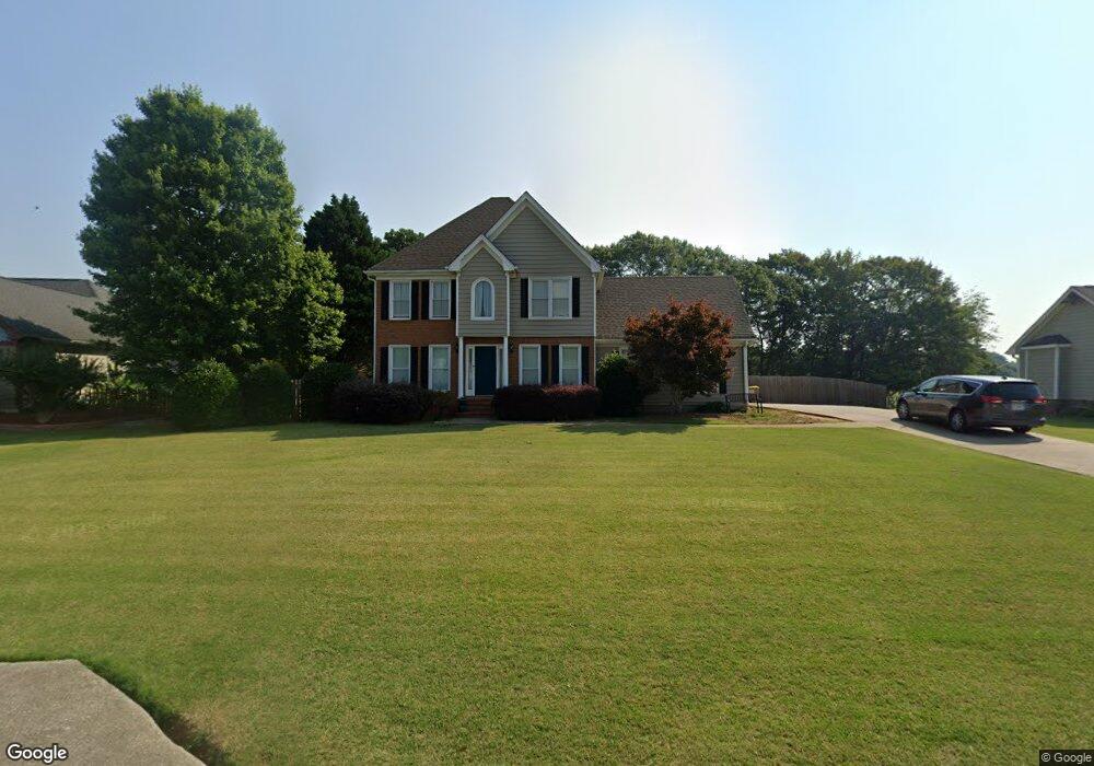
769 Coleen Dr Winder, GA 30680
Estimated Value: $340,341 - $364,000
3
Beds
3
Baths
1,836
Sq Ft
$193/Sq Ft
Est. Value
About This Home
This home is located at 769 Coleen Dr, Winder, GA 30680 and is currently estimated at $354,835, approximately $193 per square foot. 769 Coleen Dr is a home located in Barrow County with nearby schools including Bramlett Elementary School, Russell Middle School, and Winder-Barrow High School.
Ownership History
Date
Name
Owned For
Owner Type
Purchase Details
Closed on
Apr 19, 2004
Sold by
Parker Jeffrey A and Parker Susan E
Bought by
Murdock Christopher R and Murdock Emily
Current Estimated Value
Home Financials for this Owner
Home Financials are based on the most recent Mortgage that was taken out on this home.
Original Mortgage
$126,400
Outstanding Balance
$58,318
Interest Rate
5.38%
Mortgage Type
New Conventional
Estimated Equity
$296,517
Purchase Details
Closed on
Mar 26, 1998
Sold by
Ivey Shannon N
Bought by
Parker Jeffrey A and Parker Susan E
Home Financials for this Owner
Home Financials are based on the most recent Mortgage that was taken out on this home.
Original Mortgage
$115,000
Interest Rate
8.75%
Mortgage Type
New Conventional
Purchase Details
Closed on
May 2, 1996
Sold by
Hoover James P
Bought by
Ivey Shannon N
Purchase Details
Closed on
Apr 14, 1995
Bought by
Hoover James P
Create a Home Valuation Report for This Property
The Home Valuation Report is an in-depth analysis detailing your home's value as well as a comparison with similar homes in the area
Home Values in the Area
Average Home Value in this Area
Purchase History
| Date | Buyer | Sale Price | Title Company |
|---|---|---|---|
| Murdock Christopher R | $158,500 | -- | |
| Parker Jeffrey A | $127,900 | -- | |
| Ivey Shannon N | $15,000 | -- | |
| Hoover James P | -- | -- |
Source: Public Records
Mortgage History
| Date | Status | Borrower | Loan Amount |
|---|---|---|---|
| Open | Murdock Christopher R | $126,400 | |
| Closed | Murdock Christopher R | $22,500 | |
| Previous Owner | Parker Jeffrey A | $115,000 | |
| Closed | Ivey Shannon N | $0 |
Source: Public Records
Tax History Compared to Growth
Tax History
| Year | Tax Paid | Tax Assessment Tax Assessment Total Assessment is a certain percentage of the fair market value that is determined by local assessors to be the total taxable value of land and additions on the property. | Land | Improvement |
|---|---|---|---|---|
| 2024 | $1,944 | $79,457 | $18,000 | $61,457 |
| 2023 | $1,538 | $79,857 | $18,000 | $61,857 |
| 2022 | $1,887 | $67,234 | $18,000 | $49,234 |
| 2021 | $1,986 | $67,234 | $18,000 | $49,234 |
| 2020 | $1,987 | $67,234 | $18,000 | $49,234 |
| 2019 | $2,021 | $67,234 | $18,000 | $49,234 |
| 2018 | $1,673 | $56,570 | $13,600 | $42,970 |
| 2017 | $1,452 | $49,863 | $13,600 | $36,263 |
| 2016 | $1,335 | $46,558 | $13,600 | $32,958 |
| 2015 | $1,365 | $47,333 | $13,600 | $33,733 |
| 2014 | $1,188 | $41,176 | $7,056 | $34,120 |
| 2013 | -- | $39,113 | $7,056 | $32,057 |
Source: Public Records
Map
Nearby Homes
- The Hickory A Plan at Cedar Farms
- The Rabun C Plan at Cedar Farms
- The Glenwood A Plan at Cedar Farms
- The Hickory B Plan at Cedar Farms
- The Russell B Plan at Cedar Farms
- The Danbury A Plan at Cedar Farms
- The Harrison G Plan at Cedar Farms
- The Russell A Plan at Cedar Farms
- The Willow B Plan at Cedar Farms
- The Sinclair C Plan at Cedar Farms
- 760 Highway 211 NW
- 262 Blake Ln
- 629 Dee Kennedy Rd
- 809 Custom Ln
- 711 Brighton Ln
- 654 Huntington Trace
- 84 Carnaby St
- 678 Knightsbridge Ln
- 396 Carl Cedar Hill Rd
- 72 Mcmillian Ct
- 771 Coleen Dr
- 767 Coleen Dr
- 765 Coleen Dr
- 0 Coleen Dr Unit 7459455
- 0 Coleen Dr Unit 8591525
- 0 Coleen Dr Unit 7571687
- 0 Coleen Dr Unit 3282365
- 768 Coleen Dr
- 770 Coleen Dr
- 775 Coleen Dr
- 766 Coleen Dr
- 763 Coleen Dr
- 772 Coleen Dr
- 764 Coleen Dr
- 777 Coleen Dr
- 774 Coleen Dr
- 761 Coleen Dr
- 762 Coleen Dr
- 779 Coleen Dr
- 778 Coleen Dr