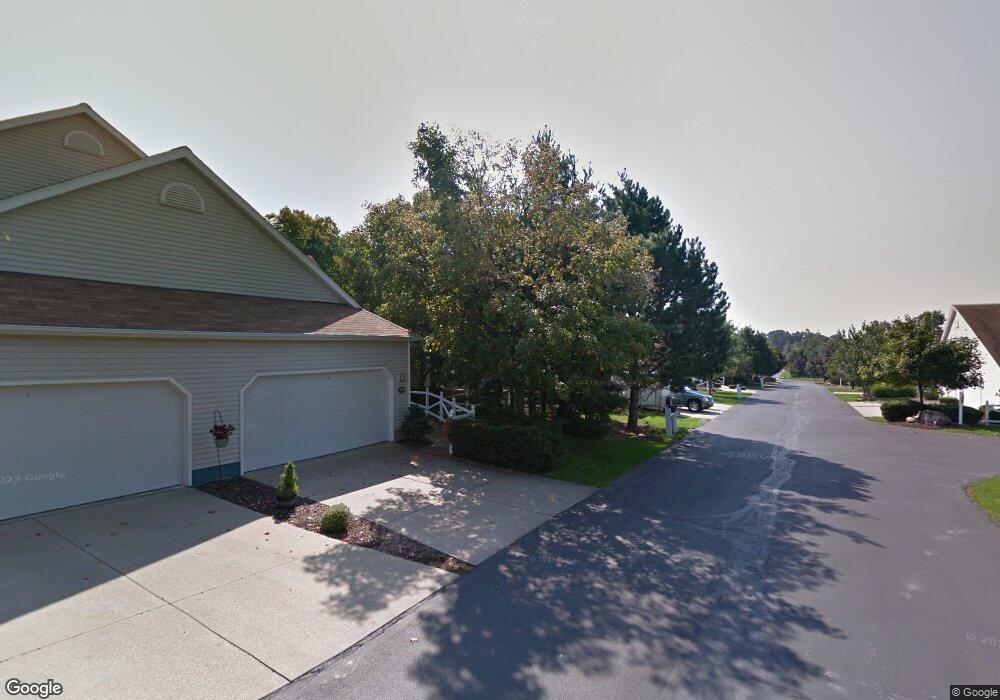
769 Hunters Trail Unit 72 Akron, OH 44313
Northwest Akron NeighborhoodEstimated Value: $299,000 - $363,000
4
Beds
4
Baths
2,178
Sq Ft
$153/Sq Ft
Est. Value
About This Home
This home is located at 769 Hunters Trail Unit 72, Akron, OH 44313 and is currently estimated at $332,531, approximately $152 per square foot. 769 Hunters Trail Unit 72 is a home located in Summit County with nearby schools including Woodridge Middle School, Woodridge High School, and Fairlawn Lutheran School.
Ownership History
Date
Name
Owned For
Owner Type
Purchase Details
Closed on
Feb 28, 2011
Sold by
Scanlon Michael C
Bought by
Albrecht Ryan H and Deshong Elizabeth G
Current Estimated Value
Home Financials for this Owner
Home Financials are based on the most recent Mortgage that was taken out on this home.
Original Mortgage
$168,100
Outstanding Balance
$116,245
Interest Rate
4.85%
Mortgage Type
New Conventional
Estimated Equity
$218,863
Purchase Details
Closed on
Aug 28, 1997
Sold by
Ameri/Con Akron Inc
Bought by
Scanlon Michael C and Scanlon Patricia L
Home Financials for this Owner
Home Financials are based on the most recent Mortgage that was taken out on this home.
Original Mortgage
$145,100
Interest Rate
7.57%
Mortgage Type
New Conventional
Create a Home Valuation Report for This Property
The Home Valuation Report is an in-depth analysis detailing your home's value as well as a comparison with similar homes in the area
Home Values in the Area
Average Home Value in this Area
Purchase History
| Date | Buyer | Sale Price | Title Company |
|---|---|---|---|
| Albrecht Ryan H | $187,000 | America Land Title Affiliate | |
| Scanlon Michael C | $181,435 | -- |
Source: Public Records
Mortgage History
| Date | Status | Borrower | Loan Amount |
|---|---|---|---|
| Open | Albrecht Ryan H | $168,100 | |
| Closed | Scanlon Michael C | $145,100 |
Source: Public Records
Tax History Compared to Growth
Tax History
| Year | Tax Paid | Tax Assessment Tax Assessment Total Assessment is a certain percentage of the fair market value that is determined by local assessors to be the total taxable value of land and additions on the property. | Land | Improvement |
|---|---|---|---|---|
| 2025 | $5,461 | $93,839 | $7,746 | $86,093 |
| 2024 | $5,461 | $93,839 | $7,746 | $86,093 |
| 2023 | $5,461 | $93,839 | $7,746 | $86,093 |
| 2022 | $4,800 | $73,462 | $6,052 | $67,410 |
| 2021 | $4,844 | $73,462 | $6,052 | $67,410 |
| 2020 | $4,784 | $73,460 | $6,050 | $67,410 |
| 2019 | $5,013 | $71,110 | $5,930 | $65,180 |
| 2018 | $5,102 | $71,110 | $6,910 | $64,200 |
| 2017 | $4,001 | $71,110 | $6,910 | $64,200 |
| 2016 | $3,983 | $58,470 | $6,910 | $51,560 |
| 2015 | $4,001 | $58,470 | $6,910 | $51,560 |
| 2014 | $3,766 | $58,470 | $6,910 | $51,560 |
| 2013 | $3,698 | $57,510 | $6,910 | $50,600 |
Source: Public Records
Map
Nearby Homes
- 770 Hunters Trail
- 1094 Hampton Ridge Dr Unit P1094
- 733 Winding Way
- 835 Sutton Place
- 1056 Wycliff Ln
- 720 Winding Way Unit 45
- 1855 Brookwood Dr
- 2096 Hidden Hollow Ln Unit 51
- 889 Sutton Place
- 881 Hampton Ridge Dr
- 1678 Brookwood Dr
- 807 Willow Creek Dr
- 736 Hampton Ridge Dr Unit 736
- 863 Willow Creek Dr
- 2474 Cardigan Dr
- 1981 Sourek Trail
- 2331 Woodpark Rd
- 2206 Woodpark Rd
- 1185 Sand Run Rd
- 441 Sandhurst Rd
- 771 Hunters Trail
- 781 Hunters Trail
- 759 Hunters Trail Unit 74
- 761 Hunters Trail Unit 73
- 779 Hunters Trail
- 768 Hunters Trail
- 1068 Hampton Ridge Dr
- 1064 Hampton Ridge Dr Unit R1064
- 1072 Hampton Ridge Dr Unit Q1072
- 1070 Hampton Ridge Dr
- 2031 Meadow Gate Unit 102
- 1076 Hampton Ridge Dr Unit Q1076
- 760 Hunters Trail
- 762 Hunters Trail
- 1052 Hampton Ridge Dr Unit S1052
- 1066 Hampton Ridge Dr
- 2033 Meadow Gate Unit 101
- 1084 Hampton Ridge Dr Unit 1084
- 749 Hunters Trail
- 1074 Hampton Ridge Dr