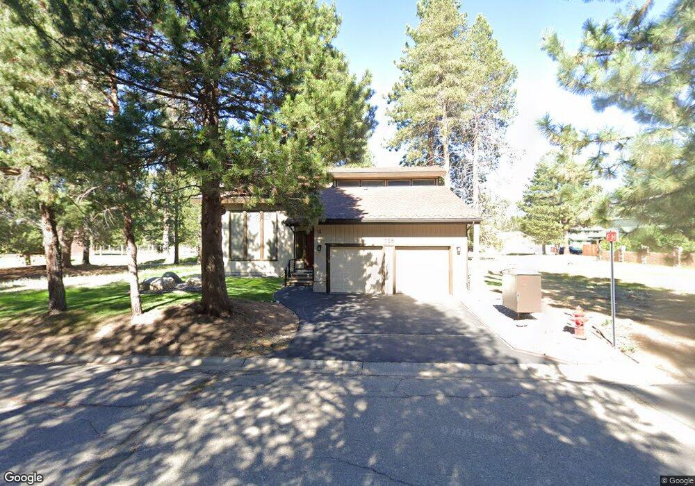
769 Montezuma Dr South Lake Tahoe, CA 96150
Estimated Value: $730,000 - $888,000
3
Beds
2
Baths
2,146
Sq Ft
$378/Sq Ft
Est. Value
About This Home
This home is located at 769 Montezuma Dr, South Lake Tahoe, CA 96150 and is currently estimated at $811,366, approximately $378 per square foot. 769 Montezuma Dr is a home located in El Dorado County with nearby schools including Tahoe Valley Elementary School, South Tahoe Middle School, and South Tahoe High School.
Ownership History
Date
Name
Owned For
Owner Type
Purchase Details
Closed on
Jan 14, 2021
Sold by
Meeker Ronald K
Bought by
Meeker Ronald Kenneth and Meeker Jennifer Kay
Current Estimated Value
Purchase Details
Closed on
Jan 4, 2021
Sold by
Diaz Marilyn M
Bought by
Diaz Julio C and Diaz Marilyn M
Purchase Details
Closed on
Nov 24, 2020
Sold by
Diaz Marilyn M and Diaz Kenneth E
Bought by
Diaz Marilyn M and Meeker Ronald K
Create a Home Valuation Report for This Property
The Home Valuation Report is an in-depth analysis detailing your home's value as well as a comparison with similar homes in the area
Home Values in the Area
Average Home Value in this Area
Purchase History
| Date | Buyer | Sale Price | Title Company |
|---|---|---|---|
| Meeker Ronald Kenneth | -- | None Available | |
| Diaz Julio C | -- | None Available | |
| Diaz Marilyn M | -- | None Available |
Source: Public Records
Tax History Compared to Growth
Tax History
| Year | Tax Paid | Tax Assessment Tax Assessment Total Assessment is a certain percentage of the fair market value that is determined by local assessors to be the total taxable value of land and additions on the property. | Land | Improvement |
|---|---|---|---|---|
| 2025 | $3,430 | $321,086 | $26,902 | $294,184 |
| 2024 | $3,430 | $314,791 | $26,375 | $288,416 |
| 2023 | $3,371 | $308,619 | $25,858 | $282,761 |
| 2022 | $3,338 | $302,568 | $25,351 | $277,217 |
| 2021 | $3,287 | $296,636 | $24,854 | $271,782 |
| 2020 | $3,240 | $293,596 | $24,600 | $268,996 |
| 2019 | $3,224 | $287,840 | $24,118 | $263,722 |
| 2018 | $3,153 | $282,197 | $23,646 | $258,551 |
| 2017 | $3,103 | $276,665 | $23,183 | $253,482 |
| 2016 | $3,041 | $271,241 | $22,729 | $248,512 |
| 2015 | $2,887 | $267,169 | $22,389 | $244,780 |
| 2014 | $2,887 | $261,937 | $21,951 | $239,986 |
Source: Public Records
Map
Nearby Homes
- 783 Michael Ct Unit Share B
- 783 Michael Ct
- 803 Michael Dr
- 2244 Texas Ave
- 2337 Sky Meadows Ct
- 555 Tahoe Keys Blvd Unit 13
- 2293 Eloise Ave Unit D
- 497 Tahoe Keys Blvd Unit 20
- 489 Tahoe Keys Blvd Unit 55
- 489 Tahoe Keys Blvd Unit 47
- 489 Tahoe Keys Blvd Unit 68
- 489 Tahoe Keys Blvd Unit 56
- 2185 Morro Dr
- 914 Tahoe Island Dr
- 477 Ala Wai Blvd Unit 91
- 2948 Pinewood Dr
- 2191 Butler Ave
- 439 Ala Wai Blvd Unit 111
- 439 Ala Wai Blvd Unit 106
- 439 Ala Wai Blvd Unit 140
- 779 Montezuma Dr
- 769 Colorado Ave
- 765 Colorado Ave
- 760 Colorado Ave
- 782 Colorado Ave
- 783 Montezuma Dr
- 775 Colorado Ave
- 786 Colorado Ave
- 769 Michael Dr
- 765 Michael Dr
- 775 Michael Dr
- 749 Colorado Ct
- 761 Michael Dr
- 783 Colorado Ave
- 779 Michael Dr
- 757 Michael Dr
- 783 Michael Dr
- 768 Michael Dr
- 787 Michael Dr
- 791 Colorado Ave