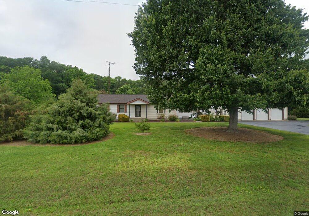
769 Pear Tree Ln Harrington, DE 19952
Estimated Value: $321,000 - $382,000
3
Beds
2
Baths
1,664
Sq Ft
$216/Sq Ft
Est. Value
About This Home
This home is located at 769 Pear Tree Ln, Harrington, DE 19952 and is currently estimated at $359,625, approximately $216 per square foot. 769 Pear Tree Ln is a home located in Kent County with nearby schools including Lake Forest South Elementary School, Lake Forest Central Elementary School, and W.T. Chipman Middle School.
Ownership History
Date
Name
Owned For
Owner Type
Purchase Details
Closed on
Oct 15, 2009
Sold by
Cordova Mae B and Jenkins Virginia L
Bought by
Wothers Michael A
Current Estimated Value
Home Financials for this Owner
Home Financials are based on the most recent Mortgage that was taken out on this home.
Original Mortgage
$130,000
Outstanding Balance
$84,931
Interest Rate
5.09%
Mortgage Type
New Conventional
Estimated Equity
$274,694
Create a Home Valuation Report for This Property
The Home Valuation Report is an in-depth analysis detailing your home's value as well as a comparison with similar homes in the area
Home Values in the Area
Average Home Value in this Area
Purchase History
| Date | Buyer | Sale Price | Title Company |
|---|---|---|---|
| Wothers Michael A | $190,000 | None Available |
Source: Public Records
Mortgage History
| Date | Status | Borrower | Loan Amount |
|---|---|---|---|
| Open | Wothers Michael A | $130,000 |
Source: Public Records
Tax History Compared to Growth
Tax History
| Year | Tax Paid | Tax Assessment Tax Assessment Total Assessment is a certain percentage of the fair market value that is determined by local assessors to be the total taxable value of land and additions on the property. | Land | Improvement |
|---|---|---|---|---|
| 2025 | $1,172 | $319,600 | $101,200 | $218,400 |
| 2024 | $1,172 | $319,600 | $101,200 | $218,400 |
| 2023 | $1,202 | $50,000 | $8,600 | $41,400 |
| 2022 | $1,076 | $50,000 | $8,600 | $41,400 |
| 2021 | $1,019 | $50,000 | $8,600 | $41,400 |
| 2020 | $1,062 | $50,000 | $8,600 | $41,400 |
| 2019 | $1,064 | $50,000 | $8,600 | $41,400 |
| 2018 | $1,052 | $50,000 | $8,600 | $41,400 |
| 2017 | $1,094 | $50,000 | $0 | $0 |
| 2016 | $1,003 | $50,000 | $0 | $0 |
| 2015 | $987 | $50,000 | $0 | $0 |
| 2014 | $973 | $50,000 | $0 | $0 |
Source: Public Records
Map
Nearby Homes
- 3398 Brownsville Rd
- 2235 Vernon Rd
- 590 Lobo Rd
- 10440 Burrsville Branch Rd
- 3809 Road 112
- 2 Road 268
- 227 Burnite Mill Rd
- 3029 Burnite Mill Rd
- 0 Pine Pitch Rd Unit DEKT2041378
- 7239 Park Brown Rd
- 12459 Kibler Rd
- Lot 12 Road 268
- Lot 11 Road 268
- Lot 7 Road 268
- Lot 6 Road 268
- Lot 5 Road 268
- Lot 3 Road 268
- Lot 2 Road 268
- Lot 1 Road 268
- Lot 10 Road 268
- 741 Pear Tree Ln
- 695 Pear Tree Ln
- 579 Pear Tree Ln
- 571 Pear Tree Ln
- 988 Pear Tree Ln
- 539 Pear Tree Ln
- 1026 Pear Tree Ln
- 518 Pear Tree Ln
- 495 Pear Tree Ln
- 754 Pear Tree Ln
- 2642 Brownsville Rd
- 2694 Brownsville Rd
- 2694 Brownsville Rd
- 479 Pear Tree Ln
- 509 Pear Tree Ln Unit 1
- 509 Pear Tree Ln
- 2766 Brownsville Rd
- 2569 Brownsville Rd
- 2804 Brownsville Rd
- 2834 Brownsville Rd