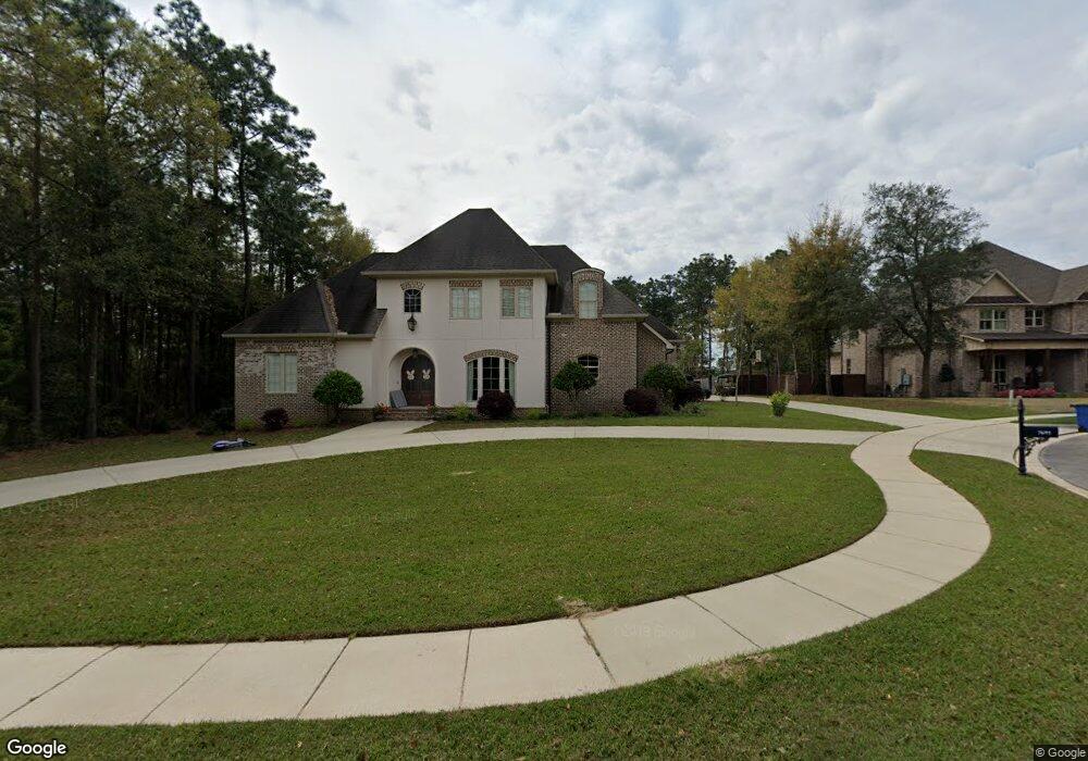
7691 Rockstone Ln S Mobile, AL 36695
Second Creek NeighborhoodEstimated Value: $725,418 - $793,000
5
Beds
6
Baths
4,547
Sq Ft
$166/Sq Ft
Est. Value
About This Home
This home is located at 7691 Rockstone Ln S, Mobile, AL 36695 and is currently estimated at $754,806, approximately $166 per square foot. 7691 Rockstone Ln S is a home located in Mobile County with nearby schools including O'rourke Elementary School, Bernice J Causey Middle School, and Baker High School.
Ownership History
Date
Name
Owned For
Owner Type
Purchase Details
Closed on
Nov 30, 2017
Sold by
Veasey Susan Saint and Veasey Jason W
Bought by
Veasey Susan Saint and Veasey Jason W
Current Estimated Value
Home Financials for this Owner
Home Financials are based on the most recent Mortgage that was taken out on this home.
Original Mortgage
$391,000
Outstanding Balance
$329,188
Interest Rate
3.94%
Mortgage Type
New Conventional
Estimated Equity
$425,618
Purchase Details
Closed on
Jan 20, 2009
Sold by
Whitney National Bank
Bought by
Veasey Susan Saint
Create a Home Valuation Report for This Property
The Home Valuation Report is an in-depth analysis detailing your home's value as well as a comparison with similar homes in the area
Home Values in the Area
Average Home Value in this Area
Purchase History
| Date | Buyer | Sale Price | Title Company |
|---|---|---|---|
| Veasey Susan Saint | -- | Anchor Title Llc | |
| Veasey Susan Saint | -- | Slt |
Source: Public Records
Mortgage History
| Date | Status | Borrower | Loan Amount |
|---|---|---|---|
| Open | Veasey Susan Saint | $391,000 |
Source: Public Records
Tax History Compared to Growth
Tax History
| Year | Tax Paid | Tax Assessment Tax Assessment Total Assessment is a certain percentage of the fair market value that is determined by local assessors to be the total taxable value of land and additions on the property. | Land | Improvement |
|---|---|---|---|---|
| 2024 | $2,872 | $60,400 | $10,000 | $50,400 |
| 2023 | $2,872 | $58,690 | $10,000 | $48,690 |
| 2022 | $2,589 | $54,760 | $10,000 | $44,760 |
| 2021 | $2,607 | $55,130 | $10,000 | $45,130 |
| 2020 | $2,632 | $55,630 | $10,000 | $45,630 |
| 2019 | $5,565 | $114,740 | $0 | $0 |
| 2018 | $2,585 | $54,680 | $0 | $0 |
| 2017 | $2,719 | $57,440 | $0 | $0 |
| 2016 | $2,744 | $57,960 | $0 | $0 |
| 2013 | $2,483 | $52,140 | $0 | $0 |
Source: Public Records
Map
Nearby Homes
- 7691 Sweetgum Ct
- 7671 Creekwood Dr
- 1542 Stone Hedge Dr W
- 7912 Yorkhaven Rd
- 7971 Suzanne Way
- 0 Creekwood Place Dr Unit 7647963
- 8011 Suzanne Way
- 8020 Suzanne Way
- 8050 Saint Jude Cir N
- 2039 Creekwood Place Ct
- 1337 Carson Rd W
- 1673 Aden Rd
- 1735 Ashmoor Dr W
- 1340 Wellsley Ct
- 7260 Pine Station Rd S
- 1832 Aden Rd
- 7361 Carson Rd S
- 1265 Hanover Ct
- 1350 Schillinger Rd S
- 1484 Pebble Creek Dr
- 7663 Rockstone Ln S Unit 5/25
- 7663 Rockstone Ln S
- 1750 Highwood Dr
- 7718 Rockstone Ln
- 1755 Highwood Dr
- 1746 Rockstone Cir
- 7700 Rockstone Ln S
- 1760 Highwood Dr
- 7676 Rockstone Ln Unit 20
- 7676 Rockstone Ln
- 7676 Rockstone Ln S
- 7688 Rockstone Ln S
- 1737 Rockstone Ln
- 7710 Highwood Ct
- 7630 Branchwood Dr
- 7720 Highwood Ct
- 7700 Highwood Ct
- 1766 Highwood Dr
- 1715 Rockstone Ln
- 7685 Oakbrook Ct
