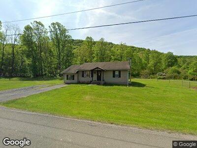
7693 State Route 973 W Cogan Station, PA 17728
Mifflin NeighborhoodEstimated Value: $168,734 - $241,000
2
Beds
1
Bath
1,008
Sq Ft
$193/Sq Ft
Est. Value
About This Home
This home is located at 7693 State Route 973 W, Cogan Station, PA 17728 and is currently estimated at $194,684, approximately $193 per square foot. 7693 State Route 973 W is a home with nearby schools including Jersey Shore Area Senior High School.
Ownership History
Date
Name
Owned For
Owner Type
Purchase Details
Closed on
Jun 15, 2022
Sold by
Mcdonnell Dermot T
Bought by
Butt-Hennigan Rachelle R
Current Estimated Value
Home Financials for this Owner
Home Financials are based on the most recent Mortgage that was taken out on this home.
Original Mortgage
$144,000
Outstanding Balance
$139,152
Interest Rate
5.1%
Mortgage Type
New Conventional
Purchase Details
Closed on
Jan 25, 1995
Sold by
Mcdonnell Dermot R and Mcdonnell Diane J
Bought by
Mcdonnell Dermot T
Create a Home Valuation Report for This Property
The Home Valuation Report is an in-depth analysis detailing your home's value as well as a comparison with similar homes in the area
Home Values in the Area
Average Home Value in this Area
Purchase History
| Date | Buyer | Sale Price | Title Company |
|---|---|---|---|
| Butt-Hennigan Rachelle R | $160,000 | None Listed On Document | |
| Mcdonnell Dermot T | -- | -- |
Source: Public Records
Mortgage History
| Date | Status | Borrower | Loan Amount |
|---|---|---|---|
| Open | Butt-Hennigan Rachelle R | $144,000 |
Source: Public Records
Tax History Compared to Growth
Tax History
| Year | Tax Paid | Tax Assessment Tax Assessment Total Assessment is a certain percentage of the fair market value that is determined by local assessors to be the total taxable value of land and additions on the property. | Land | Improvement |
|---|---|---|---|---|
| 2024 | $1,792 | $68,750 | $30,000 | $38,750 |
| 2023 | $1,791 | $68,750 | $30,000 | $38,750 |
| 2022 | $1,782 | $68,750 | $30,000 | $38,750 |
| 2021 | $1,787 | $68,750 | $30,000 | $38,750 |
| 2020 | $1,785 | $68,750 | $30,000 | $38,750 |
| 2019 | $1,748 | $68,750 | $30,000 | $38,750 |
| 2018 | $1,722 | $68,750 | $30,000 | $38,750 |
| 2017 | $1,629 | $68,750 | $30,000 | $38,750 |
| 2016 | $1,575 | $68,750 | $30,000 | $38,750 |
| 2015 | $1,575 | $68,750 | $30,000 | $38,750 |
Source: Public Records
Map
Nearby Homes
- Wp Lot 001 Pennsylvania 287
- 5595 Pennsylvania 287
- 605 Windy Ridge Rd
- 433 Main St
- 366 Main St
- 241 Main St
- 285 Larryville Rd
- 0 Hoover Dr Unit WB-101344
- 244 Douglass Ln
- 1360 Pine Run Rd
- 2789 Beautys Run Rd
- 168 N Shaffer Hill Rd
- 1155 Lone Walnut Club Rd
- 1669 Dauber Rd
- 0 Saint Michaels Rd Unit WB-99896
- 543 Haleeka Rd
- 725 Haleeka Rd
- 1592 Cement Hollow Rd
- 361 1st St
- 9604 S Route 220 Hwy
- 7693 State Route 973 W
- 7381 Quenshukeny Rd
- 444 Santschi Rd
- 669 Santschi Rd
- 2717 Windy Ridge Rd
- 6891 Quenshukeny Rd
- 7727 Pennsylvania 973
- 7794 State Route 973 W
- 6940 State Route 973 W
- 533 Santschi Rd
- 533 Santschi Rd
- 6935 Pennsylvania 973
- 6935 State Route 973 W
- 70 Chickadee Ln
- 2713 Windy Ridge Rd
- 60 Barts Dr
- 51 Barts Dr
- 284 Chickadee Ln
- 6709 Quenshukeny Rd
- 80 Barts Dr
