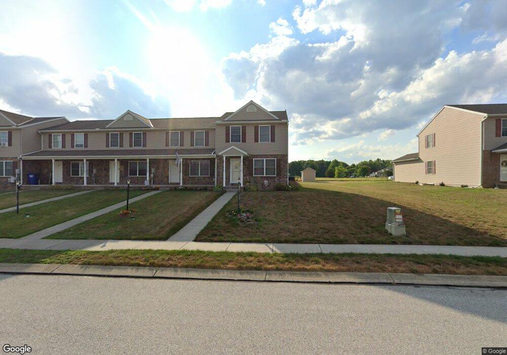
77 Cannon Ln Unit 130 Gettysburg, PA 17325
Estimated Value: $210,000 - $233,048
2
Beds
2
Baths
1,200
Sq Ft
$185/Sq Ft
Est. Value
About This Home
This home is located at 77 Cannon Ln Unit 130, Gettysburg, PA 17325 and is currently estimated at $222,012, approximately $185 per square foot. 77 Cannon Ln Unit 130 is a home located in Adams County with nearby schools including Rolling Acres El School, Maple Avenue Middle School, and Littlestown Senior High School.
Ownership History
Date
Name
Owned For
Owner Type
Purchase Details
Closed on
Sep 22, 2020
Sold by
Myers Nathaniel S and Ripley Nicole R
Bought by
Myers Nathaniel S
Current Estimated Value
Home Financials for this Owner
Home Financials are based on the most recent Mortgage that was taken out on this home.
Original Mortgage
$128,820
Outstanding Balance
$114,319
Interest Rate
2.9%
Mortgage Type
New Conventional
Estimated Equity
$107,693
Purchase Details
Closed on
Mar 16, 2010
Sold by
Gebhart Philip T and Gebhart Steven A
Bought by
Myers Nathaniel S and Ripley Nicole R
Home Financials for this Owner
Home Financials are based on the most recent Mortgage that was taken out on this home.
Original Mortgage
$142,653
Interest Rate
4.75%
Mortgage Type
FHA
Create a Home Valuation Report for This Property
The Home Valuation Report is an in-depth analysis detailing your home's value as well as a comparison with similar homes in the area
Home Values in the Area
Average Home Value in this Area
Purchase History
| Date | Buyer | Sale Price | Title Company |
|---|---|---|---|
| Myers Nathaniel S | -- | None Available | |
| Myers Nathaniel S | $158,000 | -- |
Source: Public Records
Mortgage History
| Date | Status | Borrower | Loan Amount |
|---|---|---|---|
| Open | Myers Nathaniel S | $128,820 | |
| Closed | Myers Nathaniel S | $142,653 |
Source: Public Records
Tax History Compared to Growth
Tax History
| Year | Tax Paid | Tax Assessment Tax Assessment Total Assessment is a certain percentage of the fair market value that is determined by local assessors to be the total taxable value of land and additions on the property. | Land | Improvement |
|---|---|---|---|---|
| 2025 | $2,907 | $150,000 | $32,300 | $117,700 |
| 2024 | $2,782 | $150,000 | $32,300 | $117,700 |
| 2023 | $2,729 | $150,000 | $32,300 | $117,700 |
| 2022 | $2,709 | $150,000 | $32,300 | $117,700 |
| 2021 | $2,615 | $150,000 | $32,300 | $117,700 |
| 2020 | $2,578 | $150,000 | $32,300 | $117,700 |
| 2019 | $2,525 | $150,000 | $32,300 | $117,700 |
| 2018 | $2,471 | $150,000 | $32,300 | $117,700 |
| 2017 | $2,396 | $150,000 | $32,300 | $117,700 |
| 2016 | -- | $150,000 | $32,300 | $117,700 |
| 2015 | -- | $150,000 | $32,300 | $117,700 |
| 2014 | -- | $150,000 | $32,300 | $117,700 |
Source: Public Records
Map
Nearby Homes
- 8 Maple St
- 28 Bonniefield Cir Unit 25
- 67 Cedarfield Dr
- 13 N Pine St
- 1 Hickory Ave
- 549 Grant Dr Unit 549
- 780 White Hall Rd
- 871 Sherman Dr Unit 871
- 464 Locust Ln
- 948 Heritage Dr Unit 948
- 860 Bon Ox Rd
- 279 Longstreet Dr Unit 279
- 930 Hoffman Rd
- 1365 Hanover Rd Unit 15
- 151 Clapsaddle Rd
- 0 Littlestown Rd
- 75 Cavalry Field Rd
- 141 Grand Overlook Dr
- 70 Sells Station Rd
- 2325 York Rd
- 79 Cannon Ln Unit 131
- 75 Cannon Ln Unit 129
- 81 Cannon Ln Unit 132
- 83 Cannon Ln Unit 133
- 73 Cannon Ln Unit 128
- 71 Cannon Ln Unit 127
- 69 Cannon Ln Unit 126
- 85 Cannon Ln Unit 134
- 67 Cannon Ln Unit 125
- 66 Cannon Ln Unit 113
- 61 Cannon Ln Unit 124
- 64 Cannon Ln Unit 112
- 68 Cannon Ln Unit 114
- 59 Cannon Ln Unit 123
- 57 Cannon Ln Unit 122
- 62 Cannon Ln Unit 111
- 55 Cannon Ln Unit 121
- 126 Homestead Dr
- 53 Cannon Ln Unit 120
- 56 Cannon Ln Unit 109