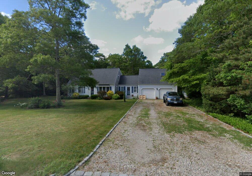
77 Capes Trail West Barnstable, MA 02668
West Barnstable NeighborhoodEstimated Value: $740,000 - $796,000
4
Beds
3
Baths
2,048
Sq Ft
$373/Sq Ft
Est. Value
About This Home
This home is located at 77 Capes Trail, West Barnstable, MA 02668 and is currently estimated at $763,943, approximately $373 per square foot. 77 Capes Trail is a home located in Barnstable County with nearby schools including West Barnstable Elementary School, Barnstable United Elementary School, and Barnstable Intermediate School.
Ownership History
Date
Name
Owned For
Owner Type
Purchase Details
Closed on
Sep 13, 2010
Sold by
Fallen Jimmy and Fallen Jessica L
Bought by
Fallen Jessica L
Current Estimated Value
Home Financials for this Owner
Home Financials are based on the most recent Mortgage that was taken out on this home.
Original Mortgage
$269,822
Outstanding Balance
$176,446
Interest Rate
4.25%
Mortgage Type
FHA
Estimated Equity
$587,497
Purchase Details
Closed on
Apr 28, 2006
Sold by
Powers Suzanne M and Powers William V
Bought by
Fallen Jessica L
Home Financials for this Owner
Home Financials are based on the most recent Mortgage that was taken out on this home.
Original Mortgage
$260,000
Interest Rate
6.4%
Mortgage Type
Purchase Money Mortgage
Purchase Details
Closed on
Feb 9, 2004
Sold by
Conway Eileen M
Bought by
Powers Suzanne M
Home Financials for this Owner
Home Financials are based on the most recent Mortgage that was taken out on this home.
Original Mortgage
$331,500
Interest Rate
5.8%
Mortgage Type
Purchase Money Mortgage
Purchase Details
Closed on
Jan 19, 1999
Sold by
Distefano Anthony T and Distefano Georgianna
Bought by
Conway Eileen M
Create a Home Valuation Report for This Property
The Home Valuation Report is an in-depth analysis detailing your home's value as well as a comparison with similar homes in the area
Home Values in the Area
Average Home Value in this Area
Purchase History
| Date | Buyer | Sale Price | Title Company |
|---|---|---|---|
| Fallen Jessica L | -- | -- | |
| Fallen Jessica L | $455,000 | -- | |
| Powers Suzanne M | $390,000 | -- | |
| Conway Eileen M | $177,500 | -- |
Source: Public Records
Mortgage History
| Date | Status | Borrower | Loan Amount |
|---|---|---|---|
| Open | Fallen Jessica L | $269,822 | |
| Previous Owner | Fallen Jessica L | $260,000 | |
| Previous Owner | Powers Suzanne M | $331,500 | |
| Previous Owner | Conway Eileen M | $1,112,000 |
Source: Public Records
Tax History
| Year | Tax Paid | Tax Assessment Tax Assessment Total Assessment is a certain percentage of the fair market value that is determined by local assessors to be the total taxable value of land and additions on the property. | Land | Improvement |
|---|---|---|---|---|
| 2025 | $6,205 | $664,300 | $176,400 | $487,900 |
| 2024 | $5,514 | $642,700 | $176,400 | $466,300 |
| 2023 | $5,271 | $578,600 | $160,400 | $418,200 |
| 2022 | $5,221 | $469,900 | $118,900 | $351,000 |
| 2021 | $4,940 | $421,500 | $118,900 | $302,600 |
| 2020 | $5,096 | $420,500 | $126,800 | $293,700 |
| 2019 | $4,797 | $390,600 | $126,800 | $263,800 |
| 2018 | $4,464 | $360,300 | $133,400 | $226,900 |
| 2017 | $4,207 | $343,700 | $133,400 | $210,300 |
| 2016 | $4,164 | $347,300 | $137,000 | $210,300 |
| 2015 | $3,882 | $324,600 | $127,100 | $197,500 |
Source: Public Records
Map
Nearby Homes
- 75 Old Toll Rd
- 510 Cedar St
- 50 Wayside Ln
- 6 Harpers Hollow
- 46 Service Rd
- 159 Great Hill Rd
- 84 White Birch Way
- 29 Fish House Rd
- 3 Mulberry Cir
- 6 George Gallant Rd
- 4 Wing Blvd
- 566 Route 6a
- 32 Willington Ave
- 82 Old Fields Rd
- 23 Old Fields Rd
- 50 Currycomb Cir
- 282 Parker Rd
- 0 Captain Kidd Rd
- 38 Lakeside Dr
- 80 Branch Terrace
- 65 Capes Trail
- 93 Capes Trail
- 150 Berkshire Trail
- 0 Capes Trail
- 0 Capes Trail
- 66 Capes Trail
- 49 Capes Trail
- 107 Capes Trail
- 115 N Winds Ln
- 130 Berkshire Trail
- 125 Capes Trail
- 155 Berkshire Trail
- 35 Capes Trail
- 135 Berkshire Trail
- 95 N Winds Ln
- 120 Berkshire Trail
- 125 Berkshire Trail
- 19 Capes Trail
- 139 Capes Trail
- 140 Capes Trail
Your Personal Tour Guide
Ask me questions while you tour the home.