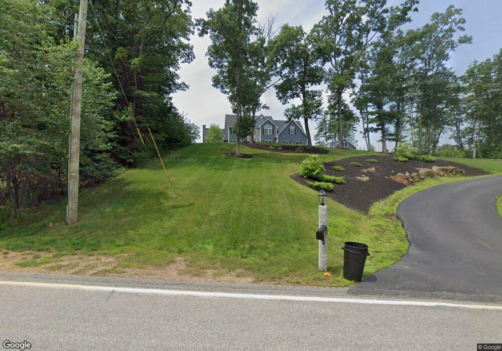
77 Coleman Rd Auburn, NH 03032
Estimated Value: $1,192,000 - $1,380,000
4
Beds
3
Baths
4,166
Sq Ft
$310/Sq Ft
Est. Value
About This Home
This home is located at 77 Coleman Rd, Auburn, NH 03032 and is currently estimated at $1,289,516, approximately $309 per square foot. 77 Coleman Rd is a home with nearby schools including Auburn Village School and Pinkerton Academy.
Ownership History
Date
Name
Owned For
Owner Type
Purchase Details
Closed on
Apr 26, 2024
Sold by
Daigle Donald P and Daigle Shannon L
Bought by
Donald & S Daigle Ret and Daigle
Current Estimated Value
Purchase Details
Closed on
Sep 27, 2023
Sold by
Cecilia Eaton T and Cecilia Eaton
Bought by
Daigle Donald and Daigle Shannon
Purchase Details
Closed on
Sep 29, 2020
Sold by
Daigle Donald P
Bought by
Daigle Donald P and Daigle Shannon L
Purchase Details
Closed on
Jan 10, 2019
Sold by
Espana Building & Dev
Bought by
Daigle Donald P
Home Financials for this Owner
Home Financials are based on the most recent Mortgage that was taken out on this home.
Original Mortgage
$520,000
Interest Rate
4.8%
Mortgage Type
New Conventional
Create a Home Valuation Report for This Property
The Home Valuation Report is an in-depth analysis detailing your home's value as well as a comparison with similar homes in the area
Home Values in the Area
Average Home Value in this Area
Purchase History
| Date | Buyer | Sale Price | Title Company |
|---|---|---|---|
| Donald & S Daigle Ret | -- | None Available | |
| Donald & S Daigle Ret | -- | None Available | |
| Daigle Donald | $175,066 | None Available | |
| Daigle Donald | $175,066 | None Available | |
| Daigle Donald P | -- | None Available | |
| Daigle Donald P | -- | None Available | |
| Daigle Donald P | $650,000 | -- | |
| Daigle Donald P | $650,000 | -- |
Source: Public Records
Mortgage History
| Date | Status | Borrower | Loan Amount |
|---|---|---|---|
| Previous Owner | Daigle Donald P | $520,000 |
Source: Public Records
Tax History Compared to Growth
Tax History
| Year | Tax Paid | Tax Assessment Tax Assessment Total Assessment is a certain percentage of the fair market value that is determined by local assessors to be the total taxable value of land and additions on the property. | Land | Improvement |
|---|---|---|---|---|
| 2024 | $14,709 | $1,092,000 | $226,500 | $865,500 |
| 2023 | $13,770 | $1,092,000 | $226,500 | $865,500 |
| 2022 | $12,334 | $691,000 | $178,800 | $512,200 |
| 2021 | $12,535 | $691,000 | $178,800 | $512,200 |
| 2020 | $12,322 | $666,800 | $178,800 | $488,000 |
| 2019 | $11,837 | $629,300 | $170,800 | $458,500 |
| 2018 | $2,390 | $140,100 | $140,100 | $0 |
| 2017 | $2,777 | $131,300 | $131,300 | $0 |
| 2016 | $2,659 | $131,300 | $131,300 | $0 |
| 2015 | $2,719 | $131,300 | $131,300 | $0 |
| 2014 | $2,798 | $131,300 | $131,300 | $0 |
| 2013 | $3,385 | $172,800 | $172,800 | $0 |
Source: Public Records
Map
Nearby Homes
- Lot 56-2 Chester Rd
- 91 Raymond Rd
- 00 Raymond Rd Unit 2
- #1 the Cliffs at Evergreen Dr
- 437 Chester Rd
- 396 Dearborn Rd
- 62 Hooksett Rd
- 54 the Cliffs at Evergreen Dr
- 45 Peach Tree Rd
- 237 Villager Rd
- 226 Villager Rd
- 249 Villager Rd
- 118 Birch Rd
- 51 the Cliffs at Evergreen Cliffside Dr Unit 51
- Lot 2 Brown Rd
- 63 the Cliffs at Evergreen Hemlock Dr Unit 63
- 56 the Cliffs at Evergreen Dr
- 53 the Cliffs at Evergreen Cliffside Dr Unit 53
- 39 the Cliffs at Evergreen Cliffside Dr Unit 39
- 59 Hawthorne Dr