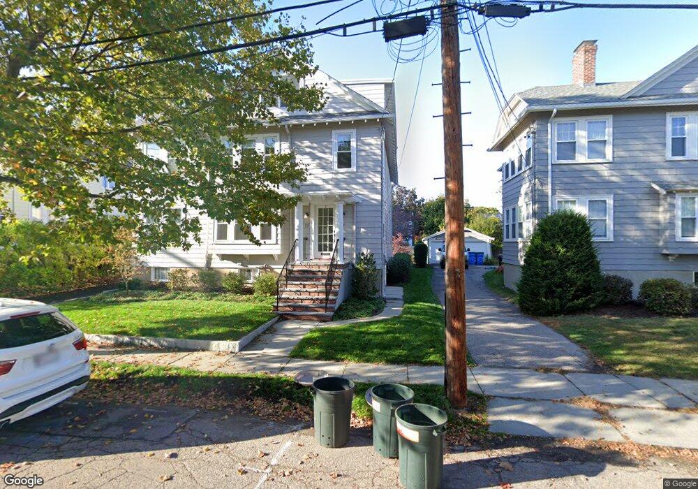
77 Elm St Unit 79 Belmont, MA 02478
Cushing Square NeighborhoodEstimated Value: $950,000 - $1,977,000
5
Beds
3
Baths
3,276
Sq Ft
$487/Sq Ft
Est. Value
About This Home
This home is located at 77 Elm St Unit 79, Belmont, MA 02478 and is currently estimated at $1,593,955, approximately $486 per square foot. 77 Elm St Unit 79 is a home located in Middlesex County with nearby schools including Mary Lee Burbank Elementary School, Winthrop L Chenery Middle School, and Belmont High School.
Ownership History
Date
Name
Owned For
Owner Type
Purchase Details
Closed on
Apr 30, 1996
Sold by
Koepke Gary L and Koepke Margaret L
Bought by
West Thomas J
Current Estimated Value
Home Financials for this Owner
Home Financials are based on the most recent Mortgage that was taken out on this home.
Original Mortgage
$264,750
Interest Rate
7.81%
Mortgage Type
Purchase Money Mortgage
Purchase Details
Closed on
Jul 28, 1993
Sold by
Fox Victor R and Fox Elizabeth
Bought by
Koepke Margaret
Create a Home Valuation Report for This Property
The Home Valuation Report is an in-depth analysis detailing your home's value as well as a comparison with similar homes in the area
Home Values in the Area
Average Home Value in this Area
Purchase History
| Date | Buyer | Sale Price | Title Company |
|---|---|---|---|
| West Thomas J | $363,000 | -- | |
| Koepke Margaret | $25,000 | -- |
Source: Public Records
Mortgage History
| Date | Status | Borrower | Loan Amount |
|---|---|---|---|
| Open | Koepke Margaret | $260,000 | |
| Closed | Koepke Margaret | $260,000 | |
| Closed | Koepke Margaret | $264,750 | |
| Previous Owner | Koepke Margaret | $40,000 |
Source: Public Records
Tax History Compared to Growth
Tax History
| Year | Tax Paid | Tax Assessment Tax Assessment Total Assessment is a certain percentage of the fair market value that is determined by local assessors to be the total taxable value of land and additions on the property. | Land | Improvement |
|---|---|---|---|---|
| 2025 | $18,645 | $1,637,000 | $836,000 | $801,000 |
| 2024 | $16,104 | $1,525,000 | $970,000 | $555,000 |
| 2023 | $16,242 | $1,445,000 | $915,000 | $530,000 |
| 2022 | $14,806 | $1,356,000 | $837,000 | $519,000 |
| 2021 | $14,806 | $1,283,000 | $829,000 | $454,000 |
| 2020 | $15,356 | $1,396,000 | $851,000 | $545,000 |
| 2019 | $12,872 | $1,103,000 | $590,000 | $513,000 |
| 2018 | $11,105 | $914,000 | $537,000 | $377,000 |
| 2017 | $11,028 | $869,000 | $492,000 | $377,000 |
| 2016 | $10,651 | $848,000 | $492,000 | $356,000 |
| 2015 | $8,953 | $694,000 | $387,000 | $307,000 |
Source: Public Records
Map
Nearby Homes
- 73 Foster Rd Unit 2
- 276 Belmont St Unit 1
- 30 Unity Ave Unit 30
- 147 Langdon Ave Unit 149
- 10 Marlboro St Unit 1
- 133 Hillside Rd
- 163 Belmont St
- 36 Madison St
- 56-58 Edgecliff Rd
- 105 Watson Rd
- 87 Templeton Pkwy Unit 3
- 161 Cushing St
- 16 Ericsson St
- 81 Winsor Ave
- 118 Blanchard Rd
- 95 Cushing St
- 25 Francis St Unit 2
- 25 Francis St Unit 1
- 43 Irma Ave Unit 43
- 66 Holworthy St
- 81 Elm St Unit 1
- 81 Elm St Unit 83
- 85 Elm St Unit 87
- 73 Elm St Unit 75
- 73-75 Elm St
- 73 Elm St Unit 73
- 73 Elm St Unit 1
- 76 Elm St Unit 2
- 76 Elm St Unit 1
- 91 Elm St Unit 93
- 91 Elm St Unit 2
- 69 Elm St Unit 71
- 93 Elm St Unit 93
- 86 Elm St
- 86 Elm St Unit 2
- 86 Elm St Unit 1
- 19 Bacon Rd
- 35 Clarendon Rd Unit 37
- 25 Bacon Rd
- 15 Bacon Rd