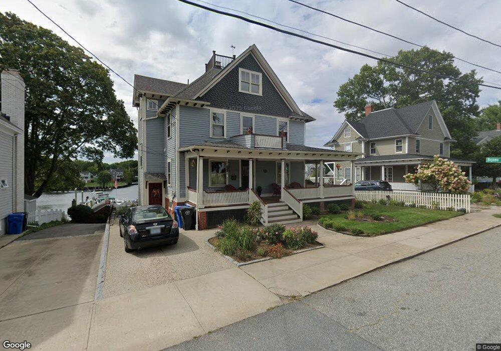
77 Fort Ave Cranston, RI 02905
Edgewood NeighborhoodEstimated Value: $594,000 - $1,002,000
4
Beds
2
Baths
2,900
Sq Ft
$303/Sq Ft
Est. Value
About This Home
This home is located at 77 Fort Ave, Cranston, RI 02905 and is currently estimated at $877,425, approximately $302 per square foot. 77 Fort Ave is a home located in Providence County with nearby schools including Edward S. Rhodes School, Park View Middle School, and Cranston High School East.
Ownership History
Date
Name
Owned For
Owner Type
Purchase Details
Closed on
Feb 17, 2022
Sold by
Ryan Kenneth L and Ryan Rochelle H
Bought by
Kenneth Lewis Ryan T
Current Estimated Value
Purchase Details
Closed on
May 6, 2002
Sold by
Michelson Jonathan and Sheridan Maureen
Bought by
Ryan Kenneth L and Ryan Rochelle H
Home Financials for this Owner
Home Financials are based on the most recent Mortgage that was taken out on this home.
Original Mortgage
$296,000
Interest Rate
7.13%
Create a Home Valuation Report for This Property
The Home Valuation Report is an in-depth analysis detailing your home's value as well as a comparison with similar homes in the area
Home Values in the Area
Average Home Value in this Area
Purchase History
| Date | Buyer | Sale Price | Title Company |
|---|---|---|---|
| Kenneth Lewis Ryan T | -- | None Available | |
| Ryan Kenneth L | $370,000 | -- |
Source: Public Records
Mortgage History
| Date | Status | Borrower | Loan Amount |
|---|---|---|---|
| Previous Owner | Ryan Kenneth L | $300,700 | |
| Previous Owner | Ryan Kenneth L | $296,000 | |
| Previous Owner | Ryan Kenneth L | $55,500 |
Source: Public Records
Tax History Compared to Growth
Tax History
| Year | Tax Paid | Tax Assessment Tax Assessment Total Assessment is a certain percentage of the fair market value that is determined by local assessors to be the total taxable value of land and additions on the property. | Land | Improvement |
|---|---|---|---|---|
| 2025 | $9,748 | $702,300 | $364,300 | $338,000 |
| 2024 | $9,558 | $702,300 | $364,300 | $338,000 |
| 2023 | $9,749 | $515,800 | $215,400 | $300,400 |
| 2022 | $9,547 | $515,800 | $215,400 | $300,400 |
| 2021 | $9,284 | $515,800 | $215,400 | $300,400 |
| 2020 | $9,965 | $479,800 | $254,500 | $225,300 |
| 2019 | $9,965 | $479,800 | $254,500 | $225,300 |
| 2018 | $9,735 | $479,800 | $254,500 | $225,300 |
| 2017 | $10,222 | $445,600 | $220,300 | $225,300 |
| 2016 | $10,004 | $445,600 | $220,300 | $225,300 |
| 2015 | $10,004 | $445,600 | $220,300 | $225,300 |
| 2014 | $9,945 | $435,400 | $210,500 | $224,900 |
Source: Public Records
Map
Nearby Homes
- 25 Seaview Ave
- 19 Remington St
- 28 Manchester St
- 8 Atlantic Ave
- 200 Post Rd Unit 411
- 200 Post Rd Unit 603
- 31 Longwood Ave
- 55 Longwood Ave
- 400 Narragansett Pkwy Unit WA11
- 21 Madison St
- 10 Rogers Rd
- 95 Roosevelt St
- 92 Washington St
- 345 Post Rd
- 114 Jefferson St
- 14 Park Ave
- 41 Drake Rd
- 1291 Narragansett Blvd Unit 4
- 98 Columbia Ave
- 126 Columbia Ave