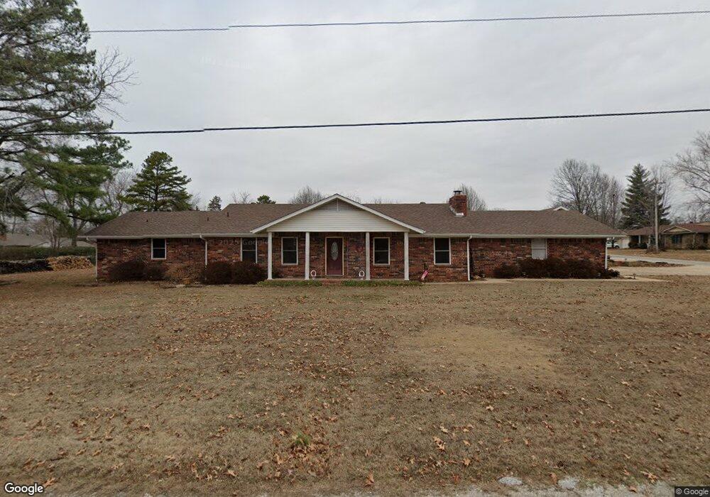
77 Fox Run Rogers, AR 72756
Estimated Value: $305,000 - $494,000
4
Beds
3
Baths
2,104
Sq Ft
$195/Sq Ft
Est. Value
About This Home
This home is located at 77 Fox Run, Rogers, AR 72756 and is currently estimated at $409,296, approximately $194 per square foot. 77 Fox Run is a home located in Benton County with nearby schools including Northside Elementary School, Lingle Middle School, and Rogers Heritage High School.
Ownership History
Date
Name
Owned For
Owner Type
Purchase Details
Closed on
Aug 31, 2006
Sold by
Kennedy Howard Glenn
Bought by
Morrison Robert G and Morrison Dana Jean
Current Estimated Value
Home Financials for this Owner
Home Financials are based on the most recent Mortgage that was taken out on this home.
Original Mortgage
$120,000
Outstanding Balance
$71,575
Interest Rate
6.64%
Mortgage Type
Purchase Money Mortgage
Estimated Equity
$337,721
Purchase Details
Closed on
Jan 14, 2004
Bought by
Kennedy H
Purchase Details
Closed on
Dec 8, 1999
Bought by
Kennedy 2P
Create a Home Valuation Report for This Property
The Home Valuation Report is an in-depth analysis detailing your home's value as well as a comparison with similar homes in the area
Home Values in the Area
Average Home Value in this Area
Purchase History
| Date | Buyer | Sale Price | Title Company |
|---|---|---|---|
| Morrison Robert G | $150,000 | Heritage Land Title Of Ar | |
| Kennedy H | -- | -- | |
| Kennedy 2P | $130,000 | -- |
Source: Public Records
Mortgage History
| Date | Status | Borrower | Loan Amount |
|---|---|---|---|
| Open | Morrison Robert G | $120,000 |
Source: Public Records
Tax History Compared to Growth
Tax History
| Year | Tax Paid | Tax Assessment Tax Assessment Total Assessment is a certain percentage of the fair market value that is determined by local assessors to be the total taxable value of land and additions on the property. | Land | Improvement |
|---|---|---|---|---|
| 2025 | $2,238 | $76,941 | $8,600 | $68,341 |
| 2024 | $2,084 | $76,941 | $8,600 | $68,341 |
| 2023 | $1,985 | $56,410 | $8,600 | $47,810 |
| 2022 | $1,599 | $56,410 | $8,600 | $47,810 |
| 2021 | $1,505 | $56,410 | $8,600 | $47,810 |
| 2020 | $1,416 | $32,630 | $3,800 | $28,830 |
| 2019 | $1,416 | $32,630 | $3,800 | $28,830 |
| 2018 | $1,441 | $32,630 | $3,800 | $28,830 |
| 2017 | $1,344 | $32,630 | $3,800 | $28,830 |
| 2016 | $1,344 | $32,630 | $3,800 | $28,830 |
| 2015 | $1,761 | $33,280 | $5,000 | $28,280 |
| 2014 | $1,411 | $33,280 | $5,000 | $28,280 |
Source: Public Records
Map
Nearby Homes
- 12437 Wildwood Dr
- 12412 Wildwood Dr
- 22 Howard Place
- Tracts A/B N 94 Hwy
- 12831 Douglas Ln
- 000 Peck Rd
- 12986 Douglas Ln
- 12620 Lindy Ln
- 11697 Lindy Ln
- 11680 Amy Ave
- 2885 Peck Rd
- 1301 Bunker Dr
- 1229 Bunker Dr
- 989 Red Cedar Place
- 2585 Peck Rd
- 2612 Fairway Cir
- 2521 Fairway Cir
- 13113 Scenic Dr
- 13124 Scenic Dr
- 202 Buttry Rd
- 78 W Fox Run
- 0 N Briarwood Rd
- --- N Briarwood Rd
- 78 Briarwood Rd
- 77 Briarwood Rd
- 88 Briarwood Rd
- 72 N Woodridge Rd
- 72 Woodridge Rd
- 87 Briarwood Rd
- 73 Woodridge Rd
- 89 Briarwood Rd
- 75 Briarwood Rd
- 72 W Fox Run
- 71 Fox Run
- 79 Briarwood Rd
- 86 Briarwood Rd
- 74 Woodridge Rd
- L90 Briarwood
- 90 Briarwood Rd
- 70 Woodridge Rd