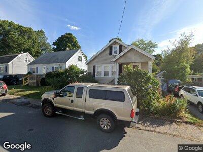
77 Fuller Rd North Weymouth, MA 02191
Estimated Value: $479,579 - $548,000
2
Beds
1
Bath
864
Sq Ft
$598/Sq Ft
Est. Value
About This Home
This home is located at 77 Fuller Rd, North Weymouth, MA 02191 and is currently estimated at $516,395, approximately $597 per square foot. 77 Fuller Rd is a home located in Norfolk County with nearby schools including Wessagusset Elementary School, Abigail Adams Middle School, and Weymouth Middle School Chapman.
Ownership History
Date
Name
Owned For
Owner Type
Purchase Details
Closed on
Feb 28, 1994
Sold by
Twyman Elizabeth J
Bought by
Antoine Maryellyn F
Current Estimated Value
Home Financials for this Owner
Home Financials are based on the most recent Mortgage that was taken out on this home.
Original Mortgage
$82,650
Interest Rate
6.96%
Mortgage Type
Purchase Money Mortgage
Create a Home Valuation Report for This Property
The Home Valuation Report is an in-depth analysis detailing your home's value as well as a comparison with similar homes in the area
Home Values in the Area
Average Home Value in this Area
Purchase History
| Date | Buyer | Sale Price | Title Company |
|---|---|---|---|
| Antoine Maryellyn F | $87,000 | -- |
Source: Public Records
Mortgage History
| Date | Status | Borrower | Loan Amount |
|---|---|---|---|
| Open | Antoine Maryellyn F | $51,000 | |
| Open | Antoine Maryellyn F | $156,000 | |
| Closed | Antoine Maryellyn F | $160,000 | |
| Closed | Antoine Maryellyn F | $15,000 | |
| Closed | Antoine Maryellyn F | $35,000 | |
| Closed | Antoine Maryellen F | $150,000 | |
| Closed | Antoine Maryellen F | $135,000 | |
| Closed | Antoine Maryellyn F | $82,650 |
Source: Public Records
Tax History Compared to Growth
Tax History
| Year | Tax Paid | Tax Assessment Tax Assessment Total Assessment is a certain percentage of the fair market value that is determined by local assessors to be the total taxable value of land and additions on the property. | Land | Improvement |
|---|---|---|---|---|
| 2025 | $4,245 | $420,300 | $211,300 | $209,000 |
| 2024 | $4,112 | $400,400 | $201,200 | $199,200 |
| 2023 | $3,876 | $370,900 | $186,300 | $184,600 |
| 2022 | $4,041 | $352,600 | $172,500 | $180,100 |
| 2021 | $3,624 | $308,700 | $172,500 | $136,200 |
| 2020 | $3,417 | $286,700 | $172,500 | $114,200 |
| 2019 | $3,337 | $275,300 | $165,900 | $109,400 |
| 2018 | $3,244 | $259,500 | $158,000 | $101,500 |
| 2017 | $3,032 | $236,700 | $143,600 | $93,100 |
| 2016 | $2,915 | $227,700 | $138,100 | $89,600 |
| 2015 | $2,749 | $213,100 | $131,500 | $81,600 |
| 2014 | $2,636 | $198,200 | $122,400 | $75,800 |
Source: Public Records
Map
Nearby Homes
- 100 Green St
- 267 Neck St Unit C2
- 267 Neck St Unit B7
- 106 North St
- 45 Doris Dr
- 30 Katherine St
- 14 Crescent Rd
- 323 Green St
- 14 Pequot Rd
- 90 Sea St Unit 219
- 151 Pilgrim Rd
- 9 Regatta Rd
- 41 Pecksuot Rd
- 3 Beals Cove Rd Unit E
- 10 Beals Cove Rd Unit C
- 7 Beals Cove Rd Unit 7A
- 11 Pecksuot Rd
- 30 Lillian Rd
- 159 Wessagussett Rd
- 141 Wessagussett Rd