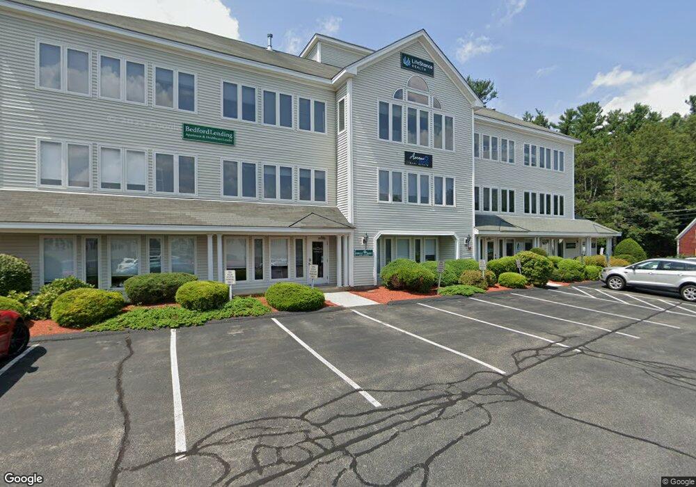
77 Gilcreast Rd Unit 2004 Londonderry, NH 03053
Estimated Value: $359,290
--
Bed
1
Bath
1,636
Sq Ft
$220/Sq Ft
Est. Value
About This Home
This home is located at 77 Gilcreast Rd Unit 2004, Londonderry, NH 03053 and is currently estimated at $359,290, approximately $219 per square foot. 77 Gilcreast Rd Unit 2004 is a home located in Rockingham County with nearby schools including Matthew Thornton Elementary School, Londonderry Middle School, and Londonderry Senior High School.
Ownership History
Date
Name
Owned For
Owner Type
Purchase Details
Closed on
Jun 28, 2016
Sold by
Licciardi Michael A
Bought by
Michael A Licciardi Ft
Current Estimated Value
Purchase Details
Closed on
Mar 27, 2013
Sold by
Londonderry Square Ass
Bought by
Licciardi Michael A
Create a Home Valuation Report for This Property
The Home Valuation Report is an in-depth analysis detailing your home's value as well as a comparison with similar homes in the area
Home Values in the Area
Average Home Value in this Area
Purchase History
| Date | Buyer | Sale Price | Title Company |
|---|---|---|---|
| Michael A Licciardi Ft | -- | -- | |
| Michael A Licciardi Ft | -- | -- | |
| Licciardi Michael A | $163,600 | -- | |
| Licciardi Michael A | $163,600 | -- |
Source: Public Records
Tax History Compared to Growth
Tax History
| Year | Tax Paid | Tax Assessment Tax Assessment Total Assessment is a certain percentage of the fair market value that is determined by local assessors to be the total taxable value of land and additions on the property. | Land | Improvement |
|---|---|---|---|---|
| 2024 | $4,482 | $277,700 | $0 | $277,700 |
| 2023 | $4,346 | $277,700 | $0 | $277,700 |
| 2022 | $4,570 | $247,300 | $0 | $247,300 |
| 2021 | $4,545 | $247,300 | $0 | $247,300 |
| 2020 | $3,650 | $181,500 | $0 | $181,500 |
| 2019 | $3,519 | $181,500 | $0 | $181,500 |
| 2018 | $3,904 | $179,100 | $0 | $179,100 |
| 2017 | $3,870 | $179,100 | $0 | $179,100 |
| 2016 | $3,851 | $179,100 | $0 | $179,100 |
| 2015 | $3,765 | $179,100 | $0 | $179,100 |
| 2014 | $3,777 | $179,100 | $0 | $179,100 |
| 2011 | -- | $171,200 | $0 | $171,200 |
Source: Public Records
Map
Nearby Homes
- 40 Elise Ave Unit Lot 20
- 1 Elise Ave Unit Lot 96
- 36 Elise Ave Unit Lot 18
- 7 Elise Ave Unit Lot 93
- 8 Elise Ave Unit Lot 4
- 14 Elise Ave Unit 7
- 12 Elise Ave Unit 6
- 107a Gilcreast Rd Unit A
- 47 Winding Pond Rd
- 267 Winding Pond Rd
- 6 Sugar Plum Ln
- 20 Mercury Dr Unit 20
- 12 Morrison Dr
- 214 Winding Pond Rd
- 111 Winterwood Dr
- 27 Midridge Cir
- 11 Midridge Cir Unit 116
- 24 Sheffield Way
- 14 Reed St
- 83 Beech Terrace
- 77 Gilcreast Rd
- 77 Gilcreast Rd Unit 2003/2004
- 77 Gilcreast Rd Unit 1000
- 77 Gilcreast Rd Unit 2003
- 77 Gilcreast Rd Unit 1004
- 77 Gilcreast Rd Unit 2000
- 77 Gilcreast Rd Unit 3000
- 77 Gilcreast Rd
- 77 Gilcreast Rd
- 77 Gilcreast Rd Unit 2003 O141
- 77 Gilcreast Rd Unit Suite 2004 O 142
- 77 Gilcreast Rd Unit Suite 2003 O141
- 77 Gilcreast Rd U 2004 (C-611)
- 77 Gilcreast Rd U 1000 (C-612)
- 75 Gilcreast Rd U 305 (Ol-649)
- 75 Gilcrest Rd #303 O124
- 81 Gilcreast Rd
- 75 Gilcreast Rd
- 75 Gilcreast Rd
- 75 Gilcreast Rd