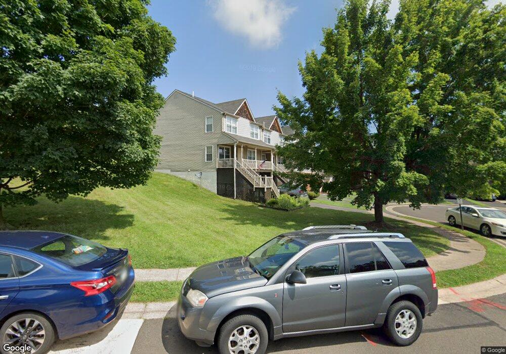
77 Mulberry Dr Southampton, PA 18966
Estimated Value: $467,000 - $515,000
4
Beds
3
Baths
1,904
Sq Ft
$256/Sq Ft
Est. Value
About This Home
This home is located at 77 Mulberry Dr, Southampton, PA 18966 and is currently estimated at $487,768, approximately $256 per square foot. 77 Mulberry Dr is a home located in Bucks County with nearby schools including Rolling Hills Elementary School, Richboro Middle School, and Council Rock High School - South.
Ownership History
Date
Name
Owned For
Owner Type
Purchase Details
Closed on
Aug 18, 2022
Sold by
Daniel Grosso
Bought by
Grosso Daniel
Current Estimated Value
Home Financials for this Owner
Home Financials are based on the most recent Mortgage that was taken out on this home.
Original Mortgage
$260,000
Outstanding Balance
$248,632
Interest Rate
5.54%
Mortgage Type
New Conventional
Estimated Equity
$239,136
Purchase Details
Closed on
Oct 26, 2010
Sold by
Grosso Daniel
Bought by
Grosso Daniel and Grosso Shannon M
Home Financials for this Owner
Home Financials are based on the most recent Mortgage that was taken out on this home.
Original Mortgage
$240,000
Interest Rate
4.4%
Mortgage Type
New Conventional
Purchase Details
Closed on
Dec 27, 2001
Sold by
Halper Philip M and Halper Shannah K
Bought by
Grosso Daniel
Home Financials for this Owner
Home Financials are based on the most recent Mortgage that was taken out on this home.
Original Mortgage
$152,750
Interest Rate
7.13%
Purchase Details
Closed on
Jan 30, 1997
Sold by
Herten Timothy J and West Marguerite A
Bought by
Halper Philip M and Halper Shannah K
Home Financials for this Owner
Home Financials are based on the most recent Mortgage that was taken out on this home.
Original Mortgage
$129,100
Interest Rate
7.8%
Create a Home Valuation Report for This Property
The Home Valuation Report is an in-depth analysis detailing your home's value as well as a comparison with similar homes in the area
Home Values in the Area
Average Home Value in this Area
Purchase History
| Date | Buyer | Sale Price | Title Company |
|---|---|---|---|
| Grosso Daniel | -- | First Platinum Abstract | |
| Grosso Daniel | -- | None Available | |
| Grosso Daniel | $191,000 | -- | |
| Halper Philip M | $135,900 | -- |
Source: Public Records
Mortgage History
| Date | Status | Borrower | Loan Amount |
|---|---|---|---|
| Open | Grosso Daniel | $260,000 | |
| Previous Owner | Grosso Daniel | $240,000 | |
| Previous Owner | Grosso Daniel | $152,750 | |
| Previous Owner | Halper Philip M | $129,100 |
Source: Public Records
Tax History Compared to Growth
Tax History
| Year | Tax Paid | Tax Assessment Tax Assessment Total Assessment is a certain percentage of the fair market value that is determined by local assessors to be the total taxable value of land and additions on the property. | Land | Improvement |
|---|---|---|---|---|
| 2025 | $5,632 | $29,240 | $3,520 | $25,720 |
| 2024 | $5,632 | $29,240 | $3,520 | $25,720 |
| 2023 | $5,308 | $29,240 | $3,520 | $25,720 |
| 2022 | $5,259 | $29,240 | $3,520 | $25,720 |
| 2021 | $5,093 | $29,240 | $3,520 | $25,720 |
| 2020 | $4,978 | $29,240 | $3,520 | $25,720 |
| 2019 | $4,765 | $29,240 | $3,520 | $25,720 |
| 2018 | $4,680 | $29,240 | $3,520 | $25,720 |
| 2017 | $4,500 | $29,240 | $3,520 | $25,720 |
| 2016 | $4,500 | $29,240 | $3,520 | $25,720 |
| 2015 | -- | $29,240 | $3,520 | $25,720 |
| 2014 | -- | $29,240 | $3,520 | $25,720 |
Source: Public Records
Map
Nearby Homes
- 23 Brianna Rd
- 105 Hopkins Ct Unit 744A
- 80 Hershey Ct
- 163 Leedom Way Unit 25
- 14 Chesapeake Dr
- 151 Knox Ct
- 327 Hale Dr Unit 801A
- 102 Keenan Ln
- 104 Cornell Rd
- 31 Hillcroft Way
- 21019 Bennett Place Unit 7
- 2604 Beacon Hill Dr Unit 2
- 281 E Village Rd
- 7 Bennett Place
- 15 Heritage Dr Unit 8
- 9017 Heritage Place Unit 9
- 501 Heritage Place Unit 1
- 60 Signal Hill Rd
- 1011 Diamond Dr Unit 1011
- 15 Dover Place