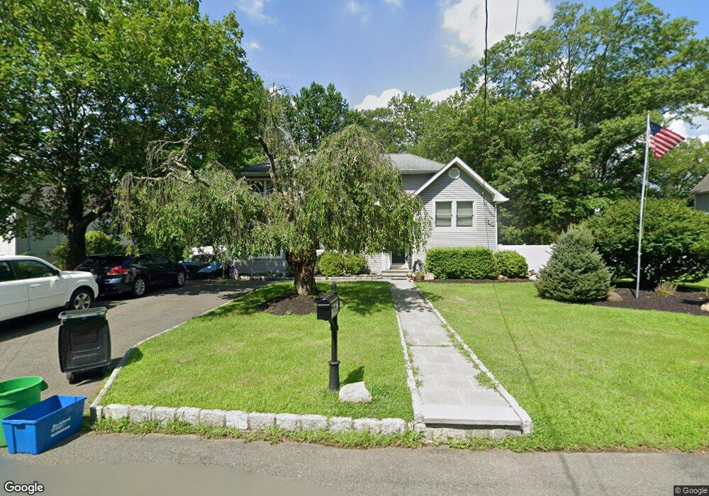
77 Villa Rd Pearl River, NY 10965
Estimated Value: $772,039 - $854,000
4
Beds
3
Baths
1,801
Sq Ft
$448/Sq Ft
Est. Value
About This Home
This home is located at 77 Villa Rd, Pearl River, NY 10965 and is currently estimated at $806,010, approximately $447 per square foot. 77 Villa Rd is a home located in Rockland County with nearby schools including George W Miller Elementary School, Highview Elementary School, and A Macarthur Barr Middle School.
Ownership History
Date
Name
Owned For
Owner Type
Purchase Details
Closed on
May 19, 2005
Sold by
Casey Eileen T
Bought by
Boera William C and Boera Catherine P
Current Estimated Value
Home Financials for this Owner
Home Financials are based on the most recent Mortgage that was taken out on this home.
Original Mortgage
$352,000
Outstanding Balance
$182,945
Interest Rate
5.79%
Mortgage Type
Fannie Mae Freddie Mac
Estimated Equity
$623,065
Purchase Details
Closed on
Feb 12, 2003
Sold by
Casey Eileen T
Bought by
Casey Thomas R
Create a Home Valuation Report for This Property
The Home Valuation Report is an in-depth analysis detailing your home's value as well as a comparison with similar homes in the area
Home Values in the Area
Average Home Value in this Area
Purchase History
| Date | Buyer | Sale Price | Title Company |
|---|---|---|---|
| Boera William C | $440,000 | -- | |
| Casey Eileen T | -- | -- | |
| Casey Thomas R | -- | -- |
Source: Public Records
Mortgage History
| Date | Status | Borrower | Loan Amount |
|---|---|---|---|
| Open | Boera William C | $352,000 |
Source: Public Records
Tax History Compared to Growth
Tax History
| Year | Tax Paid | Tax Assessment Tax Assessment Total Assessment is a certain percentage of the fair market value that is determined by local assessors to be the total taxable value of land and additions on the property. | Land | Improvement |
|---|---|---|---|---|
| 2024 | $17,675 | $213,700 | $58,100 | $155,600 |
| 2023 | $17,675 | $213,700 | $58,100 | $155,600 |
| 2022 | $5,264 | $213,700 | $58,100 | $155,600 |
| 2021 | $15,904 | $213,700 | $58,100 | $155,600 |
| 2020 | $16,416 | $213,700 | $58,100 | $155,600 |
| 2019 | $4,906 | $213,700 | $58,100 | $155,600 |
| 2018 | $14,497 | $213,700 | $58,100 | $155,600 |
| 2017 | $14,338 | $213,700 | $58,100 | $155,600 |
| 2016 | $13,395 | $213,700 | $58,100 | $155,600 |
| 2015 | -- | $160,000 | $58,100 | $101,900 |
| 2014 | -- | $160,000 | $58,100 | $101,900 |
Source: Public Records
Map
Nearby Homes
- 87 Pinto Rd
- 14 Staubitz Ave
- 46 Cara Dr
- 4 Brown Dr
- 5 Hillaire Place
- 110 Orchid Dr
- 452 Somerset Dr Unit F
- 250 Blauvelt Rd
- 432 Somerset Dr Unit M
- 352 Holt Dr
- 165 Forest Ave
- 854 E Crooked Hill Rd Unit 854
- 221 N Middletown Rd Unit F
- 137 Blauvelt Rd
- 12 Lilac Ct
- 359 Orangeburg Rd
- 4 Sunrise Ln
- 73 Bogert Ave
- 26 E George Ave
- 215 Rose Rd