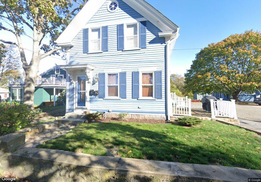
77 Wheeler St Gloucester, MA 01930
Riverview NeighborhoodEstimated Value: $647,000 - $682,000
3
Beds
1
Bath
1,479
Sq Ft
$452/Sq Ft
Est. Value
About This Home
This home is located at 77 Wheeler St, Gloucester, MA 01930 and is currently estimated at $668,163, approximately $451 per square foot. 77 Wheeler St is a home located in Essex County with nearby schools including Beeman Memorial, Ralph B O'maley Middle School, and Gloucester High School.
Ownership History
Date
Name
Owned For
Owner Type
Purchase Details
Closed on
Jul 24, 2009
Sold by
Bondi John J
Bought by
Makowski Paul A
Current Estimated Value
Home Financials for this Owner
Home Financials are based on the most recent Mortgage that was taken out on this home.
Original Mortgage
$220,000
Outstanding Balance
$145,543
Interest Rate
5.58%
Estimated Equity
$522,620
Purchase Details
Closed on
Apr 14, 2000
Sold by
Gray Stuart F and Gray Colleen J
Bought by
Porper William H and Porper Maryanney
Purchase Details
Closed on
Nov 26, 1999
Sold by
Robbins Jayne
Bought by
Gray Stuart F and Gray Colleen J
Create a Home Valuation Report for This Property
The Home Valuation Report is an in-depth analysis detailing your home's value as well as a comparison with similar homes in the area
Home Values in the Area
Average Home Value in this Area
Purchase History
| Date | Buyer | Sale Price | Title Company |
|---|---|---|---|
| Makowski Paul A | $275,000 | -- | |
| Porper William H | $130,000 | -- | |
| Gray Stuart F | $280,000 | -- |
Source: Public Records
Mortgage History
| Date | Status | Borrower | Loan Amount |
|---|---|---|---|
| Open | Gray Stuart F | $220,000 | |
| Previous Owner | Gray Stuart F | $273,000 | |
| Previous Owner | Gray Stuart F | $265,000 |
Source: Public Records
Tax History
| Year | Tax Paid | Tax Assessment Tax Assessment Total Assessment is a certain percentage of the fair market value that is determined by local assessors to be the total taxable value of land and additions on the property. | Land | Improvement |
|---|---|---|---|---|
| 2025 | $5,579 | $574,000 | $251,900 | $322,100 |
| 2024 | $5,439 | $559,000 | $239,900 | $319,100 |
| 2023 | $5,538 | $522,900 | $214,200 | $308,700 |
| 2022 | $5,176 | $441,300 | $182,100 | $259,200 |
| 2021 | $4,966 | $399,200 | $165,600 | $233,600 |
| 2020 | $4,757 | $385,800 | $165,600 | $220,200 |
| 2019 | $4,538 | $357,600 | $165,600 | $192,000 |
| 2018 | $4,337 | $335,400 | $165,600 | $169,800 |
| 2017 | $4,163 | $315,600 | $157,700 | $157,900 |
| 2016 | $4,140 | $304,200 | $158,200 | $146,000 |
| 2015 | $4,090 | $299,600 | $158,200 | $141,400 |
Source: Public Records
Map
Nearby Homes
- 13 Honeysuckle Rd
- 2 Breezy Point Rd
- 31 Echo Ave
- 2 Finch Ln
- 672 Washington St
- 167 Atlantic St
- 13 Mystic Ave
- 226 Atlantic St
- 6 Monroe Ct
- 98 Maplewood Ave
- 40 Sargent St
- 15 Harvard St
- 84 Centennial Ave
- 19 Trask St Unit 2
- 5 Samoset Rd Unit B
- 33 Maplewood Ave Unit 16
- 113 Pleasant St
- 5 Lepage Ln
- 20 Beacon St Unit 2
- 20 Beacon St Unit 1
Your Personal Tour Guide
Ask me questions while you tour the home.