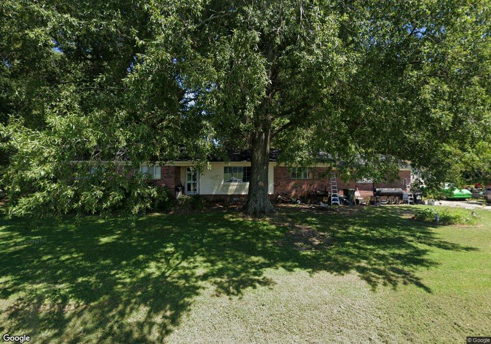
770 Bethel Church Rd Humboldt, TN 38343
Estimated Value: $164,377 - $372,000
--
Bed
2
Baths
1,632
Sq Ft
$161/Sq Ft
Est. Value
About This Home
This home is located at 770 Bethel Church Rd, Humboldt, TN 38343 and is currently estimated at $262,094, approximately $160 per square foot. 770 Bethel Church Rd is a home located in Crockett County with nearby schools including Pope School, Northeast Middle School, and North Side High School.
Ownership History
Date
Name
Owned For
Owner Type
Purchase Details
Closed on
Dec 20, 1989
Bought by
Carter Terry and Carter Linda
Current Estimated Value
Purchase Details
Closed on
Jan 1, 1984
Bought by
Branch Bobby Ray and Branch Connie D
Purchase Details
Closed on
Oct 1, 1979
Purchase Details
Closed on
Jan 1, 1979
Purchase Details
Closed on
Nov 1, 1978
Purchase Details
Closed on
Jan 1, 1978
Purchase Details
Closed on
Jun 28, 1972
Create a Home Valuation Report for This Property
The Home Valuation Report is an in-depth analysis detailing your home's value as well as a comparison with similar homes in the area
Home Values in the Area
Average Home Value in this Area
Purchase History
| Date | Buyer | Sale Price | Title Company |
|---|---|---|---|
| Carter Terry | $47,000 | -- | |
| Branch Bobby Ray | $38,000 | -- | |
| -- | -- | -- | |
| -- | $40,900 | -- | |
| -- | -- | -- | |
| -- | $39,800 | -- | |
| -- | -- | -- |
Source: Public Records
Tax History Compared to Growth
Tax History
| Year | Tax Paid | Tax Assessment Tax Assessment Total Assessment is a certain percentage of the fair market value that is determined by local assessors to be the total taxable value of land and additions on the property. | Land | Improvement |
|---|---|---|---|---|
| 2025 | $771 | $49,850 | $0 | $0 |
| 2024 | $771 | $33,950 | $2,875 | $31,075 |
| 2023 | $756 | $33,950 | $2,875 | $31,075 |
| 2022 | $771 | $33,950 | $2,875 | $31,075 |
| 2021 | $510 | $19,300 | $2,125 | $17,175 |
| 2020 | $500 | $19,300 | $2,125 | $17,175 |
| 2019 | $503 | $19,050 | $2,125 | $16,925 |
| 2018 | $503 | $19,050 | $2,125 | $16,925 |
| 2017 | $503 | $19,050 | $2,125 | $16,925 |
| 2016 | $503 | $19,050 | $2,125 | $16,925 |
| 2015 | $524 | $19,050 | $2,125 | $16,925 |
| 2014 | $524 | $19,843 | $0 | $0 |
Source: Public Records
Map
Nearby Homes
- 24 Walter Helms Rd
- 23 Forked Oak Ln
- 120 Westwood Cove
- 61 Blueridge Dr
- 341 Kelly Dr
- 64 Emerald Downs
- 16 Birch Hollow Ln
- 8 Sebastian Dr
- 230 Fairview Dr
- 15 Amanda Cove
- Hwy 45 Bypass
- 133 Westhaven Place
- 844 Leanne Dr
- 13 Acadia Cove
- 92 Samuel Dr
- 25 Noah
- 17 Noah Cove
- 78 Larkhaven Loop
- 73 Westhaven Place
- 762 Alecia Page Cove
- 726 Bethel Church Rd
- 0 Moore Rd
- 70 Bethel Church Rd
- 134 Moore Rd
- 61 Bethel Rd
- 82 Bethel Church Rd
- 191 Old Meridian Rd
- 719 Bethel Church Rd
- 599 Bethel Church Rd
- 185 Moore Rd
- 77 Bethel Church Rd
- 46 Bethel Church Rd
- 49 Bethel Church Rd
- 59 Bethel Church Rd
- 547 Bethel Church Rd
- 523 Bethel Church Rd
- 23 Old Meridian Rd Unit 23
- 1161 Windy City Rd
- 1139 Windy City Rd
- 1165 Windy City Rd