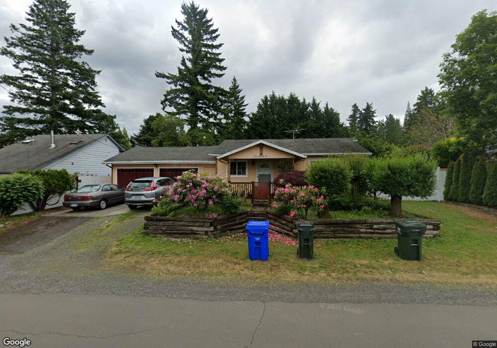
770 Cedar St Fairview, OR 97024
Estimated Value: $344,000 - $402,275
2
Beds
1
Bath
966
Sq Ft
$397/Sq Ft
Est. Value
About This Home
This home is located at 770 Cedar St, Fairview, OR 97024 and is currently estimated at $383,319, approximately $396 per square foot. 770 Cedar St is a home located in Multnomah County with nearby schools including Fairview Elementary School, Reynolds Middle School, and Reynolds High School.
Ownership History
Date
Name
Owned For
Owner Type
Purchase Details
Closed on
Dec 19, 2005
Sold by
Long Michael L and Long Teresa M
Bought by
Dela Pena Joey S and Dela Pena Jane S
Current Estimated Value
Purchase Details
Closed on
Jan 7, 1998
Sold by
Nasshahn Erik A and Nasshahn Elisabeth A
Bought by
Long Michael L and Long Teresa M
Home Financials for this Owner
Home Financials are based on the most recent Mortgage that was taken out on this home.
Original Mortgage
$93,000
Interest Rate
7.16%
Mortgage Type
Purchase Money Mortgage
Create a Home Valuation Report for This Property
The Home Valuation Report is an in-depth analysis detailing your home's value as well as a comparison with similar homes in the area
Home Values in the Area
Average Home Value in this Area
Purchase History
| Date | Buyer | Sale Price | Title Company |
|---|---|---|---|
| Dela Pena Joey S | $179,000 | First American | |
| Long Michael L | $97,900 | Fidelity National Title Co |
Source: Public Records
Mortgage History
| Date | Status | Borrower | Loan Amount |
|---|---|---|---|
| Previous Owner | Long Michael L | $93,000 |
Source: Public Records
Tax History Compared to Growth
Tax History
| Year | Tax Paid | Tax Assessment Tax Assessment Total Assessment is a certain percentage of the fair market value that is determined by local assessors to be the total taxable value of land and additions on the property. | Land | Improvement |
|---|---|---|---|---|
| 2024 | $2,837 | $160,290 | -- | -- |
| 2023 | $2,769 | $155,630 | $0 | $0 |
| 2022 | $2,702 | $151,100 | $0 | $0 |
| 2021 | $2,632 | $146,700 | $0 | $0 |
| 2020 | $2,456 | $142,430 | $0 | $0 |
| 2019 | $2,357 | $138,290 | $0 | $0 |
| 2018 | $2,334 | $134,270 | $0 | $0 |
| 2017 | $2,261 | $130,360 | $0 | $0 |
| 2016 | $2,165 | $126,570 | $0 | $0 |
| 2015 | $2,104 | $122,890 | $0 | $0 |
| 2014 | $2,035 | $119,320 | $0 | $0 |
Source: Public Records
Map
Nearby Homes
- 619 Depot St
- 1505 NE Village St
- 1495 NE Village St
- 1443 NE Village St
- 2171 NE 207th Place
- 2150 NE 207th Place
- 1305 NE Village St
- 1333 NE Charles Ct
- 21100 NE Sandy Blvd Unit 39
- 21100 NE Sandy Blvd Unit 76
- 21100 NE Sandy Blvd Unit 72
- 21100 NE Sandy Blvd Unit 52
- 21100 NE Sandy Blvd Unit 18
- 21100 NE Sandy Blvd Unit 114
- 120 Cedar St
- 21430 NE Rosewood Dr
- 21802 NE Larkspur Ln
- 2600 NE 205th Ave Unit 20
- 21440 NE Willow Glen Rd
- 21821 NE Heartwood Cir
- 740 Cedar St
- 780 Cedar St
- 730 Cedar St
- 800 Wistful Vista Dr
- 790 Wistful Vista Dr
- 777 Cedar St
- 755 Cedar St
- 720 Cedar St
- 770 Wistful Vista Dr
- 21418 NE Hancock St
- 745 Cedar St
- 21427 NE Hancock St
- 787 Cedar St
- 710 Cedar St
- 735 Cedar St
- 21414 NE Hancock St
- 787 Cedar St
- 787 Cedar (2 Houses) St
- 725 Cedar St
- 700 Cedar St