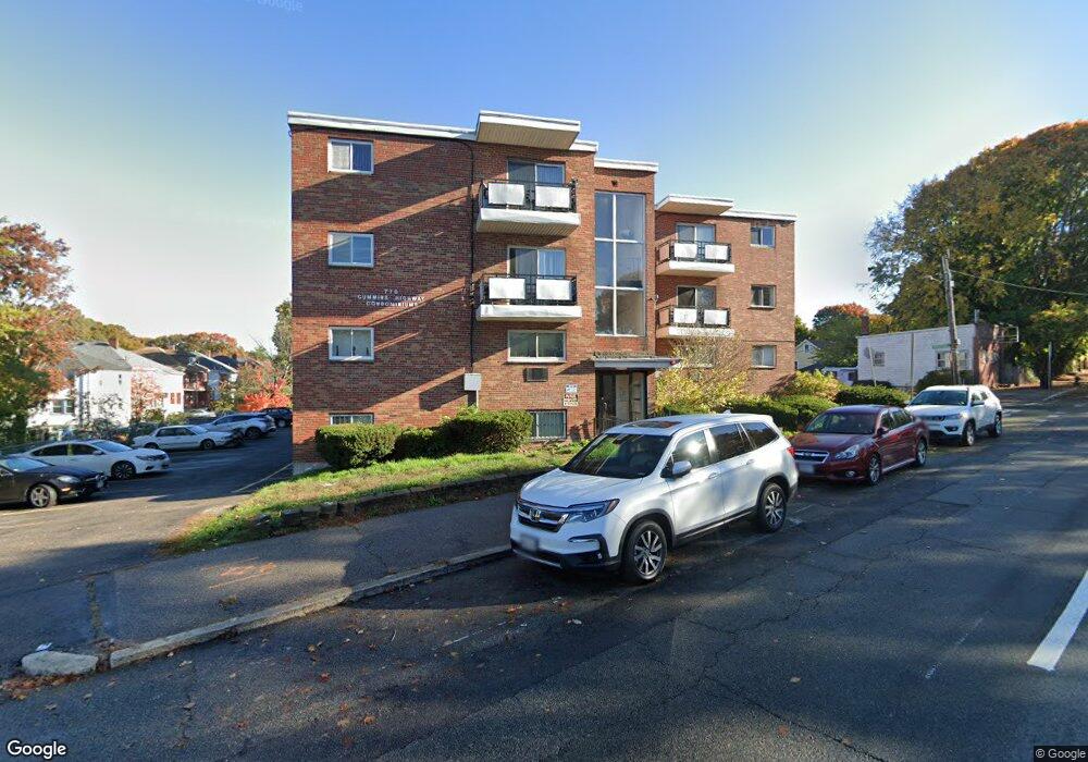
770 Cummins Hwy Unit 15 Mattapan, MA 02126
Southern Mattapan NeighborhoodEstimated Value: $294,000 - $332,000
2
Beds
1
Bath
652
Sq Ft
$479/Sq Ft
Est. Value
About This Home
This home is located at 770 Cummins Hwy Unit 15, Mattapan, MA 02126 and is currently estimated at $312,597, approximately $479 per square foot. 770 Cummins Hwy Unit 15 is a home located in Suffolk County with nearby schools including KIPP Academy Boston Charter School and Berea Seventh-day Adventist Academy.
Ownership History
Date
Name
Owned For
Owner Type
Purchase Details
Closed on
May 2, 1994
Sold by
Department Of Housing & Urban Dev
Bought by
Lue Lana
Current Estimated Value
Purchase Details
Closed on
Dec 7, 1992
Sold by
Romain Ketty M
Bought by
Us Dept Hud
Purchase Details
Closed on
Feb 2, 1989
Sold by
Britton Geneva S
Bought by
Romain Ketty M
Home Financials for this Owner
Home Financials are based on the most recent Mortgage that was taken out on this home.
Original Mortgage
$71,400
Interest Rate
10.62%
Mortgage Type
Purchase Money Mortgage
Create a Home Valuation Report for This Property
The Home Valuation Report is an in-depth analysis detailing your home's value as well as a comparison with similar homes in the area
Home Values in the Area
Average Home Value in this Area
Purchase History
| Date | Buyer | Sale Price | Title Company |
|---|---|---|---|
| Lue Lana | $16,900 | -- | |
| Lue Lana | $16,900 | -- | |
| Us Dept Hud | $85,000 | -- | |
| Romain Ketty M | $74,000 | -- |
Source: Public Records
Mortgage History
| Date | Status | Borrower | Loan Amount |
|---|---|---|---|
| Previous Owner | Romain Ketty M | $71,400 | |
| Previous Owner | Romain Ketty M | $15,000 |
Source: Public Records
Tax History Compared to Growth
Tax History
| Year | Tax Paid | Tax Assessment Tax Assessment Total Assessment is a certain percentage of the fair market value that is determined by local assessors to be the total taxable value of land and additions on the property. | Land | Improvement |
|---|---|---|---|---|
| 2025 | $3,301 | $285,100 | $0 | $285,100 |
| 2024 | $2,806 | $257,400 | $0 | $257,400 |
| 2023 | $2,682 | $249,700 | $0 | $249,700 |
| 2022 | $2,539 | $233,400 | $0 | $233,400 |
| 2021 | $2,314 | $216,900 | $0 | $216,900 |
| 2020 | $1,533 | $145,200 | $0 | $145,200 |
| 2019 | $1,391 | $132,000 | $0 | $132,000 |
| 2018 | $1,383 | $132,000 | $0 | $132,000 |
| 2017 | $1,318 | $124,500 | $0 | $124,500 |
| 2016 | $1,330 | $120,900 | $0 | $120,900 |
| 2015 | $1,422 | $117,400 | $0 | $117,400 |
| 2014 | $1,433 | $113,900 | $0 | $113,900 |
Source: Public Records
Map
Nearby Homes
- 770 Cummins Hwy Unit 1
- 770 Cummins Hwy Unit 22
- 10 Brockton St
- 839-843 Cummins Hwy
- 95 Woodhaven St
- 231 Itasca St
- 90 Hollingsworth St
- 48-50 Rockdale St
- 34 Ridlon Rd
- 100 Itasca St
- 20 Monterey Ave
- 23 Caton St
- 60 and 64 Monterey Ave
- 1465 Blue Hill Ave
- 645 River St
- 116 Almont St
- 179 Hebron St
- 25 Alpine St Unit 7
- 72 Livermore St
- 14-14R Kennebec St
- 770 Cummins Hwy Unit 28
- 770 Cummins Hwy Unit 27
- 770 Cummins Hwy Unit 26
- 770 Cummins Hwy Unit 25
- 770 Cummins Hwy Unit 24
- 770 Cummins Hwy Unit 23
- 770 Cummins Hwy Unit 21
- 770 Cummins Hwy Unit 20
- 770 Cummins Hwy Unit 19
- 770 Cummins Hwy Unit 18
- 770 Cummins Hwy Unit 17
- 770 Cummins Hwy Unit 16
- 770 Cummins Hwy Unit 14
- 770 Cummins Hwy Unit 12A
- 770 Cummins Hwy Unit 11
- 770 Cummins Hwy Unit 10
- 770 Cummins Hwy Unit 9
- 770 Cummins Hwy Unit 8
- 770 Cummins Hwy Unit 7
- 770 Cummins Hwy Unit 6