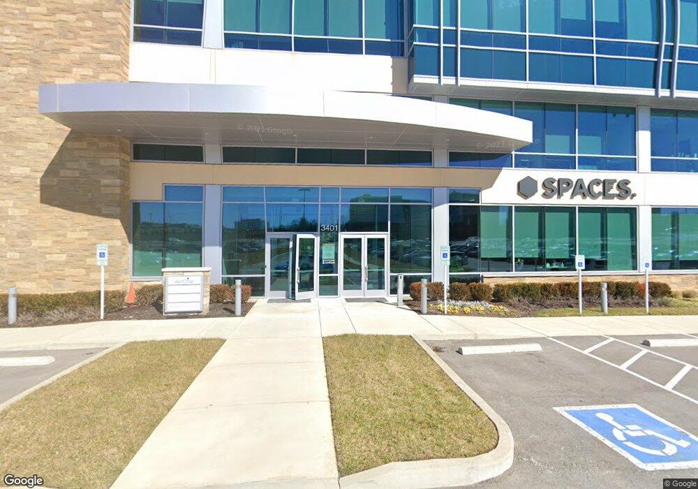
770 Jordan Rd Franklin, TN 37067
McEwen NeighborhoodEstimated Value: $51,569,504
Studio
3
Baths
182,125
Sq Ft
$283/Sq Ft
Est. Value
About This Home
This home is located at 770 Jordan Rd, Franklin, TN 37067 and is currently estimated at $51,569,504, approximately $283 per square foot. 770 Jordan Rd is a home located in Williamson County with nearby schools including Johnson Elementary School, Freedom Intermediate School, and Freedom Middle School.
Ownership History
Date
Name
Owned For
Owner Type
Purchase Details
Closed on
Nov 8, 2024
Sold by
3665 Mallory Jv Llc
Bought by
Mg Fields-Strato Llc
Current Estimated Value
Home Financials for this Owner
Home Financials are based on the most recent Mortgage that was taken out on this home.
Original Mortgage
$26,800,000
Outstanding Balance
$26,528,237
Interest Rate
6.54%
Mortgage Type
New Conventional
Estimated Equity
$25,041,267
Purchase Details
Closed on
Aug 15, 2023
Sold by
3665 Mallory Jv Llc
Bought by
City Of Franklin Tennessee
Purchase Details
Closed on
Jan 25, 2017
Sold by
Duke Realty Lp
Bought by
3665 Mallory Jv Llc
Home Financials for this Owner
Home Financials are based on the most recent Mortgage that was taken out on this home.
Original Mortgage
$25,250,000
Interest Rate
4.32%
Mortgage Type
Construction
Purchase Details
Closed on
Jan 24, 2017
Sold by
3665 Mallory Jv Llc
Bought by
Tharaldson Motels Ii Inc
Home Financials for this Owner
Home Financials are based on the most recent Mortgage that was taken out on this home.
Original Mortgage
$25,250,000
Interest Rate
4.32%
Mortgage Type
Construction
Purchase Details
Closed on
Oct 20, 2006
Sold by
Sands Cecelia S and The Cecelia S Sands Tennessee
Bought by
Duke Realty Lp
Purchase Details
Closed on
Oct 19, 2006
Sold by
Sands Cecelia S and The Cecelia S Sands Tennessee
Bought by
Duke Realty Lp
Purchase Details
Closed on
Mar 31, 2004
Sold by
Sands Cecelia S and The Cecelia S Sands Tennessee
Bought by
Boyle Jordan Road Llc
Purchase Details
Closed on
Jan 1, 1999
Sold by
Sands Cecelia S
Bought by
Sands Cecelia S and The Cecelia S Sands Tennessee
Purchase Details
Closed on
Aug 28, 1996
Sold by
Sands Randal H
Bought by
Mallory Valley Utility Dis
Create a Home Valuation Report for This Property
The Home Valuation Report is an in-depth analysis detailing your home's value as well as a comparison with similar homes in the area
Home Values in the Area
Average Home Value in this Area
Purchase History
| Date | Buyer | Sale Price | Title Company |
|---|---|---|---|
| Mg Fields-Strato Llc | $49,500,000 | None Listed On Document | |
| Mg Fields-Strato Llc | $49,500,000 | None Listed On Document | |
| City Of Franklin Tennessee | $30,834 | None Listed On Document | |
| 3665 Mallory Jv Llc | -- | None Available | |
| 3665 Mallory Jv Llc | $9,860,000 | None Available | |
| Tharaldson Motels Ii Inc | $7,000,000 | None Available | |
| Duke Realty Lp | $8,567,380 | None Available | |
| Duke Realty Lp | -- | None Available | |
| Boyle Jordan Road Llc | $765,982 | -- | |
| Sands Cecelia S | -- | -- | |
| Mallory Valley Utility Dis | -- | -- |
Source: Public Records
Mortgage History
| Date | Status | Borrower | Loan Amount |
|---|---|---|---|
| Open | Mg Fields-Strato Llc | $26,800,000 | |
| Closed | Mg Fields-Strato Llc | $26,800,000 | |
| Previous Owner | Tharaldson Motels Ii Inc | $25,250,000 |
Source: Public Records
Tax History
| Year | Tax Paid | Tax Assessment Tax Assessment Total Assessment is a certain percentage of the fair market value that is determined by local assessors to be the total taxable value of land and additions on the property. | Land | Improvement |
|---|---|---|---|---|
| 2025 | -- | $19,830,080 | $5,949,040 | $13,881,040 |
| 2024 | -- | $21,532,280 | $5,572,320 | $15,959,960 |
| 2023 | $464,258 | $21,532,280 | $5,572,320 | $15,959,960 |
| 2022 | $480,579 | $22,289,280 | $5,572,320 | $16,716,960 |
| 2021 | $480,579 | $22,289,280 | $5,572,320 | $16,716,960 |
| 2020 | $448,471 | $17,398,800 | $3,827,360 | $13,571,440 |
| 2019 | $80,545 | $3,124,800 | $3,124,800 | $0 |
| 2018 | $78,357 | $3,124,800 | $3,124,800 | $0 |
| 2017 | $92,515 | $3,719,040 | $3,719,040 | $0 |
| 2016 | $91,399 | $3,719,040 | $3,719,040 | $0 |
| 2015 | -- | $3,254,160 | $3,254,160 | $0 |
| 2014 | -- | $3,254,160 | $3,254,160 | $0 |
Source: Public Records
Map
Nearby Homes
- 324 Grant Park Dr
- 1013 Firestone Dr
- 739 Huffine Manor Cir
- 3201 Aspen Grove Dr Unit D3
- 3201 Aspen Grove Dr Unit C1
- 3201 Aspen Grove Dr Unit A4
- 3201 Aspen Grove Dr Unit D6
- 3201 Aspen Grove Dr Unit G-1
- 201 Berry Hunter Ln
- 200 Berry Hunter Ln
- 220 Berry Hunter Ln
- 118 Stanwick Dr
- 322 Logans Cir
- 250 Berry Hunter Ln
- 213 Berry Hunter Ln
- 1000 Sun Bird Dr
- 658 Huffine Manor Cir
- 214 Berry Hunter Ln
- 208 Berry Hunter Ln
- 219 Berry Hunter Ln
- 790 Jordan Rd
- 756 Jordan Rd
- 4015 Aspen Grove Dr Unit 1 - 1040.991242
- 4015 Aspen Grove Dr Unit 1-1020.554987
- 4015 Aspen Grove Dr Unit 2-2007.555063
- 4015 Aspen Grove Dr Unit 1 - 2065.1381579
- 4015 Aspen Grove Dr Unit 2-2004.546722
- 4015 Aspen Grove Dr Unit 1 - 2013.774192
- 4015 Aspen Grove Dr
- 4015 Aspen Grove Dr
- 4085 Mallory Ln
- 3326 Aspen Grove Dr Unit 404
- 3326 Aspen Grove Dr Unit 300
- 3326 Aspen Grove Dr Unit 130
- 3326 Aspen Grove Dr Unit 306
- 3326 Aspen Grove Dr Unit 310
- 3326 Aspen Grove Dr Unit 402
- 1723 Mcewen Dr
- 3351 Aspen Grove Dr Unit 300
- 3351 Aspen Grove Dr
Your Personal Tour Guide
Ask me questions while you tour the home.